
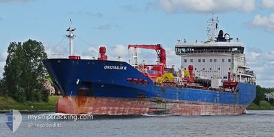
QIKIQTAALUK W.
Oil/Chemical Tanker
Current Trip
| Time Travelled | 15 h, 48 mins |
|---|---|
| Remaining Time | --- |
| Distance Travelled | 124.49 nm |
| Remaining Distance | --- |
| AVG Speed | 6.4 Noeuds |
| MAX Speed | 14.5 Noeuds |
| AVG Wind | 9.7 knots |
| MAX Wind | 13 knots |
| MIN Temp | -1.1°C / 30.02°F |
| MAX Temp | 5.6°C / 42.08°F |
| Tirant d eau | 7.1 m |
| Position reçue | 2 h, 38 m depuis |
Current Position
| Longitude | -80.70756° |
|---|---|
| Latitude | 42.32127° |
| Etat | Under way using engine |
| Vitesse | 14.2 Noeuds |
| Parcours | 250.1° |
| Zone | Gulf of St-Lawrence |
| Station | T-AIS |
| Position reçue | 2 h, 38 m depuis |
Info
Information
The current position of QIKIQTAALUK W. is in Gulf of St-Lawrence with coordinates 42.32127° / -80.70756° as reported on 2024-04-25 18:40 by AIS to our vessel tracker app. The vessel's current speed is 14.2 Noeuds and is heading at the port of SARNIA. The estimated time of arrival as calculated by MyShipTracking vessel tracking app is 2024-04-26 07:00 LT
The vessel QIKIQTAALUK W. (IMO: 9421221, MMSI: 316037697) is a Oil/Chemical Tanker that was built in 2011 ( 13 Age ). It's sailing under the flag of [CA] Canada.
In this page you can find informations about the vessels current position, last detected port calls, and current voyage information. If the vessels is not in coverage by AIS you will find the latest position.
The current position of QIKIQTAALUK W. is detected by our AIS receivers and we are not responsible for the reliability of the data. The last position was recorded while the vessel was in Coverage by the Ais receivers of our vessel tracking app.
The current draught of QIKIQTAALUK W. as reported by AIS is 7.1 meters
Weather
| Temperature | 5.7°C / 42.26°F |
|---|---|
| Wind Speed | 11 knots |
| Direction | 49° NE |
| Pressure | 1028.1 hPa |
| Humidity | 57.9 % |
| Cloud Coverage | 43 % |
Featured Company
Last Port Calls
| Port | Arrival | Departure | Time In Port |
|---|---|---|---|
| 2024-04-25 04:55 | 2024-04-25 05:30 | 34 m | |
| 2024-04-23 18:39 | 2024-04-23 20:34 | 1 h | |
| 2024-04-21 09:38 | 2024-04-22 05:18 | 19 h | |
| 2024-04-19 18:51 | 2024-04-19 20:11 | 1 h | |
| 2024-04-18 10:18 | 2024-04-18 11:02 | 44 m | |
| 2024-04-16 02:04 | 2024-04-17 20:21 | 1 d | |
| 2024-04-12 21:53 | 2024-04-13 10:22 | 12 h |
Most Visited Ports (Last year)
| Port | Arrivals | |
|---|---|---|
| 12 | ||
| 9 | ||
| 5 | ||
| 4 | ||
| 2 | ||
| 1 |
Last Trips
| Origin | Departure | Destination | Arrival | Distance | |
|---|---|---|---|---|---|
| 2024-04-23 16:34 | 2024-04-25 00:55 | 298.80 nm | |||
| 2024-04-22 01:18 | 2024-04-23 14:39 | 425.61 nm | |||
| 2024-04-19 16:11 | 2024-04-21 05:38 | 428.06 nm | |||
| 2024-04-18 07:02 | 2024-04-19 14:51 | 296.98 nm | |||
| 2024-04-17 16:21 | 2024-04-18 06:18 | 61.45 nm | |||
| 2024-04-13 06:22 | 2024-04-15 22:04 | 255.67 nm |
Events
| Heure | Evenement | Détails | Position/ Destination | Info |
|---|---|---|---|---|
| 2024-04-25 18:51 | Etat Changé | Default Under way using engine |
42.30469 / -80.76149
CASNI
|
Vitesse: 14.2 kn Parcours: 250.1° |
| 2024-04-25 18:40 | Hors de la zone couverte |
42.32127 / -80.70756
Gulf of St-Lawrence
CASNI
|
Vitesse: 14.2 kn Parcours: 250.1° |
|
| 2024-04-25 18:19 | Etat Changé | Under way using engine Default |
42.34989 / -80.60404
CASNI
|
Vitesse: 14 kn Parcours: 249° |
| 2024-04-25 18:17 | Etat Changé | Default Under way using engine |
42.35166 / -80.59167
CASNI
|
Vitesse: 14.2 kn Parcours: 249.3° |
| 2024-04-25 13:44 | Changement d'ETA | 2024/04/26 07:00 2024/04/26 08:00 |
42.83705 / -79.28978
CASNI
|
Vitesse: 13.5 kn Parcours: 238.7° |
| 2024-04-25 13:05 | Démarrage | 0.58 nm, North of PORT COLBORNE |
42.89108 / -79.24813
CASNI
|
Vitesse: 3.5 kn Parcours: 192° |
| 2024-04-25 12:29 | Arret | 1.1 nm, North of PORT COLBORNE |
42.89963 / -79.24602
CASNI
|
Vitesse: 0.2 kn Parcours: 189° |
| 2024-04-25 11:47 | Changement d'ETA | 2024/04/26 08:00 2024/04/26 11:00 |
42.93439 / -79.23815
CASNI
|
Vitesse: 7.3 kn Parcours: 192.6° |
| 2024-04-25 10:09 | Démarrage | 5.7 nm, South East of DALHOUSIE |
43.11935 / -79.19499
CASNI
|
Vitesse: 3.2 kn Parcours: 189° |
| 2024-04-25 08:00 | Arret | 4.95 nm, South East of DALHOUSIE |
43.13669 / -79.19269
CASNI
|
Vitesse: Parcours: 182° |