
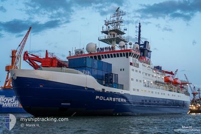
POLARSTERN
Research/Survey Vessel
Current Trip
AU HBA>>NA WVB
| Time Travelled | 6 days |
|---|---|
| Remaining Time | --- |
| Distance Travelled | 1774.35 nm |
| Remaining Distance | --- |
| AVG Speed | 11.4 Noeuds |
| MAX Speed | 13.4 Noeuds |
| AVG Wind | 12.5 knots |
| MAX Wind | 18.9 knots |
| MIN Temp | 15.6°C / 60.08°F |
| MAX Temp | 28.9°C / 84.02°F |
| Tirant d eau | 11.1 m |
| Position reçue | 2 d depuis |
Current Position
| Longitude | 1.05130° |
|---|---|
| Latitude | -10.73008° |
| Etat | Under way using engine |
| Vitesse | 11.7 Noeuds |
| Parcours | 311° |
| Zone | South Atlantic Ocean |
| Station | T-AIS |
| Position reçue | 2 d depuis |
Info
Information
The current position of POLARSTERN is in South Atlantic Ocean with coordinates -10.73008° / 1.05130° as reported on 2024-04-20 14:31 by AIS to our vessel tracker app. The vessel's current speed is 11.7 Noeuds
The vessel POLARSTERN (IMO: 8013132, MMSI: 211202460) is a Research/Survey Vessel that was built in 1982 ( 42 Age ). It's sailing under the flag of [DE] Germany.
In this page you can find informations about the vessels current position, last detected port calls, and current voyage information. If the vessels is not in coverage by AIS you will find the latest position.
The current position of POLARSTERN is detected by our AIS receivers and we are not responsible for the reliability of the data. The last position was recorded while the vessel was in Coverage by the Ais receivers of our vessel tracking app.
The current draught of POLARSTERN as reported by AIS is 11.1 meters
Weather
| Temperature | 28.7°C / 83.66°F |
|---|---|
| Wind Speed | 12 knots |
| Direction | 135° SE |
| Pressure | 1010 hPa |
| Humidity | 76.7 % |
| Cloud Coverage | 85 % |
Featured Company
Last Port Calls
| Port | Arrival | Departure | Time In Port |
|---|---|---|---|
| 2024-04-15 19:58 | 2024-04-16 14:58 | 19 h | |
| 2024-04-14 06:21 | 2024-04-14 17:33 | 11 h | |
| 2024-02-02 07:43 | 2024-02-06 07:13 | 3 d | |
| 2024-02-02 07:19 |
Most Visited Ports (Last year)
| Port | Arrivals | |
|---|---|---|
| 2 | ||
| 1 | ||
| 1 | ||
| 1 | ||
| 1 | ||
| 1 |
Last Trips
| Origin | Departure | Destination | Arrival | Distance | |
|---|---|---|---|---|---|
| 2024-04-14 19:33 | 2024-04-15 21:58 | 14.83 nm | |||
| 2024-02-06 18:13 | 2024-04-14 08:21 | 7574.92 nm | |||
| 2024-02-02 18:19 | 2024-02-02 18:43 | 2.37 nm |
Events
| Heure | Evenement | Détails | Position/ Destination | Info |
|---|---|---|---|---|
| 2024-04-22 13:29 | Démarrage |
-4.82446 / -5.24094
AU HBA>>NA WVB
|
Vitesse: 7.8 kn Parcours: 318° |
|
| 2024-04-22 12:05 | Arret |
-4.83167 / -5.24167
AU HBA>>NA WVB
|
Vitesse: Parcours: -1° |
|
| 2024-04-21 13:23 | Démarrage |
-7.86192 / -2.01692
AU HBA>>NA WVB
|
Vitesse: 6.5 kn Parcours: 357° |
|
| 2024-04-21 12:03 | Arret |
-7.86398 / -2.02003
AU HBA>>NA WVB
|
Vitesse: 0.3 kn Parcours: 160° |
|
| 2024-04-20 14:34 | Etat Changé | Default Under way using engine |
-10.72213 / 1.04298
AU HBA>>NA WVB
|
Vitesse: 11.7 kn Parcours: 311° |
| 2024-04-20 14:31 | Hors de la zone couverte |
-10.73008 / 1.05130
South Atlantic Ocean
|
Vitesse: 11.7 kn Parcours: 311° |
|
| 2024-04-20 14:18 | Etat Changé | Under way using engine Default |
-10.75926 / 1.08281
AU HBA>>NA WVB
|
Vitesse: 12 kn Parcours: 314° |
| 2024-04-20 13:46 | Etat Changé | Default Under way using engine |
-10.83167 / 1.16167
AU HBA>>NA WVB
|
Vitesse: 11.8 kn Parcours: 317.7° |
| 2024-04-20 13:31 | Etat Changé | Under way using engine Default |
-10.86564 / 1.19705
AU HBA>>NA WVB
|
Vitesse: 12 kn Parcours: 314° |
| 2024-04-20 13:18 | Etat Changé | Default Under way using engine |
-10.89569 / 1.22940
AU HBA>>NA WVB
|
Vitesse: 12.2 kn Parcours: 315.2° |