
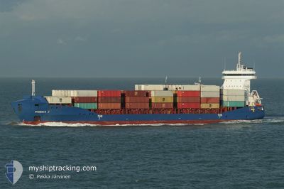
PHOENIX J
Container Ship
Current Trip
| Time Travelled | 2 days |
|---|---|
| Remaining Time | 3 h, 59 mins |
| Distance Travelled | 857.05 nm |
| Remaining Distance | 86.02 nm |
| AVG Speed | 17 Noeuds |
| MAX Speed | 18.9 Noeuds |
| AVG Wind | 20.4 knots |
| MAX Wind | 27 knots |
| MIN Temp | -0.6°C / 30.92°F |
| MAX Temp | 9.5°C / 49.1°F |
| Tirant d eau | 8 m |
| Position reçue | 6 h, 23 m depuis |
Current Position
| Longitude | 21.11844° |
|---|---|
| Latitude | 63.59237° |
| Etat | Under way using engine |
| Vitesse | 16.8 Noeuds |
| Parcours | 65° |
| Zone | Gulf of Bothnia |
| Station | T-AIS |
| Position reçue | 6 h, 23 m depuis |
Info
Information
The current position of PHOENIX J is in Gulf of Bothnia with coordinates 63.59237° / 21.11844° as reported on 2024-04-16 06:11 by AIS to our vessel tracker app. The vessel's current speed is 16.8 Noeuds and is heading at the port of OULU. The estimated time of arrival as calculated by MyShipTracking vessel tracking app is 2024-04-16 16:33 LT
The vessel PHOENIX J (IMO: 9504047, MMSI: 305648000) is a Container Ship that was built in 2010 ( 14 Age ). It's sailing under the flag of [AG] Antigua Barbuda.
In this page you can find informations about the vessels current position, last detected port calls, and current voyage information. If the vessels is not in coverage by AIS you will find the latest position.
The current position of PHOENIX J is detected by our AIS receivers and we are not responsible for the reliability of the data. The last position was recorded while the vessel was in Coverage by the Ais receivers of our vessel tracking app.
The current draught of PHOENIX J as reported by AIS is 8 meters
Weather
| Temperature | -0.2°C / 31.64°F |
|---|---|
| Wind Speed | 12 knots |
| Direction | 357° N |
| Pressure | 1002.6 hPa |
| Humidity | 98.1 % |
| Cloud Coverage | 100 % |
Featured Company
Last Port Calls
| Port | Arrival | Departure | Time In Port |
|---|---|---|---|
| 2024-04-14 07:59 | 2024-04-14 08:03 | 4 m | |
| 2024-04-11 19:02 | 2024-04-13 05:13 | 1 d | |
| 2024-04-11 10:40 | 2024-04-11 18:57 | 8 h | |
| 2024-04-10 11:48 | 2024-04-10 16:14 | 4 h | |
| 2024-04-09 06:58 | 2024-04-10 02:17 | 19 h | |
| 2024-04-08 15:19 | 2024-04-08 15:55 | 36 m | |
| 2024-04-05 07:37 | 2024-04-05 16:05 | 8 h | |
| 2024-04-03 08:49 | 2024-04-04 08:53 | 1 d | |
| 2024-04-01 09:53 | 2024-04-01 09:56 | 2 m | |
| 2024-03-30 12:34 | 2024-03-30 23:26 | 10 h |
Most Visited Ports (Last year)
| Port | Arrivals | |
|---|---|---|
| 18 | ||
| 15 | ||
| 12 | ||
| 12 | ||
| 8 | ||
| 8 |
Last Trips
| Origin | Departure | Destination | Arrival | Distance | |
|---|---|---|---|---|---|
| 2024-04-13 07:13 | 2024-04-14 09:59 | 317.34 nm | |||
| 2024-04-11 20:57 | 2024-04-11 21:02 | 0.96 nm | |||
| 2024-04-10 18:14 | 2024-04-11 12:40 | 250.48 nm | |||
| 2024-04-10 04:17 | 2024-04-10 13:48 | 119.55 nm | |||
| 2024-04-08 17:55 | 2024-04-09 08:58 | 89.95 nm | |||
| 2024-04-05 18:05 | 2024-04-08 17:19 | 953.20 nm | |||
| 2024-04-04 10:53 | 2024-04-05 09:37 | 322.65 nm | |||
| 2024-04-01 11:56 | 2024-04-03 10:49 | 705.19 nm | |||
| 2024-03-31 00:26 | 2024-04-01 11:53 | 318.47 nm | |||
| 2024-03-30 13:30 | 2024-03-30 13:34 | 0.56 nm |
Events
| Heure | Evenement | Détails | Position/ Destination | Info |
|---|---|---|---|---|
| 2024-04-16 06:15 | Etat Changé | Default Under way using engine |
63.60133 / 21.16200
FIOUL VIA NOK
|
Vitesse: 16.8 kn Parcours: 65° |
| 2024-04-16 06:11 | Hors de la zone couverte |
63.59237 / 21.11844
Gulf of Bothnia
FIOUL VIA NOK
|
Vitesse: 16.8 kn Parcours: 65° |
|
| 2024-04-16 06:08 | Etat Changé | Under way using engine Default |
63.58765 / 21.09586
FIOUL VIA NOK
|
Vitesse: 16.8 kn Parcours: 70° |
| 2024-04-16 06:03 | Etat Changé | Default Under way using engine |
63.57883 / 21.04717
FIOUL VIA NOK
|
Vitesse: 16.8 kn Parcours: 70.2° |
| 2024-04-16 05:38 | Etat Changé | Under way using engine Default |
63.54514 / 20.79260
FIOUL VIA NOK
|
Vitesse: 16.3 kn Parcours: 57° |
| 2024-04-16 05:35 | Etat Changé | Default Under way using engine |
63.54200 / 20.77050
FIOUL VIA NOK
|
Vitesse: 16.4 kn Parcours: 53.3° |
| 2024-04-16 05:11 | Changement de zone | Swedish part of the Gulf of Bothnia Finnish part of the Gulf of Bothnia |
63.45217 / 20.63167
Gulf of Bothnia
FIOUL VIA NOK
|
Vitesse: 16.4 kn Parcours: 31.4° |
| 2024-04-16 03:00 | Etat Changé | Under way using engine Default |
62.90433 / 20.14050
FIOUL VIA NOK
|
Vitesse: 16.8 kn Parcours: 13° |
| 2024-04-16 02:55 | Etat Changé | Default Under way using engine |
62.88250 / 20.12967
FIOUL VIA NOK
|
Vitesse: 16.9 kn Parcours: 12.5° |
| 2024-04-16 02:50 | Changement de zone | Finnish part of the Gulf of Bothnia Swedish part of the Gulf of Bothnia |
62.85883 / 20.11783
Gulf of Bothnia
FIOUL VIA NOK
|
Vitesse: 17 kn Parcours: 12.6° |