
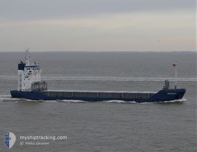
PARAMAR
General Cargo
Current Trip
| Time Travelled | 3 days |
|---|---|
| Remaining Time | 2 days |
| Distance Travelled | 681.26 nm |
| Remaining Distance | 563.09 nm |
| AVG Speed | 8.4 Noeuds |
| MAX Speed | 10 Noeuds |
| AVG Wind | 12.2 knots |
| MAX Wind | 27.1 knots |
| MIN Temp | 12°C / 53.6°F |
| MAX Temp | 24.3°C / 75.74°F |
| Tirant d eau | 6 m |
| Position reçue | 11 h, 22 m depuis |
Current Position
| Longitude | -9.04646° |
|---|---|
| Latitude | 44.31324° |
| Etat | Under way using engine |
| Vitesse | 7.2 Noeuds |
| Parcours | 43° |
| Zone | North Atlantic Ocean |
| Station | T-AIS |
| Position reçue | 11 h, 22 m depuis |
Info
Information
The current position of PARAMAR is in North Atlantic Ocean with coordinates 44.31324° / -9.04646° as reported on 2024-04-19 16:18 by AIS to our vessel tracker app. The vessel's current speed is 7.2 Noeuds and is heading at the port of BELFAST. The estimated time of arrival as calculated by MyShipTracking vessel tracking app is 2024-04-22 18:01 LT
The vessel PARAMAR (IMO: 9190262, MMSI: 275529000) is a General Cargo that was built in 1999 ( 25 Age ). It's sailing under the flag of [LV] Latvia.
In this page you can find informations about the vessels current position, last detected port calls, and current voyage information. If the vessels is not in coverage by AIS you will find the latest position.
The current position of PARAMAR is detected by our AIS receivers and we are not responsible for the reliability of the data. The last position was recorded while the vessel was in Coverage by the Ais receivers of our vessel tracking app.
The current draught of PARAMAR as reported by AIS is 6 meters
Weather
| Temperature | 11.9°C / 53.42°F |
|---|---|
| Wind Speed | 19 knots |
| Direction | 74° ENE |
| Pressure | 1022.5 hPa |
| Humidity | 82.8 % |
| Cloud Coverage | 3 % |
Featured Company
Last Port Calls
| Port | Arrival | Departure | Time In Port |
|---|---|---|---|
| 2024-04-16 06:19 | 2024-04-16 06:51 | 32 m | |
| 2024-04-13 12:57 | 2024-04-14 17:24 | 1 d | |
| 2024-03-25 15:59 | 2024-03-25 17:40 | 1 h | |
| 2024-03-23 06:13 | 2024-03-25 13:30 | 2 d | |
| 2024-03-10 21:56 | 2024-03-12 02:40 | 1 d | |
| 2024-02-29 18:48 | 2024-03-06 13:05 | 5 d | |
| 2024-02-21 12:11 | 2024-02-22 17:12 | 1 d | |
| 2024-02-16 11:35 | 2024-02-19 22:03 | 3 d | |
| 2024-02-08 15:47 | 2024-02-09 21:39 | 1 d | |
| 2024-02-08 07:47 | 2024-02-08 14:18 | 6 h |
Last Trips
| Origin | Departure | Destination | Arrival | Distance | |
|---|---|---|---|---|---|
| 2024-04-14 18:24 | 2024-04-16 08:19 | 262.09 nm | |||
| 2024-03-25 18:40 | 2024-04-13 12:57 | 1881.89 nm | |||
| 2024-03-25 14:30 | 2024-03-25 16:59 | 24.82 nm | |||
| 2024-03-12 03:40 | 2024-03-23 07:13 | 1350.47 nm | |||
| 2024-03-06 14:05 | 2024-03-10 22:56 | 318.81 nm | |||
| 2024-02-22 18:12 | 2024-02-29 19:48 | 1539.56 nm | |||
| 2024-02-19 23:03 | 2024-02-21 13:11 | 355.21 nm | |||
| 2024-02-09 22:39 | 2024-02-16 12:35 | 1106.78 nm | |||
| 2024-02-08 15:18 | 2024-02-08 16:47 | 11.09 nm | |||
| 2024-02-05 15:42 | 2024-02-08 08:47 | 301.75 nm |
Events
| Heure | Evenement | Détails | Position/ Destination | Info |
|---|---|---|---|---|
| 2024-04-19 16:25 | Etat Changé | Default Under way using engine |
44.32333 / -9.03500
GBBEL
|
Vitesse: 7.2 kn Parcours: 43° |
| 2024-04-19 16:18 | Hors de la zone couverte |
44.31324 / -9.04646
North Atlantic Ocean
GBBEL
|
Vitesse: 7.2 kn Parcours: 43° |
|
| 2024-04-19 16:06 | Etat Changé | Under way using engine Default |
44.29442 / -9.06598
GBBEL
|
Vitesse: 7 kn Parcours: 37° |
| 2024-04-19 15:49 | Dans la zone couverte |
44.29442 / -9.06598
North Atlantic Ocean
GBBEL
|
Vitesse: 6.8 kn Parcours: 38° |
|
| 2024-04-19 14:40 | Etat Changé | Default Under way using engine |
44.14834 / -9.21500
GBBEL
|
Vitesse: 7.6 kn Parcours: 26° |
| 2024-04-19 14:24 | Hors de la zone couverte |
44.12223 / -9.23843
North Atlantic Ocean
GBBEL
|
Vitesse: 7.6 kn Parcours: 26° |
|
| 2024-04-19 14:10 | Etat Changé | Under way using engine Default |
44.09592 / -9.25260
GBBEL
|
Vitesse: 8 kn Parcours: 20° |
| 2024-04-19 13:55 | Dans la zone couverte |
44.09592 / -9.25260
North Atlantic Ocean
GBBEL
|
Vitesse: 7 kn Parcours: 21° |
|
| 2024-04-19 11:28 | Etat Changé | Default Under way using engine |
43.79822 / -9.42688
GBBEL
|
Vitesse: 7.2 kn Parcours: 20.4° |
| 2024-04-19 10:52 | Hors de la zone couverte |
43.73295 / -9.47123
North Atlantic Ocean
GBBEL
|
Vitesse: 7.2 kn Parcours: 20.4° |