
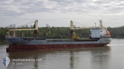
OSLO BULK 4
General Cargo
Current Trip
MX TAM
| Time Travelled | 6 h, 53 mins |
|---|---|
| Remaining Time | --- |
| Distance Travelled | 49.53 nm |
| Remaining Distance | --- |
| AVG Speed | 9.9 Noeuds |
| MAX Speed | 10.7 Noeuds |
| AVG Wind | 10.1 knots |
| MAX Wind | 11 knots |
| MIN Temp | 23.2°C / 73.76°F |
| MAX Temp | 25.3°C / 77.54°F |
| Tirant d eau | 6.8 m |
| Position reçue | 9 d depuis |
Current Position
| Longitude | -74.21631° |
|---|---|
| Latitude | 11.24910° |
| Etat | Moored |
| Vitesse | |
| Parcours | 24° |
| Zone | Gulf of Mexico |
| Station | T-AIS |
| Position reçue | 9 d depuis |
Info
Information
The current position of OSLO BULK 4 is in Gulf of Mexico with coordinates 11.24910° / -74.21631° as reported on 2024-04-10 22:00 by AIS to our vessel tracker app. The vessel's current speed is 0 Noeuds
The vessel OSLO BULK 4 (IMO: 9589956, MMSI: 257432000) is a General Cargo that was built in 2010 ( 14 Age ). It's sailing under the flag of [NO] Norway.
In this page you can find informations about the vessels current position, last detected port calls, and current voyage information. If the vessels is not in coverage by AIS you will find the latest position.
The current position of OSLO BULK 4 is detected by our AIS receivers and we are not responsible for the reliability of the data. The last position was recorded while the vessel was in Coverage by the Ais receivers of our vessel tracking app.
The current draught of OSLO BULK 4 as reported by AIS is 6.8 meters
Weather
| Temperature | 23.5°C / 74.3°F |
|---|---|
| Wind Speed | 9 knots |
| Direction | 205° SSW |
| Pressure | 1016.6 hPa |
| Humidity | 83 % |
| Cloud Coverage | 18 % |
Featured Company
Last Port Calls
| Port | Arrival | Departure | Time In Port |
|---|---|---|---|
| 2024-04-17 03:15 | 2024-04-19 20:06 | 2 d | |
| 2024-04-10 13:13 | 2024-04-11 15:55 | 1 d | |
| 2024-04-07 22:59 | 2024-04-08 07:07 | 8 h | |
| 2024-04-01 00:47 | 2024-04-03 18:07 | 2 d | |
| 2024-03-25 20:24 | 2024-03-27 20:45 | 2 d | |
| 2024-03-19 23:23 | 2024-03-22 03:27 | 2 d | |
| 2024-03-12 05:21 | 2024-03-13 07:17 | 1 d | |
| 2024-02-15 08:53 | 2024-02-16 20:51 | 1 d |
Most Visited Ports (Last year)
| Port | Arrivals | |
|---|---|---|
| 9 | ||
| 3 | ||
| 3 | ||
| 3 | ||
| 3 | ||
| 2 |
Last Trips
| Origin | Departure | Destination | Arrival | Distance | |
|---|---|---|---|---|---|
| 2024-04-11 10:55 | 2024-04-16 22:15 | 1473.40 nm | |||
| 2024-04-08 02:07 | 2024-04-10 08:13 | 459.73 nm | |||
| 2024-04-03 13:07 | 2024-04-07 17:59 | 1118.40 nm | |||
| 2024-03-27 14:45 | 2024-03-31 19:47 | 809.23 nm | |||
| 2024-03-21 22:27 | 2024-03-25 14:24 | 817.94 nm | |||
| 2024-03-13 01:17 | 2024-03-19 18:23 | 1326.01 nm | |||
| 2024-02-16 16:51 | 2024-03-11 23:21 | 2836.52 nm | |||
| 2024-01-30 16:46 | 2024-02-15 04:53 | 1898.75 nm |
Events
| Heure | Evenement | Détails | Position/ Destination | Info |
|---|---|---|---|---|
| 2024-04-19 20:06 | PORT DE DEPART |
|
30.61976 / -88.03281
MX TAM
|
Vitesse: 9.9 kn Parcours: 179° |
| 2024-04-19 19:22 | Démarrage |
30.70344 / -88.03758
[US] MOBILE
|
Vitesse: 5.5 kn Parcours: 166° |
|
| 2024-04-17 03:15 | Arret |
30.69970 / -88.03865
[US] MOBILE
|
Vitesse: Parcours: 168° |
|
| 2024-04-17 03:15 | Port d'arrivée |
|
30.69970 / -88.03865
[US] MOBILE
|
Vitesse: 0.9 kn Parcours: 305° |
| 2024-04-11 15:55 | Démarrage | 0.25 nm, North West of SANTA MARTA |
11.24613 / -74.22398
MX TAM
|
Vitesse: 7.3 kn Parcours: 245° |
| 2024-04-11 15:55 | PORT DE DEPART |
|
11.24613 / -74.22398
MX TAM
|
Vitesse: 0.8 kn Parcours: 22° |
| 2024-04-10 22:12 | Etat Changé | Default Moored |
11.24909 / -74.21632
[CO] SANTA MARTA
|
Vitesse: Parcours: 24° |
| 2024-04-10 22:00 | Etat Changé | Moored Default |
11.24910 / -74.21631
[CO] SANTA MARTA
|
Vitesse: Parcours: 24° |
| 2024-04-10 22:00 | Hors de la zone couverte |
11.24910 / -74.21631
Gulf of Mexico
[CO] SANTA MARTA
|
Vitesse: Parcours: 57.8° |
|
| 2024-04-10 21:34 | Etat Changé | Default Moored |
11.24833 / -74.21500
[CO] SANTA MARTA
|
Vitesse: Parcours: 24° |