
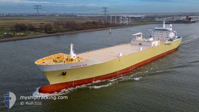
ORANGE SUN
Fruit Juice Tanker
Current Trip
| Time Travelled | 14 days |
|---|---|
| Remaining Time | 57 mins |
| Distance Travelled | 5479.08 nm |
| Remaining Distance | 18.03 nm |
| AVG Speed | 15.2 Noeuds |
| MAX Speed | 18.3 Noeuds |
| AVG Wind | 17.4 knots |
| MAX Wind | 35.7 knots |
| MIN Temp | 10.9°C / 51.62°F |
| MAX Temp | 29.8°C / 85.64°F |
| Tirant d eau | 7.6 m |
| Position reçue | 12 h, 38 m depuis |
Current Position
| Longitude | -43.68929° |
|---|---|
| Latitude | -23.56190° |
| Etat | Under way using engine |
| Vitesse | 13.7 Noeuds |
| Parcours | 252.2° |
| Zone | South Atlantic Ocean |
| Station | T-AIS |
| Position reçue | 12 h, 38 m depuis |
Info
Information
The current position of ORANGE SUN is in South Atlantic Ocean with coordinates -23.56190° / -43.68929° as reported on 2024-04-19 10:00 by AIS to our vessel tracker app. The vessel's current speed is 13.7 Noeuds and is heading at the port of SANTOS. The estimated time of arrival as calculated by MyShipTracking vessel tracking app is 2024-04-19 23:36 LT
The vessel ORANGE SUN (IMO: 9342580, MMSI: 636012804) is a Fruit Juice Tanker that was built in 2007 ( 17 Age ). It's sailing under the flag of [LR] Liberia.
In this page you can find informations about the vessels current position, last detected port calls, and current voyage information. If the vessels is not in coverage by AIS you will find the latest position.
The current position of ORANGE SUN is detected by our AIS receivers and we are not responsible for the reliability of the data. The last position was recorded while the vessel was in Coverage by the Ais receivers of our vessel tracking app.
The current draught of ORANGE SUN as reported by AIS is 7.6 meters
Weather
| Temperature | 22.9°C / 73.22°F |
|---|---|
| Wind Speed | 7 knots |
| Direction | 89° E |
| Pressure | 1019.1 hPa |
| Humidity | 66.7 % |
| Cloud Coverage | 1 % |
Featured Company
Last Port Calls
| Port | Arrival | Departure | Time In Port |
|---|---|---|---|
| 2024-03-31 05:50 | 2024-04-05 06:49 | 5 d | |
| 2024-03-11 07:08 | 2024-03-16 02:18 | 4 d | |
| 2024-02-17 18:08 | 2024-02-25 18:07 | 7 d | |
| 2024-02-04 02:31 |
Most Visited Ports (Last year)
| Port | Arrivals | |
|---|---|---|
| 9 | ||
| 5 | ||
| 3 | ||
| 1 | ||
| 1 |
Events
| Heure | Evenement | Détails | Position/ Destination | Info |
|---|---|---|---|---|
| 2024-04-19 10:13 | Etat Changé | Default Under way using engine |
-23.57591 / -43.73940
BRSSZ
|
Vitesse: 13.7 kn Parcours: 252.2° |
| 2024-04-19 10:00 | Hors de la zone couverte |
-23.56190 / -43.68929
South Atlantic Ocean
BRSSZ
|
Vitesse: 13.7 kn Parcours: 252.2° |
|
| 2024-04-19 06:34 | Etat Changé | Under way using engine Default |
-23.32488 / -42.83861
BRSSZ
|
Vitesse: 14.2 kn Parcours: 251° |
| 2024-04-19 06:08 | Etat Changé | Default Under way using engine |
-23.28768 / -42.72620
BRSSZ
|
Vitesse: 14.7 kn Parcours: 251.2° |
| 2024-04-19 05:25 | Changement d'ETA | 2024/04/20 00:30 2024/04/19 18:00 |
-23.23431 / -42.54325
BRSSZ
|
Vitesse: 14.8 kn Parcours: 254.1° |
| 2024-04-19 05:25 | Etat Changé | Under way using engine Default |
-23.23431 / -42.54325
BRSSZ
|
Vitesse: 14.6 kn Parcours: 254° |
| 2024-04-19 05:15 | Dans la zone couverte |
-23.23507 / -42.54637
South Atlantic Ocean
BRSSZ
|
Vitesse: 14.9 kn Parcours: 254.6° |
|
| 2024-04-18 20:42 | Etat Changé | Default Under way using engine |
-22.17535 / -40.71178
BRSSZ
|
Vitesse: 12.9 kn Parcours: 233.7° |
| 2024-04-18 20:30 | Hors de la zone couverte |
-22.14881 / -40.67473
South Atlantic Ocean
BRSSZ
|
Vitesse: 12.9 kn Parcours: 233.7° |
|
| 2024-04-18 20:28 | Changement de zone | Brazilian part of the South Atlantic Ocean Spanish (Canary Islands) part of the North Atlantic Ocean |
-22.14526 / -40.66954
South Atlantic Ocean
BRSSZ
|
Vitesse: 12.9 kn Parcours: 234° |