
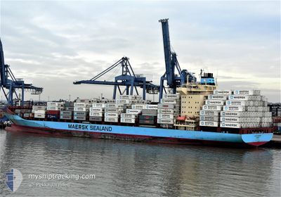
OLIVIA MAERSK
Container Ship
Current Trip
| Time Travelled | 12 days |
|---|---|
| Remaining Time | 4 days |
| Distance Travelled | 4689.88 nm |
| Remaining Distance | 1808.36 nm |
| AVG Speed | 16 Noeuds |
| MAX Speed | 17.6 Noeuds |
| AVG Wind | 12.2 knots |
| MAX Wind | 24.8 knots |
| MIN Temp | 21.7°C / 71.06°F |
| MAX Temp | 31.1°C / 87.98°F |
| Tirant d eau | 9.5 m |
| Position reçue | 9 d depuis |
Current Position
| Longitude | -95.86173° |
|---|---|
| Latitude | 0.29723° |
| Etat | Under way using engine |
| Vitesse | 15.6 Noeuds |
| Parcours | 232.4° |
| Zone | North Pacific Ocean |
| Station | T-AIS |
| Position reçue | 9 d depuis |
Info
Information
The current position of OLIVIA MAERSK is in North Pacific Ocean with coordinates 0.29723° / -95.86173° as reported on 2024-04-11 00:14 by AIS to our vessel tracker app. The vessel's current speed is 15.6 Noeuds and is heading at the port of TAURANGA. The estimated time of arrival as calculated by MyShipTracking vessel tracking app is 2024-04-25 00:46 LT
The vessel OLIVIA MAERSK (IMO: 9251638, MMSI: 220216000) is a Container Ship that was built in 2003 ( 21 Age ). It's sailing under the flag of [DK] Denmark.
In this page you can find informations about the vessels current position, last detected port calls, and current voyage information. If the vessels is not in coverage by AIS you will find the latest position.
The current position of OLIVIA MAERSK is detected by our AIS receivers and we are not responsible for the reliability of the data. The last position was recorded while the vessel was in Coverage by the Ais receivers of our vessel tracking app.
The current draught of OLIVIA MAERSK as reported by AIS is 9.5 meters
Weather
| Temperature | 21.8°C / 71.24°F |
|---|---|
| Wind Speed | 9 knots |
| Direction | 330° NNW |
| Pressure | 1014.9 hPa |
| Humidity | 84.1 % |
| Cloud Coverage | 100 % |
Featured Company
Last Port Calls
| Port | Arrival | Departure | Time In Port |
|---|---|---|---|
| 2024-04-06 02:13 | 2024-04-07 22:20 | 1 d | |
| 2024-03-20 11:43 | 2024-03-21 06:38 | 18 h | |
| 2024-03-08 15:54 | 2024-03-09 20:17 | 1 d | |
| 2024-03-05 02:39 | 2024-03-06 00:04 | 21 h | |
| 2024-02-29 18:32 | 2024-03-01 11:02 | 16 h | |
| 2024-02-12 01:29 | 2024-02-13 19:26 | 1 d | |
| 2024-02-04 15:08 | 2024-02-05 14:39 | 23 h | |
| 2024-02-02 10:26 | 2024-02-03 04:16 | 17 h |
Last Trips
| Origin | Departure | Destination | Arrival | Distance | |
|---|---|---|---|---|---|
| 2024-03-21 19:38 | 2024-04-05 21:13 | 6484.35 nm | |||
| 2024-03-10 07:17 | 2024-03-21 00:43 | 2168.69 nm | |||
| 2024-03-06 10:04 | 2024-03-09 02:54 | 1105.46 nm | |||
| 2024-03-02 00:02 | 2024-03-05 12:39 | 1450.78 nm | |||
| 2024-02-13 14:26 | 2024-03-01 07:32 | 6511.14 nm | |||
| 2024-02-05 09:39 | 2024-02-11 20:29 | 372.16 nm | |||
| 2024-02-02 23:16 | 2024-02-04 10:08 | 367.81 nm | |||
| 2024-01-07 19:35 | 2024-02-02 05:26 | 8846.46 nm |
Events
| Heure | Evenement | Détails | Position/ Destination | Info |
|---|---|---|---|---|
| 2024-04-11 00:19 | Etat Changé | Default Under way using engine |
.28347 / -95.88055
PABLB>NZTRG
|
Vitesse: 15.6 kn Parcours: 232.4° |
| 2024-04-11 00:14 | Hors de la zone couverte |
.29723 / -95.86173
North Pacific Ocean
PABLB>NZTRG
|
Vitesse: 15.6 kn Parcours: 232.4° |
|
| 2024-04-10 22:13 | Etat Changé | Under way using engine Default |
.61117 / -95.44289
PABLB>NZTRG
|
Vitesse: 15.3 kn Parcours: 230° |
| 2024-04-10 22:03 | Etat Changé | Default Under way using engine |
.63662 / -95.41043
PABLB>NZTRG
|
Vitesse: 15.3 kn Parcours: 231.1° |
| 2024-04-10 21:51 | Etat Changé | Under way using engine Default |
.66904 / -95.36907
PABLB>NZTRG
|
Vitesse: 15.3 kn Parcours: 235° |
| 2024-04-10 21:47 | Etat Changé | Default Under way using engine |
.67939 / -95.35593
PABLB>NZTRG
|
Vitesse: 15.1 kn Parcours: 232.5° |
| 2024-04-10 21:13 | Detecté en mer | High seas of the North Pacific Ocean |
.76574 / -95.23793
North Pacific Ocean
PABLB>NZTRG
|
Vitesse: 15.6 kn Parcours: 235.3° |
| 2024-04-10 20:38 | Etat Changé | Under way using engine Default |
.85411 / -95.11577
PABLB>NZTRG
|
Vitesse: 16 kn Parcours: 235° |
| 2024-04-10 20:23 | Etat Changé | Default Under way using engine |
.89475 / -95.05924
PABLB>NZTRG
|
Vitesse: 15.9 kn Parcours: 235.7° |
| 2024-04-10 19:48 | Etat Changé | Under way using engine Default |
.98308 / -94.93624
PABLB>NZTRG
|
Vitesse: 15.7 kn Parcours: 234° |