
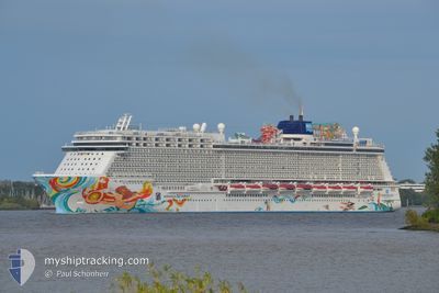
NORWEGIAN GETAWAY
Passengers Ship
Current Trip
| Time Travelled | 8 h, 50 mins |
|---|---|
| Remaining Time | 2 h, 1 mins |
| Distance Travelled | 80.35 nm |
| Remaining Distance | 19.70 nm |
| AVG Speed | 9.5 Noeuds |
| MAX Speed | 11.4 Noeuds |
| AVG Wind | 12.6 knots |
| MAX Wind | 13.9 knots |
| MIN Temp | 26.4°C / 79.52°F |
| MAX Temp | 27.2°C / 80.96°F |
| Tirant d eau | 8.6 m |
| Position reçue | 9 m depuis |
Current Position
| Longitude | -64.42701° |
|---|---|
| Latitude | 18.17590° |
| Etat | Under way using engine |
| Vitesse | 9 Noeuds |
| Parcours | 329° |
| Zone | Caribbean Sea |
| Station | T-AIS |
| Position reçue | 9 m depuis |
Info
Information
The current position of NORWEGIAN GETAWAY is in Caribbean Sea with coordinates 18.17590° / -64.42701° as reported on 2024-04-24 08:27 by AIS to our vessel tracker app. The vessel's current speed is 9 Noeuds and is heading at the port of ROAD TOWN. The estimated time of arrival as calculated by MyShipTracking vessel tracking app is 2024-04-24 10:38 LT
The vessel NORWEGIAN GETAWAY (IMO: 9606924, MMSI: 311050900) is a Passengers Ship that was built in 2014 ( 10 Age ). It's sailing under the flag of [BS] Bahamas.
In this page you can find informations about the vessels current position, last detected port calls, and current voyage information. If the vessels is not in coverage by AIS you will find the latest position.
The current position of NORWEGIAN GETAWAY is detected by our AIS receivers and we are not responsible for the reliability of the data. The last position was recorded while the vessel was in Coverage by the Ais receivers of our vessel tracking app.
The current draught of NORWEGIAN GETAWAY as reported by AIS is 8.6 meters
Weather
| Temperature | 26.7°C / 80.06°F |
|---|---|
| Wind Speed | 12 knots |
| Direction | 111° ESE |
| Pressure | 1014.1 hPa |
| Humidity | 81 % |
| Cloud Coverage | 100 % |
Featured Company
Last Port Calls
| Port | Arrival | Departure | Time In Port |
|---|---|---|---|
| 2024-04-23 16:04 | 2024-04-23 23:47 | 7 h | |
| 2024-04-19 07:09 | 2024-04-19 20:54 | 13 h | |
| 2024-04-15 10:15 | 2024-04-16 01:16 | 15 h | |
| 2024-04-14 10:09 | 2024-04-14 21:02 | 10 h | |
| 2024-04-13 11:08 | 2024-04-13 21:12 | 10 h | |
| 2024-04-12 11:22 | 2024-04-12 20:54 | 9 h | |
| 2024-04-11 17:29 | 2024-04-11 23:47 | 6 h | |
| 2024-04-10 12:58 | 2024-04-10 21:16 | 8 h | |
| 2024-04-07 07:45 | 2024-04-07 20:54 | 13 h | |
| 2024-04-04 14:54 | 2024-04-05 00:48 | 9 h |
Most Visited Ports (Last year)
| Port | Arrivals | |
|---|---|---|
| 19 | ||
| 16 | ||
| 14 | ||
| 13 | ||
| 10 | ||
| 8 |
Last Trips
| Origin | Departure | Destination | Arrival | Distance | |
|---|---|---|---|---|---|
| 2024-04-19 16:54 | 2024-04-23 12:04 | 1586.48 nm | |||
| 2024-04-15 21:16 | 2024-04-19 03:09 | 1425.36 nm | |||
| 2024-04-14 17:02 | 2024-04-15 06:15 | 108.67 nm | |||
| 2024-04-13 17:12 | 2024-04-14 06:09 | 192.83 nm | |||
| 2024-04-12 16:54 | 2024-04-13 07:08 | 93.46 nm | |||
| 2024-04-11 19:47 | 2024-04-12 07:22 | 100.29 nm | |||
| 2024-04-10 17:16 | 2024-04-11 13:29 | 374.00 nm | |||
| 2024-04-07 16:54 | 2024-04-10 08:58 | 1275.68 nm | |||
| 2024-04-04 20:48 | 2024-04-07 03:45 | 1012.97 nm | |||
| 2024-03-31 16:51 | 2024-04-04 10:54 | 1522.30 nm |
Events
| Heure | Evenement | Détails | Position/ Destination | Info |
|---|---|---|---|---|
| 2024-04-24 08:34 | Etat Changé | Default Under way using engine |
18.19169 / -64.43662
ROAD TOWN, TORTOLA
|
Vitesse: 9 kn Parcours: 329° |
| 2024-04-24 07:35 | Etat Changé | Under way using engine Default |
18.15134 / -64.31153
ROAD TOWN, TORTOLA
|
Vitesse: 7.1 kn Parcours: 265° |
| 2024-04-24 07:33 | Etat Changé | Default Under way using engine |
18.15182 / -64.30602
ROAD TOWN, TORTOLA
|
Vitesse: 7.2 kn Parcours: 264° |
| 2024-04-24 07:21 | Detecté en mer | British Virgin Islands part of the Caribbean Sea |
18.15404 / -64.28217
Caribbean Sea
ROAD TOWN, TORTOLA
|
Vitesse: 7 kn Parcours: 265° |
| 2024-04-24 07:21 | Etat Changé | Under way using engine Default |
18.15404 / -64.28217
ROAD TOWN, TORTOLA
|
Vitesse: 7.2 kn Parcours: 264° |
| 2024-04-24 07:18 | Dans la zone couverte |
18.15404 / -64.28217
Caribbean Sea
ROAD TOWN, TORTOLA
|
Vitesse: 7 kn Parcours: 265° |
|
| 2024-04-24 01:56 | Etat Changé | Default Under way using engine |
18.05419 / -63.44105
ROAD TOWN, TORTOLA
|
Vitesse: 10.7 kn Parcours: 283.8° |
| 2024-04-24 01:49 | Detecté en mer | Anguilla part of the Caribbean Sea |
18.04931 / -63.41950
Caribbean Sea
ROAD TOWN, TORTOLA
|
Vitesse: 10.7 kn Parcours: 283.8° |
| 2024-04-24 01:49 | Etat Changé | Under way using engine Default |
18.04931 / -63.41950
ROAD TOWN, TORTOLA
|
Vitesse: 10.6 kn Parcours: 282° |
| 2024-04-24 01:49 | Hors de la zone couverte |
18.04931 / -63.41950
Caribbean Sea
ROAD TOWN, TORTOLA
|
Vitesse: 10.7 kn Parcours: 283.8° |