
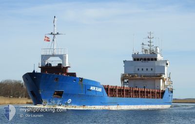
NORDLAND
General Cargo
Current Trip
| Time Travelled | 23 h, 31 mins |
|---|---|
| Remaining Time | --- |
| Distance Travelled | 235.59 nm |
| Remaining Distance | --- |
| AVG Speed | 10.2 Noeuds |
| MAX Speed | 12.8 Noeuds |
| AVG Wind | 11.4 knots |
| MAX Wind | 22.8 knots |
| MIN Temp | 2.5°C / 36.5°F |
| MAX Temp | 7.5°C / 45.5°F |
| Tirant d eau | 5.7 m |
| Position reçue | Maintenant |
Current Position
| Longitude | 4.70826° |
|---|---|
| Latitude | 53.37438° |
| Etat | Under way using engine |
| Vitesse | 11.7 Noeuds |
| Parcours | 32° |
| Zone | North Sea |
| Station | T-AIS |
| Position reçue | Maintenant |
Info
Information
The current position of NORDLAND is in North Sea with coordinates 53.37438° / 4.70826° as reported on 2024-04-25 17:42 by AIS to our vessel tracker app. The vessel's current speed is 11.7 Noeuds and is heading at the port of VIRPIPERA. The estimated time of arrival as calculated by MyShipTracking vessel tracking app is 2024-04-30 15:00 LT
The vessel NORDLAND (IMO: 9281786, MMSI: 275519000) is a General Cargo that was built in 2003 ( 21 Age ). It's sailing under the flag of [LV] Latvia.
In this page you can find informations about the vessels current position, last detected port calls, and current voyage information. If the vessels is not in coverage by AIS you will find the latest position.
The current position of NORDLAND is detected by our AIS receivers and we are not responsible for the reliability of the data. The last position was recorded while the vessel was in Coverage by the Ais receivers of our vessel tracking app.
The current draught of NORDLAND as reported by AIS is 5.7 meters
Weather
| Temperature | 7°C / 44.6°F |
|---|---|
| Wind Speed | 8 knots |
| Direction | 286° WNW |
| Pressure | 999.5 hPa |
| Humidity | 73.3 % |
| Cloud Coverage | 100 % |
Featured Company
Last Port Calls
| Port | Arrival | Departure | Time In Port |
|---|---|---|---|
| 2024-04-21 04:34 | 2024-04-24 18:12 | 3 d | |
| 2024-04-18 04:50 | 2024-04-18 17:55 | 13 h | |
| 2024-04-18 04:16 | 2024-04-18 04:28 | 12 m | |
| 2024-04-05 07:09 | 2024-04-11 16:14 | 6 d | |
| 2024-03-18 00:49 | 2024-03-18 00:53 | 4 m | |
| 2024-03-14 19:30 | 2024-03-15 21:15 | 1 d | |
| 2024-03-11 14:27 | 2024-03-13 15:40 | 2 d | |
| 2024-02-19 10:17 | 2024-03-02 13:11 | 12 d | |
| 2024-02-12 07:37 | 2024-02-14 10:13 | 2 d | |
| 2024-02-07 19:16 | 2024-02-11 10:03 | 3 d |
Last Trips
| Origin | Departure | Destination | Arrival | Distance | |
|---|---|---|---|---|---|
| 2024-04-18 19:55 | 2024-04-21 05:34 | 264.49 nm | |||
| 2024-04-18 06:28 | 2024-04-18 06:50 | 1.28 nm | |||
| 2024-04-11 19:14 | 2024-04-18 06:16 | 1348.67 nm | |||
| 2024-03-18 01:53 | 2024-04-05 10:09 | 967.51 nm | |||
| 2024-03-15 21:15 | 2024-03-18 01:49 | 454.67 nm | |||
| 2024-03-13 16:40 | 2024-03-14 19:30 | 233.03 nm | |||
| 2024-03-02 15:11 | 2024-03-11 15:27 | 1231.18 nm | |||
| 2024-02-14 11:13 | 2024-02-19 12:17 | 686.69 nm | |||
| 2024-02-11 12:03 | 2024-02-12 08:37 | 205.23 nm | |||
| 2024-02-07 08:35 | 2024-02-07 21:16 | 140.01 nm |
Events
| Heure | Evenement | Détails | Position/ Destination | Info |
|---|---|---|---|---|
| 2024-04-25 15:47 | Etat Changé | Under way using engine Default |
53.04168 / 4.40721
FIRAA
|
Vitesse: 11.6 kn Parcours: 31° |
| 2024-04-25 15:25 | Etat Changé | Default Under way using engine |
52.98262 / 4.34818
FIRAA
|
Vitesse: 11.3 kn Parcours: 30.1° |
| 2024-04-25 14:30 | Etat Changé | Under way using engine Default |
52.83612 / 4.19461
FIRAA
|
Vitesse: 10.6 kn Parcours: 34° |
| 2024-04-25 14:25 | Etat Changé | Default Under way using engine |
52.82564 / 4.18328
FIRAA
|
Vitesse: 10.7 kn Parcours: 32.6° |
| 2024-04-25 14:17 | Etat Changé | Under way using engine Default |
52.80380 / 4.15982
FIRAA
|
Vitesse: 10.7 kn Parcours: 34° |
| 2024-04-25 13:40 | Etat Changé | Default Under way using engine |
52.71381 / 4.06351
FIRAA
|
Vitesse: 10.7 kn Parcours: 30.6° |
| 2024-04-25 13:31 | Etat Changé | Under way using engine Default |
52.69313 / 4.03789
FIRAA
|
Vitesse: 10.4 kn Parcours: 41° |
| 2024-04-25 13:21 | Etat Changé | Default Under way using engine |
52.67128 / 4.00846
FIRAA
|
Vitesse: 10.5 kn Parcours: 41.5° |
| 2024-04-25 12:48 | Etat Changé | Under way using engine Default |
52.59814 / 3.90948
FIRAA
|
Vitesse: 10 kn Parcours: 42° |
| 2024-04-25 12:39 | Changement de zone | Dutch part of the North Sea United Kingdom part of the North Sea |
52.57760 / 3.88147
North Sea
FIRAA
|
Vitesse: 10 kn Parcours: 40° |