
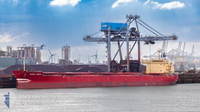
NORDIC ORION
Bulk Carrier
Current Trip
| Trip Time | 8 days |
|---|---|
| Trip Distance | 2203.42 nm |
| AVG Speed | 11.1 Noeuds |
| MAX Speed | 14.1 Noeuds |
| Tirant d eau | 7.3 m |
| AVG Wind | 16.4 knots |
| MAX Wind | 26 knots |
| MIN Temp | -6.4°C / 20.48°F |
| MAX Temp | 14.4°C / 57.92°F |
| Position reçue | 2 d depuis |
Current Position
| Longitude | 21.12443° |
|---|---|
| Latitude | 63.59310° |
| Etat | Under way using engine |
| Vitesse | 7.2 Noeuds |
| Parcours | 65° |
| Zone | Gulf of Bothnia |
| Station | T-AIS |
| Position reçue | 2 d depuis |
Info
Information
The current position of NORDIC ORION is in Gulf of Bothnia with coordinates 63.59310° / 21.12443° as reported on 2024-04-22 05:09 by AIS to our vessel tracker app. The vessel's current speed is 7.2 Noeuds and is currently inside the port of LULEA.
The vessel NORDIC ORION (IMO: 9529463, MMSI: 538009229) is a Bulk Carrier that was built in 2011 ( 13 Age ). It's sailing under the flag of [MH] Marshall Is.
In this page you can find informations about the vessels current position, last detected port calls, and current voyage information. If the vessels is not in coverage by AIS you will find the latest position.
The current position of NORDIC ORION is detected by our AIS receivers and we are not responsible for the reliability of the data. The last position was recorded while the vessel was in Coverage by the Ais receivers of our vessel tracking app.
The current draught of NORDIC ORION as reported by AIS is 7.3 meters
Weather
| Temperature | -0.7°C / 30.74°F |
|---|---|
| Wind Speed | 7 knots |
| Direction | 89° E |
| Pressure | 1011.2 hPa |
| Humidity | 96.4 % |
| Cloud Coverage | 95 % |
Featured Company
Last Port Calls
| Port | Arrival | Departure | Time In Port |
|---|---|---|---|
| 2024-04-23 04:20 | |||
| 2024-04-12 09:00 | 2024-04-14 21:24 | 2 d | |
| 2024-03-31 13:50 | 2024-04-01 16:59 | 1 d | |
| 2024-03-30 03:29 | 2024-03-30 14:20 | 10 h | |
| 2024-03-07 19:05 | 2024-03-11 07:39 | 3 d | |
| 2024-02-18 14:55 | 2024-02-19 23:56 | 1 d |
Most Visited Ports (Last year)
| Port | Arrivals | |
|---|---|---|
| 4 | ||
| 3 | ||
| 2 | ||
| 2 | ||
| 2 | ||
| 1 |
Last Trips
| Origin | Departure | Destination | Arrival | Distance | |
|---|---|---|---|---|---|
| 2024-04-14 23:24 | 2024-04-23 06:20 | 2203.42 nm | |||
| 2024-04-01 12:59 | 2024-04-12 11:00 | 2790.99 nm | |||
| 2024-03-30 10:20 | 2024-03-31 09:50 | 4.23 nm | |||
| 2024-03-11 03:39 | 2024-03-29 23:29 | 597.68 nm | |||
| 2024-02-19 20:56 | 2024-03-07 14:05 | 3884.78 nm | |||
| 2024-01-31 06:58 | 2024-02-18 11:55 | 4380.23 nm |
Events
| Heure | Evenement | Détails | Position/ Destination | Info |
|---|---|---|---|---|
| 2024-04-23 05:40 | Arret |
65.54462 / 22.28462
[SE] LULEA
|
Vitesse: 0.1 kn Parcours: 99° |
|
| 2024-04-23 04:20 | Port d'arrivée |
|
65.54435 / 22.27192
[SE] LULEA
|
Vitesse: 8.5 kn Parcours: 298° |
| 2024-04-23 03:44 | Démarrage | 7.62 nm, South East of LULEA |
65.49419 / 22.40293
ESGIJ=>SELLA
|
Vitesse: 3.8 kn Parcours: 307° |
| 2024-04-23 03:36 | Arret | 7.78 nm, South East of LULEA |
65.49253 / 22.40798
ESGIJ=>SELLA
|
Vitesse: Parcours: 308° |
| 2024-04-22 05:16 | Etat Changé | Default Under way using engine |
63.59981 / 21.15547
ESGIJ=>SELLA
|
Vitesse: 7.2 kn Parcours: 65° |
| 2024-04-22 05:09 | Hors de la zone couverte |
63.59310 / 21.12443
Gulf of Bothnia
ESGIJ=>SELLA
|
Vitesse: 7.2 kn Parcours: 65° |
|
| 2024-04-22 03:02 | Detecté en mer | Swedish part of the Gulf of Bothnia |
63.45935 / 20.64430
Gulf of Bothnia
ESGIJ=>SELLA
|
Vitesse: 5.3 kn Parcours: 30° |
| 2024-04-21 23:28 | Changement de zone | Finnish part of the Gulf of Bothnia Swedish part of the Gulf of Bothnia |
62.85558 / 20.19958
Gulf of Bothnia
ESGIJ=>SELLA
|
Vitesse: 11.1 kn Parcours: 13° |
| 2024-04-21 23:27 | Etat Changé | Under way using engine Default |
62.85355 / 20.19862
ESGIJ=>SELLA
|
Vitesse: 11.1 kn Parcours: 16° |
| 2024-04-21 23:12 | Dans la zone couverte |
62.85558 / 20.19958
Gulf of Bothnia
ESGIJ=>SELLA
|
Vitesse: 11.1 kn Parcours: 13° |