
NORDIC NANJING
Bulk Carrier
Current Trip
| Time Travelled | --- |
|---|---|
| Remaining Time | 12 h, 59 mins |
| Distance Travelled | --- |
| Remaining Distance | 148.35 nm |
| AVG Speed | --- |
| MAX Speed | --- |
| AVG Wind | --- |
| MAX Wind | --- |
| MIN Temp | --- |
| MAX Temp | --- |
| Tirant d eau | 8.6 m |
| Position reçue | 1 m depuis |
Current Position
| Longitude | 1.81693° |
|---|---|
| Latitude | 51.13775° |
| Etat | Under way using engine |
| Vitesse | 11 Noeuds |
| Parcours | 49.5° |
| Zone | North Sea |
| Station | T-AIS |
| Position reçue | 1 m depuis |
Info
Information
The current position of NORDIC NANJING is in North Sea with coordinates 51.13775° / 1.81693° as reported on 2024-04-25 05:54 by AIS to our vessel tracker app. The vessel's current speed is 11 Noeuds and is heading at the port of AMSTERDAM. The estimated time of arrival as calculated by MyShipTracking vessel tracking app is 2024-04-25 18:54 LT
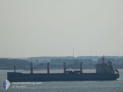
The vessel NORDIC NANJING (IMO: 9647291, MMSI: 636018580) is a Bulk Carrier that was built in 2013 ( 11 Age ). It's sailing under the flag of [LR] Liberia.
In this page you can find informations about the vessels current position, last detected port calls, and current voyage information. If the vessels is not in coverage by AIS you will find the latest position.
The current position of NORDIC NANJING is detected by our AIS receivers and we are not responsible for the reliability of the data. The last position was recorded while the vessel was in Coverage by the Ais receivers of our vessel tracking app.
The current draught of NORDIC NANJING as reported by AIS is 8.6 meters
Weather
| Temperature | 6.2°C / 43.16°F |
|---|---|
| Wind Speed | 9 knots |
| Direction | 257° WSW |
| Pressure | 1008.3 hPa |
| Humidity | 71.1 % |
| Cloud Coverage | 100 % |
Featured Company
Events
| Heure | Evenement | Détails | Position/ Destination | Info |
|---|---|---|---|---|
| 2024-04-25 04:53 | Changement de zone | French part of the North Sea French part of the English Channel |
51.01905 / 1.58875
North Sea
NL AMS
|
Vitesse: 11.6 kn Parcours: 45.7° |
| 2024-04-25 02:38 | Etat Changé | Under way using engine Default |
50.64144 / 1.23939
NL AMS
|
Vitesse: 12.1 kn Parcours: 49° |
| 2024-04-25 02:36 | Etat Changé | Default Under way using engine |
50.63807 / 1.23342
NL AMS
|
Vitesse: 12.1 kn Parcours: 48.9° |
| 2024-04-25 02:23 | Changement de zone | French part of the English Channel United Kingdom part of the English Channel |
50.60822 / 1.17966
English Channel
NL AMS
|
Vitesse: 12.2 kn Parcours: 48.7° |
| 2024-04-25 02:20 | Etat Changé | Under way using engine Default |
50.60233 / 1.16899
NL AMS
|
Vitesse: 12.1 kn Parcours: 48° |
| 2024-04-25 02:16 | Dans la zone couverte |
50.60822 / 1.17966
English Channel
NL AMS
|
Vitesse: 12.2 kn Parcours: 48.7° |
|
| 2024-04-25 01:24 | Etat Changé | Default Under way using engine |
50.49517 / .93914
NL AMS
|
Vitesse: 11.8 kn Parcours: 73.8° |
| 2024-04-25 01:17 | Hors de la zone couverte |
50.49141 / .90480
English Channel
NL AMS
|
Vitesse: 11.8 kn Parcours: 73.8° |
|
| 2024-04-25 01:14 | Etat Changé | Under way using engine Default |
50.48810 / .88748
NL AMS
|
Vitesse: 11.8 kn Parcours: 74° |
| 2024-04-25 00:56 | Etat Changé | Default Under way using engine |
50.47095 / .80007
NL AMS
|
Vitesse: 11.8 kn Parcours: 71.9° |