
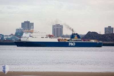
NORBAY
Passenger A
Current Trip
| Time Travelled | 1 h, 13 mins |
|---|---|
| Remaining Time | 2 h, 39 mins |
| Distance Travelled | 19.61 nm |
| Remaining Distance | 53.47 nm |
| AVG Speed | 18.5 Noeuds |
| MAX Speed | 20.9 Noeuds |
| AVG Wind | 11.9 knots |
| MAX Wind | 14 knots |
| MIN Temp | 10.5°C / 50.9°F |
| MAX Temp | 10.7°C / 51.26°F |
| Tirant d eau | 5.1 m |
| Position reçue | 1 m depuis |
Current Position
| Longitude | -5.83468° |
|---|---|
| Latitude | 52.09056° |
| Etat | Under way using engine |
| Vitesse | 17.8 Noeuds |
| Parcours | 149.8° |
| Zone | Irish Sea and St. George's Channel |
| Station | T-AIS |
| Position reçue | 1 m depuis |
Info
Information
The current position of NORBAY is in Irish Sea and St. George's Channel with coordinates 52.09056° / -5.83468° as reported on 2024-04-19 08:39 by AIS to our vessel tracker app. The vessel's current speed is 17.8 Noeuds and is heading at the port of PEMBROKE. The estimated time of arrival as calculated by MyShipTracking vessel tracking app is 2024-04-19 11:19 LT
The vessel NORBAY (IMO: 9056595, MMSI: 310362000) is a Passenger A It's sailing under the flag of [BM] Bermuda.
In this page you can find informations about the vessels current position, last detected port calls, and current voyage information. If the vessels is not in coverage by AIS you will find the latest position.
The current position of NORBAY is detected by our AIS receivers and we are not responsible for the reliability of the data. The last position was recorded while the vessel was in Coverage by the Ais receivers of our vessel tracking app.
The current draught of NORBAY as reported by AIS is 5.1 meters
Weather
| Temperature | 10.1°C / 50.18°F |
|---|---|
| Wind Speed | 15 knots |
| Direction | 291° WNW |
| Pressure | 1021.8 hPa |
| Humidity | 91.2 % |
| Cloud Coverage | 100 % |
Featured Company
Last Port Calls
| Port | Arrival | Departure | Time In Port |
|---|---|---|---|
| 2024-04-19 05:25 | 2024-04-19 07:27 | 2 h | |
| 2024-04-18 22:43 | 2024-04-19 02:02 | 3 h | |
| 2024-04-18 17:22 | 2024-04-18 19:36 | 2 h | |
| 2024-04-18 10:56 | 2024-04-18 14:08 | 3 h | |
| 2024-04-18 05:31 | 2024-04-18 07:36 | 2 h | |
| 2024-04-17 22:50 | 2024-04-18 02:22 | 3 h | |
| 2024-04-17 17:27 | 2024-04-17 19:49 | 2 h | |
| 2024-04-17 11:32 | 2024-04-17 14:18 | 2 h | |
| 2024-04-17 05:50 | 2024-04-17 08:14 | 2 h | |
| 2024-04-16 23:20 | 2024-04-17 02:33 | 3 h |
Last Trips
| Origin | Departure | Destination | Arrival | Distance | |
|---|---|---|---|---|---|
| 2024-04-19 03:02 | 2024-04-19 06:25 | 63.73 nm | |||
| 2024-04-18 20:36 | 2024-04-18 23:43 | 62.87 nm | |||
| 2024-04-18 15:08 | 2024-04-18 18:22 | 62.23 nm | |||
| 2024-04-18 08:36 | 2024-04-18 11:56 | 63.00 nm | |||
| 2024-04-18 03:22 | 2024-04-18 06:31 | 62.58 nm | |||
| 2024-04-17 20:49 | 2024-04-17 23:50 | 62.81 nm | |||
| 2024-04-17 15:18 | 2024-04-17 18:27 | 61.01 nm | |||
| 2024-04-17 09:14 | 2024-04-17 12:32 | 66.96 nm | |||
| 2024-04-17 03:33 | 2024-04-17 06:50 | 62.10 nm | |||
| 2024-04-16 21:17 | 2024-04-17 00:20 | 62.17 nm |
Events
| Heure | Evenement | Détails | Position/ Destination | Info |
|---|---|---|---|---|
| 2024-04-19 07:27 | PORT DE DEPART |
|
52.25964 / -6.33639
IEROS-GBPED-IEROS
|
Vitesse: 10.8 kn Parcours: 55° |
| 2024-04-19 07:25 | Démarrage |
52.25509 / -6.33962
[IE] ROSSLARE
|
Vitesse: 3.1 kn Parcours: 323° |
|
| 2024-04-19 07:20 | Tirant d'eau modifié | 5.1 5.3 |
52.25459 / -6.33844
[IE] ROSSLARE
|
Vitesse: Parcours: 326° |
| 2024-04-19 07:15 | Etat Changé | Under way using engine Moored |
52.25458 / -6.33844
[IE] ROSSLARE
|
Vitesse: Parcours: 326° |
| 2024-04-19 05:50 | Changement d'ETA | 2024/04/19 12:45 2024/04/19 06:45 |
52.25459 / -6.33844
[IE] ROSSLARE
|
Vitesse: Parcours: 326° |
| 2024-04-19 05:50 | Etat Changé | Moored Under way using engine |
52.25459 / -6.33844
[IE] ROSSLARE
|
Vitesse: Parcours: 326° |
| 2024-04-19 05:26 | Arret |
52.25655 / -6.34148
[IE] ROSSLARE
|
Vitesse: 0.3 kn Parcours: 252° |
|
| 2024-04-19 05:25 | Port d'arrivée |
|
52.25663 / -6.34131
[IE] ROSSLARE
|
Vitesse: 1.3 kn Parcours: 233° |
| 2024-04-19 04:10 | Detecté en mer | Irish part of the Irish Sea and St. George's Channel |
52.09117 / -5.82551
Irish Sea and St. George's Channel
IEROS-GBPED-IEROS
|
Vitesse: 20.2 kn Parcours: 321.6° |
| 2024-04-19 04:05 | Detecté en mer | United Kingdom part of the Irish Sea and St. George's Channel |
52.06906 / -5.79796
Irish Sea and St. George's Channel
IEROS-GBPED-IEROS
|
Vitesse: 20 kn Parcours: 322.5° |