
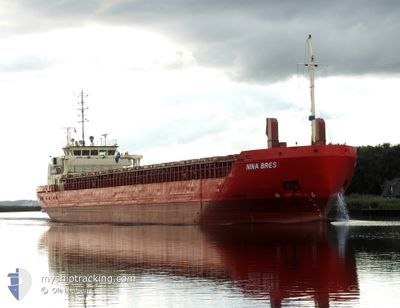
NINA BRES
General Cargo
Current Trip
| Time Travelled | 1 day |
|---|---|
| Remaining Time | --- |
| Distance Travelled | 281.21 nm |
| Remaining Distance | --- |
| AVG Speed | 7.6 Noeuds |
| MAX Speed | 11.2 Noeuds |
| AVG Wind | 4 knots |
| MAX Wind | 15 knots |
| MIN Temp | --- |
| MAX Temp | 9.2°C / 48.56°F |
| Tirant d eau | 5.3 m |
| Position reçue | 1 m depuis |
Current Position
| Longitude | 8.01903° |
|---|---|
| Latitude | 56.81633° |
| Etat | Under way using engine |
| Vitesse | 10.2 Noeuds |
| Parcours | 213.9° |
| Zone | North Sea |
| Station | T-AIS |
| Position reçue | 1 m depuis |
Info
Information
The current position of NINA BRES is in North Sea with coordinates 56.81633° / 8.01903° as reported on 2024-04-18 08:48 by AIS to our vessel tracker app. The vessel's current speed is 10.2 Noeuds and is heading at the port of AGADIR. The estimated time of arrival as calculated by MyShipTracking vessel tracking app is 2024-04-27 12:00 LT
The vessel NINA BRES (IMO: 9394260, MMSI: 304244000) is a General Cargo that was built in 2007 ( 17 Age ). It's sailing under the flag of [AG] Antigua Barbuda.
In this page you can find informations about the vessels current position, last detected port calls, and current voyage information. If the vessels is not in coverage by AIS you will find the latest position.
The current position of NINA BRES is detected by our AIS receivers and we are not responsible for the reliability of the data. The last position was recorded while the vessel was in Coverage by the Ais receivers of our vessel tracking app.
The current draught of NINA BRES as reported by AIS is 5.3 meters
Weather
| Temperature | 6.4°C / 43.52°F |
|---|---|
| Wind Speed | 9 knots |
| Direction | 78° ENE |
| Pressure | 1014.6 hPa |
| Humidity | 79.9 % |
| Cloud Coverage | 60 % |
Featured Company
Last Port Calls
| Port | Arrival | Departure | Time In Port |
|---|---|---|---|
| 2024-04-12 16:18 | 2024-04-16 18:43 | 4 d | |
| 2024-04-09 14:52 | 2024-04-10 06:30 | 15 h | |
| 2024-04-05 07:04 | 2024-04-06 04:00 | 20 h | |
| 2024-03-28 06:02 | 2024-03-30 08:56 | 2 d | |
| 2024-03-23 18:01 | 2024-03-26 18:07 | 3 d | |
| 2024-03-13 06:27 | 2024-03-14 21:40 | 1 d | |
| 2024-03-07 08:42 | 2024-03-11 11:08 | 4 d | |
| 2024-03-04 05:53 | |||
| 2024-02-10 04:46 | 2024-02-15 00:03 | 4 d | |
| 2024-02-05 21:02 | 2024-02-07 00:33 | 1 d |
Last Trips
| Origin | Departure | Destination | Arrival | Distance | |
|---|---|---|---|---|---|
| 2024-04-10 08:30 | 2024-04-12 18:18 | 556.20 nm | |||
| 2024-04-06 06:00 | 2024-04-09 16:52 | 445.88 nm | |||
| 2024-03-30 09:56 | 2024-04-05 09:04 | 243.06 nm | |||
| 2024-03-26 18:07 | 2024-03-28 07:02 | 338.19 nm | |||
| 2024-03-14 22:40 | 2024-03-23 18:01 | 2009.88 nm | |||
| 2024-03-11 12:08 | 2024-03-13 07:27 | 407.65 nm | |||
| 2024-02-15 01:03 | 2024-03-04 06:53 | 2308.33 nm | |||
| 2024-02-07 01:33 | 2024-02-10 05:46 | 690.52 nm | |||
| 2024-02-05 20:16 | 2024-02-05 22:02 | 22.51 nm | |||
| 2024-02-05 17:58 | 2024-02-05 19:18 | 8.27 nm |
Events
| Heure | Evenement | Détails | Position/ Destination | Info |
|---|---|---|---|---|
| 2024-04-18 06:05 | Changement de zone | Danish part of the North Sea Danish part of the Skaggerak |
57.19577 / 8.47176
North Sea
AGADIR
|
Vitesse: 9.7 kn Parcours: 209.8° |
| 2024-04-17 20:38 | Detecté en mer | Danish part of the Skaggerak |
57.80311 / 10.93017
Skaggerak
AGADIR
|
Vitesse: 9.5 kn Parcours: 300.5° |
| 2024-04-17 19:59 | Changement de zone | Danish part of the Kattegat Swedish part of the Kattegat |
57.75008 / 11.10506
Kattegat
AGADIR
|
Vitesse: 10.1 kn Parcours: 298.9° |
| 2024-04-17 17:31 | Démarrage | 1.25 nm, North of ASPERO |
57.67101 / 11.78395
AGADIR
|
Vitesse: 5 kn Parcours: 189.2° |
| 2024-04-17 17:26 | Etat Changé | Under way using engine At anchor |
57.67186 / 11.78231
AGADIR
|
Vitesse: 0.4 kn Parcours: 356° |
| 2024-04-17 12:31 | Etat Changé | At anchor Under way using engine |
57.67275 / 11.78353
AGADIR
|
Vitesse: 0.1 kn Parcours: 254° |
| 2024-04-17 12:30 | Arret | 1.27 nm, South of KROSSHOLMEN |
57.67283 / 11.78352
AGADIR
|
Vitesse: 0.3 kn Parcours: 250° |
| 2024-04-17 08:45 | Etat Changé | Under way using engine Default |
58.01570 / 12.13937
AGADIR
|
Vitesse: 9.1 kn Parcours: 191° |
| 2024-04-17 08:36 | Dans la zone couverte |
58.01400 / 12.13780
Kattegat
AGADIR
|
Vitesse: 10.2 kn Parcours: 205.9° |
|
| 2024-04-17 07:05 | Hors de la zone couverte |
58.17483 / 12.12168
Kattegat
AGADIR
|
Vitesse: 10.7 kn Parcours: 179.7° |