
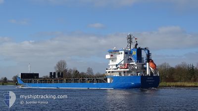
MYRTE
General Cargo
Current Trip
| Time Travelled | 16 h, 10 mins |
|---|---|
| Remaining Time | --- |
| Distance Travelled | 192.15 nm |
| Remaining Distance | --- |
| AVG Speed | 12.1 Noeuds |
| MAX Speed | 13 Noeuds |
| AVG Wind | 11.4 knots |
| MAX Wind | 16 knots |
| MIN Temp | 4.3°C / 39.74°F |
| MAX Temp | 6.3°C / 43.34°F |
| Tirant d eau | 8.1 m |
| Position reçue | 5 h, 13 m depuis |
Current Position
| Longitude | --- |
|---|---|
| Latitude | --- |
| Etat | Under way using engine |
| Vitesse | 12 Noeuds |
| Parcours | 140° |
| Zone | Gulf of Bothnia |
| Station | T-AIS |
| Position reçue | 5 h, 13 m depuis |
Info
Information
The current position of MYRTE is in Gulf of Bothnia with coordinates 59.81233° / 19.61117° as reported on 2025-12-09 15:12 by AIS to our vessel tracker app. The vessel's current speed is 12 Noeuds and is heading at the port of HONFLEUR AVANT-PORT. The estimated time of arrival as calculated by MyShipTracking vessel tracking app is 2025-12-15 05:00 LT
The vessel MYRTE (IMO: 9364136, MMSI: 246110000) is a General Cargo that was built in 2008 ( 17 Age ). It's sailing under the flag of [NL] Netherlands.
In this page you can find informations about the vessels current position, last detected port calls, and current voyage information. If the vessels is not in coverage by AIS you will find the latest position.
The current position of MYRTE is detected by our AIS receivers and we are not responsible for the reliability of the data. The last position was recorded while the vessel was in Coverage by the Ais receivers of our vessel tracking app.
The current draught of MYRTE as reported by AIS is 8.1 meters
Weather
| Temperature | 6.2°C / 43.16°F |
|---|---|
| Wind Speed | 5 knots |
| Direction | 312° NW |
| Pressure | 1008.4 hPa |
| Humidity | 87.4 % |
| Cloud Coverage | 100 % |
Featured Company
Last Port Calls
| Port | Arrival | Departure | Time In Port |
|---|---|---|---|
| 2025-12-06 17:46 | 2025-12-09 06:15 | 2 d | |
| 2025-12-01 23:53 | 2025-12-05 09:21 | 3 d | |
| 2025-11-28 06:41 | 2025-11-30 19:17 | 2 d | |
| 2025-11-16 11:06 | 2025-11-18 20:15 | 2 d | |
| 2025-11-14 06:41 | 2025-11-15 13:07 | 1 d | |
| 2025-11-09 22:21 | 2025-11-11 15:25 | 1 d | |
| 2025-11-06 16:51 | 2025-11-09 21:54 | 3 d | |
| 2025-10-25 18:52 | 2025-10-28 09:08 | 2 d | |
| 2025-10-20 18:28 | 2025-10-23 14:08 | 2 d | |
| 2025-10-16 12:34 | 2025-10-20 07:19 | 3 d |
Last Trips
| Origin | Departure | Destination | Arrival | Distance | |
|---|---|---|---|---|---|
| 2025-12-05 09:21 | 2025-12-06 17:46 | 326.28 nm | |||
| 2025-11-30 19:17 | 2025-12-01 23:53 | 296.66 nm | |||
| 2025-11-18 20:15 | 2025-11-28 06:41 | 2404.92 nm | |||
| 2025-11-15 13:07 | 2025-11-16 11:06 | 204.75 nm | |||
| 2025-11-11 15:25 | 2025-11-14 06:41 | 543.17 nm | |||
| 2025-11-09 21:54 | 2025-11-09 22:21 | 0.01 nm | |||
| 2025-10-28 09:08 | 2025-11-06 16:51 | 1991.25 nm | |||
| 2025-10-23 14:08 | 2025-10-25 18:52 | 334.34 nm | |||
| 2025-10-20 07:19 | 2025-10-20 18:28 | 118.54 nm | |||
| 2025-10-10 09:34 | 2025-10-16 12:34 | 1241.64 nm |
Events
| Heure | Evenement | Détails | Position/ Destination | Info |
|---|---|---|---|---|
| 2025-12-09 15:17 | Etat Changé | Default Under way using engine |
59.79867 / 19.63383
HONFLEUR
|
Vitesse: 12 kn Parcours: 140° |
| 2025-12-09 15:12 | Etat Changé | Under way using engine Default |
59.81233 / 19.61117
HONFLEUR
|
Vitesse: 12.1 kn Parcours: 140° |
| 2025-12-09 15:12 | Hors de la zone couverte |
59.81233 / 19.61117
Gulf of Bothnia
HONFLEUR
|
Vitesse: 12 kn Parcours: 140° |
|
| 2025-12-09 14:41 | Etat Changé | Default Under way using engine |
59.89125 / 19.48087
HONFLEUR
|
Vitesse: 12.3 kn Parcours: 141° |
| 2025-12-09 14:35 | Etat Changé | Under way using engine Default |
59.90583 / 19.45767
HONFLEUR
|
Vitesse: 12.3 kn Parcours: 141° |
| 2025-12-09 14:25 | Etat Changé | Default Under way using engine |
59.93356 / 19.41273
HONFLEUR
|
Vitesse: 12.2 kn Parcours: 140° |
| 2025-12-09 14:19 | Etat Changé | Under way using engine Default |
59.94929 / 19.38690
HONFLEUR
|
Vitesse: 12.3 kn Parcours: 140° |
| 2025-12-09 14:13 | Etat Changé | Default Under way using engine |
59.96450 / 19.36183
HONFLEUR
|
Vitesse: 12.2 kn Parcours: 140° |
| 2025-12-09 14:03 | Etat Changé | Under way using engine Default |
59.98983 / 19.31967
HONFLEUR
|
Vitesse: 12.1 kn Parcours: 140° |
| 2025-12-09 14:01 | Dans la zone couverte |
59.98900 / 19.32100
Gulf of Bothnia
HONFLEUR
|
Vitesse: 12.1 kn Parcours: 141° |