
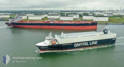
MYKINES
Vehicles Carrier
Current Trip
| Time Travelled | 12 h, 7 mins |
|---|---|
| Remaining Time | 1 day |
| Distance Travelled | 181.41 nm |
| Remaining Distance | 537.52 nm |
| AVG Speed | 15.4 Noeuds |
| MAX Speed | 17.3 Noeuds |
| AVG Wind | 12.3 knots |
| MAX Wind | 21.6 knots |
| MIN Temp | 4.5°C / 40.1°F |
| MAX Temp | 7.8°C / 46.04°F |
| Tirant d eau | 6.3 m |
| Position reçue | 30 m depuis |
Current Position
| Longitude | 1.26539° |
|---|---|
| Latitude | 54.13352° |
| Etat | Under way using engine |
| Vitesse | 15.5 Noeuds |
| Parcours | 346.8° |
| Zone | North Sea |
| Station | T-AIS |
| Position reçue | 30 m depuis |
Info
Information
The current position of MYKINES is in North Sea with coordinates 54.13352° / 1.26539° as reported on 2024-04-23 11:30 by AIS to our vessel tracker app. The vessel's current speed is 15.5 Noeuds and is heading at the port of TORSHAVN. The estimated time of arrival as calculated by MyShipTracking vessel tracking app is 2024-04-24 21:57 LT
The vessel MYKINES (IMO: 9121998, MMSI: 231002000) is a Vehicles Carrier that was built in 1996 ( 28 Age ). It's sailing under the flag of [FO] Faroe Is.
In this page you can find informations about the vessels current position, last detected port calls, and current voyage information. If the vessels is not in coverage by AIS you will find the latest position.
The current position of MYKINES is detected by our AIS receivers and we are not responsible for the reliability of the data. The last position was recorded while the vessel was in Coverage by the Ais receivers of our vessel tracking app.
The current draught of MYKINES as reported by AIS is 6.3 meters
Weather
| Temperature | 7.2°C / 44.96°F |
|---|---|
| Wind Speed | 21 knots |
| Direction | 355° N |
| Pressure | 1021.4 hPa |
| Humidity | 79.2 % |
| Cloud Coverage | 100 % |
Featured Company
Last Port Calls
| Port | Arrival | Departure | Time In Port |
|---|---|---|---|
| 2024-04-22 16:47 | 2024-04-22 23:53 | 7 h | |
| 2024-04-19 07:47 | 2024-04-19 21:10 | 13 h | |
| 2024-04-17 21:56 | 2024-04-18 01:16 | 3 h | |
| 2024-04-15 16:29 | 2024-04-15 23:58 | 7 h | |
| 2024-04-15 15:41 | 2024-04-15 16:27 | 46 m | |
| 2024-04-12 07:37 | 2024-04-12 21:25 | 13 h | |
| 2024-04-10 19:32 | 2024-04-11 03:17 | 7 h | |
| 2024-04-08 16:41 | |||
| 2024-04-08 15:49 | 2024-04-08 16:32 | 43 m | |
| 2024-04-05 07:40 | 2024-04-05 15:52 | 8 h |
Last Trips
| Origin | Departure | Destination | Arrival | Distance | |
|---|---|---|---|---|---|
| 2024-04-19 21:10 | 2024-04-22 18:47 | 1103.57 nm | |||
| 2024-04-18 02:16 | 2024-04-19 07:47 | 428.52 nm | |||
| 2024-04-16 01:58 | 2024-04-17 22:56 | 719.59 nm | |||
| 2024-04-15 18:27 | 2024-04-15 18:29 | 0.24 nm | |||
| 2024-04-12 21:25 | 2024-04-15 17:41 | 1098.15 nm | |||
| 2024-04-11 04:17 | 2024-04-12 07:37 | 429.10 nm | |||
| 2024-04-08 18:32 | 2024-04-10 20:32 | 720.24 nm | |||
| 2024-04-08 18:32 | 2024-04-08 18:41 | 0.37 nm | |||
| 2024-04-05 15:52 | 2024-04-08 17:49 | 1198.63 nm | |||
| 2024-04-04 08:36 | 2024-04-05 07:40 | 427.81 nm |
Events
| Heure | Evenement | Détails | Position/ Destination | Info |
|---|---|---|---|---|
| 2024-04-23 11:34 | Etat Changé | Default Under way using engine |
54.15167 / 1.25667
FOTHO
|
Vitesse: 15.5 kn Parcours: 346.8° |
| 2024-04-23 08:40 | Etat Changé | Under way using engine Default |
53.46938 / 1.78421
FOTHO
|
Vitesse: 15 kn Parcours: 320° |
| 2024-04-23 08:22 | Etat Changé | Default Under way using engine |
53.41000 / 1.87167
FOTHO
|
Vitesse: 15.6 kn Parcours: 315.2° |
| 2024-04-23 08:15 | Etat Changé | Under way using engine Default |
53.38843 / 1.91057
FOTHO
|
Vitesse: 15 kn Parcours: 313° |
| 2024-04-23 07:55 | Dans la zone couverte |
53.38843 / 1.91057
North Sea
FOTHO
|
Vitesse: 15.6 kn Parcours: 315.2° |
|
| 2024-04-23 04:55 | Etat Changé | Default Under way using engine |
52.77049 / 2.83403
FOTHO
|
Vitesse: 15.4 kn Parcours: 326.7° |
| 2024-04-23 04:55 | Hors de la zone couverte |
52.76940 / 2.83520
North Sea
FOTHO
|
Vitesse: 15.4 kn Parcours: 326.7° |
|
| 2024-04-23 04:30 | Etat Changé | Under way using engine Default |
52.68242 / 2.93024
FOTHO
|
Vitesse: 15.2 kn Parcours: 327° |
| 2024-04-23 04:27 | Etat Changé | Default Under way using engine |
52.67212 / 2.94129
FOTHO
|
Vitesse: 15.3 kn Parcours: 326.4° |
| 2024-04-23 04:23 | Changement de zone | United Kingdom part of the North Sea Dutch part of the North Sea |
52.65476 / 2.96009
North Sea
FOTHO
|
Vitesse: 15.3 kn Parcours: 326.4° |