
MY MERAY
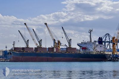
Bulk Carrier
Current Trip
| Time Travelled | 5 days |
|---|---|
| Remaining Time | 2 days |
| Distance Travelled | 842.91 nm |
| Remaining Distance | 552.80 nm |
| AVG Speed | 9.6 Noeuds |
| MAX Speed | 17.5 Noeuds |
| AVG Wind | 8.9 knots |
| MAX Wind | 23.6 knots |
| MIN Temp | 12.4°C / 54.32°F |
| MAX Temp | 24.4°C / 75.92°F |
| Tirant d eau | 10.7 m |
| Position reçue | 10 h, 30 m depuis |
Current Position
| Longitude | 23.64904° |
|---|---|
| Latitude | 36.63680° |
| Etat | Under way using engine |
| Vitesse | 10.1 Noeuds |
| Parcours | 214° |
| Zone | Aegean Sea |
| Station | T-AIS |
| Position reçue | 10 h, 30 m depuis |
Info
Information
The current position of MY MERAY is in Aegean Sea with coordinates 36.63680° / 23.64904° as reported on 2024-04-19 10:01 by AIS to our vessel tracker app. The vessel's current speed is 10.1 Noeuds and is heading at the port of KHOMS. The estimated time of arrival as calculated by MyShipTracking vessel tracking app is 2024-04-21 22:45 LT
The vessel MY MERAY (IMO: 9000302, MMSI: 312495000) is a Bulk Carrier that was built in 1992 ( 32 Age ). It's sailing under the flag of [BZ] Belize.
In this page you can find informations about the vessels current position, last detected port calls, and current voyage information. If the vessels is not in coverage by AIS you will find the latest position.
The current position of MY MERAY is detected by our AIS receivers and we are not responsible for the reliability of the data. The last position was recorded while the vessel was in Coverage by the Ais receivers of our vessel tracking app.
The current draught of MY MERAY as reported by AIS is 10.7 meters
Weather
| Temperature | 16.3°C / 61.34°F |
|---|---|
| Wind Speed | 24 knots |
| Direction | 262° W |
| Pressure | 1007.7 hPa |
| Humidity | 62.7 % |
| Cloud Coverage | 50 % |
Featured Company
Last Port Calls
| Port | Arrival | Departure | Time In Port |
|---|---|---|---|
| 2024-04-03 15:29 | 2024-04-14 04:34 | 10 d | |
| 2024-02-28 10:15 | 2024-03-21 15:56 | 22 d | |
| 2024-02-12 01:33 | 2024-02-13 09:07 | 1 d |
Most Visited Ports (Last year)
| Port | Arrivals | |
|---|---|---|
| 5 | ||
| 3 | ||
| 2 | ||
| 2 | ||
| 2 | ||
| 2 |
Last Trips
| Origin | Departure | Destination | Arrival | Distance | |
|---|---|---|---|---|---|
| 2024-03-21 17:56 | 2024-04-03 18:29 | 1381.09 nm | |||
| 2024-02-13 12:07 | 2024-02-28 12:15 | 1504.19 nm | |||
| 2024-01-30 00:30 | 2024-02-12 04:33 | 1532.50 nm |
Events
| Heure | Evenement | Détails | Position/ Destination | Info |
|---|---|---|---|---|
| 2024-04-19 10:01 | Hors de la zone couverte |
36.63680 / 23.64904
Aegean Sea
LY KHO
|
Vitesse: 10.1 kn Parcours: 214° |
|
| 2024-04-19 10:01 | Dans la zone couverte |
36.63680 / 23.64904
Aegean Sea
LY KHO
|
Vitesse: 10.1 kn Parcours: 214° |
|
| 2024-04-19 08:47 | Hors de la zone couverte |
36.81319 / 23.79886
Aegean Sea
LY KHO
|
Vitesse: 10.4 kn Parcours: 213.7° |
|
| 2024-04-19 01:32 | Dans la zone couverte |
37.94904 / 24.60997
Aegean Sea
LY KHO
|
Vitesse: 11.3 kn Parcours: 203.4° |
|
| 2024-04-19 00:28 | Hors de la zone couverte |
38.14282 / 24.72085
Aegean Sea
LY KHO
|
Vitesse: 11.2 kn Parcours: 204.2° |
|
| 2024-04-18 23:17 | Dans la zone couverte |
38.34186 / 24.84367
Aegean Sea
LY KHO
|
Vitesse: 11.1 kn Parcours: 209.5° |
|
| 2024-04-18 21:37 | Hors de la zone couverte |
38.61022 / 25.01460
Aegean Sea
LY KHO
|
Vitesse: 10.3 kn Parcours: 203.4° |
|
| 2024-04-18 21:21 | Changement de destination | LY KHO LY MRA |
38.65347 / 25.04002
LY KHO
|
Vitesse: 10 kn Parcours: 205.4° |
| 2024-04-18 21:21 | Changement d'ETA | 2024/04/21 12:00 2024/04/21 08:00 |
38.65347 / 25.04002
LY KHO
|
Vitesse: 10 kn Parcours: 205.4° |
| 2024-04-18 20:48 | Dans la zone couverte |
38.73276 / 25.08749
Aegean Sea
LY MRA
|
Vitesse: 9.9 kn Parcours: 204.8° |