
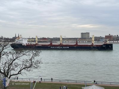
MUSALA
Cargo
Current Trip
| Time Travelled | 11 h, 22 mins |
|---|---|
| Remaining Time | --- |
| Distance Travelled | 24.17 nm |
| Remaining Distance | --- |
| AVG Speed | 11 Noeuds |
| MAX Speed | 12.7 Noeuds |
| AVG Wind | 8.5 knots |
| MAX Wind | 11 knots |
| MIN Temp | 9.9°C / 49.82°F |
| MAX Temp | 11.6°C / 52.88°F |
| Tirant d eau | 6.6 m |
| Position reçue | 20 m depuis |
Current Position
| Longitude | --- |
|---|---|
| Latitude | --- |
| Etat | At anchor |
| Vitesse | |
| Parcours | 327° |
| Zone | Adriatic Sea |
| Station | T-AIS |
| Position reçue | 20 m depuis |
Info
Information
The current position of MUSALA is in Adriatic Sea with coordinates 44.50225° / 12.45816° as reported on 2025-12-07 04:38 by AIS to our vessel tracker app. The vessel's current speed is 0 Noeuds and is heading at the port of THESSALONIKI. The estimated time of arrival as calculated by MyShipTracking vessel tracking app is 2025-12-10 09:00 LT
The vessel MUSALA (IMO: 9937294, MMSI: 256433000) is a Cargo It's sailing under the flag of [MT] Malta.
In this page you can find informations about the vessels current position, last detected port calls, and current voyage information. If the vessels is not in coverage by AIS you will find the latest position.
The current position of MUSALA is detected by our AIS receivers and we are not responsible for the reliability of the data. The last position was recorded while the vessel was in Coverage by the Ais receivers of our vessel tracking app.
The current draught of MUSALA as reported by AIS is 6.6 meters
Weather
| Temperature | 10.3°C / 50.54°F |
|---|---|
| Wind Speed | 8 knots |
| Direction | 315° NW |
| Pressure | 1014.5 hPa |
| Humidity | 73.1 % |
| Cloud Coverage | 100 % |
Featured Company
Last Port Calls
| Port | Arrival | Departure | Time In Port |
|---|---|---|---|
| 2025-12-05 14:21 | 2025-12-06 18:37 | 1 d | |
| 2025-11-28 10:25 | 2025-12-02 15:45 | 4 d | |
| 2025-11-02 08:19 | 2025-11-03 16:25 | 1 d | |
| 2025-10-24 15:19 | 2025-10-24 16:48 | 1 h | |
| 2025-10-23 05:24 | 2025-10-23 06:06 | 41 m | |
| 2025-10-20 16:34 | 2025-10-20 17:34 | 1 h | |
| 2025-10-18 05:14 | 2025-10-19 21:37 | 1 d | |
| 2025-10-13 22:37 | 2025-10-13 23:37 | 1 h | |
| 2025-10-12 16:05 | 2025-10-12 21:25 | 5 h | |
| 2025-10-11 14:42 | 2025-10-11 15:16 | 33 m |
Most Visited Ports (Last year)
| Port | Arrivals | |
|---|---|---|
| 6 | ||
| 6 | ||
| 6 | ||
| 3 | ||
| 2 | ||
| 2 |
Last Trips
| Origin | Departure | Destination | Arrival | Distance | |
|---|---|---|---|---|---|
| 2025-12-02 15:45 | 2025-12-05 14:21 | 38.36 nm | |||
| 2025-11-03 16:25 | 2025-11-28 10:25 | 5174.81 nm | |||
| 2025-10-24 16:48 | 2025-11-02 08:19 | 166.06 nm | |||
| 2025-10-23 06:06 | 2025-10-24 15:19 | 298.25 nm | |||
| 2025-10-20 17:34 | 2025-10-23 05:24 | 530.77 nm | |||
| 2025-10-19 21:37 | 2025-10-20 16:34 | 235.06 nm | |||
| 2025-10-13 23:37 | 2025-10-18 05:14 | 248.64 nm | |||
| 2025-10-12 21:25 | 2025-10-13 22:37 | 286.31 nm | |||
| 2025-10-11 15:16 | 2025-10-12 16:05 | 227.75 nm | |||
| 2025-10-10 01:27 | 2025-10-11 14:42 | 302.70 nm |
Events
| Heure | Evenement | Détails | Position/ Destination | Info |
|---|---|---|---|---|
| 2025-12-07 04:41 | Etat Changé | Default At anchor |
44.50224 / 12.45815
GRSKG
|
Vitesse: Parcours: 327° |
| 2025-12-07 04:38 | Etat Changé | At anchor Default |
44.50225 / 12.45816
GRSKG
|
Vitesse: Parcours: -1° |
| 2025-12-07 04:38 | Dans la zone couverte |
44.50225 / 12.45816
Adriatic Sea
GRSKG
|
Vitesse: Parcours: 34.2° |
|
| 2025-12-07 02:44 | Etat Changé | Default At anchor |
44.50221 / 12.45809
GRSKG
|
Vitesse: Parcours: 327° |
| 2025-12-07 02:38 | Hors de la zone couverte |
44.50221 / 12.45812
Adriatic Sea
GRSKG
|
Vitesse: Parcours: 34.2° |
|
| 2025-12-07 02:38 | Etat Changé | At anchor Default |
44.50221 / 12.45812
GRSKG
|
Vitesse: Parcours: 328° |
| 2025-12-07 02:32 | Dans la zone couverte |
44.50221 / 12.45812
Adriatic Sea
GRSKG
|
Vitesse: Parcours: 34.2° |
|
| 2025-12-07 01:44 | Etat Changé | Default At anchor |
44.50215 / 12.45801
GRSKG
|
Vitesse: 0.1 kn Parcours: 324° |
| 2025-12-07 01:38 | Etat Changé | At anchor Default |
44.50219 / 12.45813
GRSKG
|
Vitesse: Parcours: 323° |
| 2025-12-07 01:38 | Hors de la zone couverte |
44.50219 / 12.45813
Adriatic Sea
GRSKG
|
Vitesse: 0.1 kn Parcours: 34.2° |