
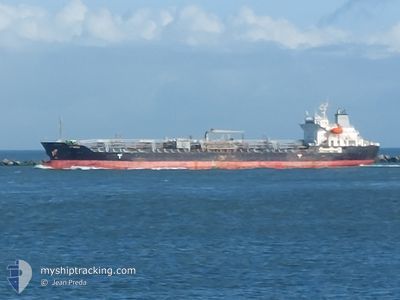
ORION
Oil/Chemical Tanker
Current Trip
MEJILLONE-CHILE
| Time Travelled | 3 days |
|---|---|
| Remaining Time | --- |
| Distance Travelled | 772.70 nm |
| Remaining Distance | --- |
| AVG Speed | 10.6 Noeuds |
| MAX Speed | 14.1 Noeuds |
| AVG Wind | 13.6 knots |
| MAX Wind | 30 knots |
| MIN Temp | 13.6°C / 56.48°F |
| MAX Temp | 19.9°C / 67.82°F |
| Tirant d eau | 10.4 m |
| Position reçue | 17 h, 50 m depuis |
Current Position
| Longitude | 141.14463° |
|---|---|
| Latitude | 34.70458° |
| Etat | Under way using engine |
| Vitesse | 10.5 Noeuds |
| Parcours | 98° |
| Zone | North Pacific Ocean |
| Station | T-AIS |
| Position reçue | 17 h, 50 m depuis |
Info
Information
The current position of ORION is in North Pacific Ocean with coordinates 34.70458° / 141.14463° as reported on 2024-04-24 12:23 by AIS to our vessel tracker app. The vessel's current speed is 10.5 Noeuds
The vessel ORION (IMO: 9400370, MMSI: 574005010) is a Oil/Chemical Tanker that was built in 2009 ( 15 Age ). It's sailing under the flag of [VN] Vietnam.
In this page you can find informations about the vessels current position, last detected port calls, and current voyage information. If the vessels is not in coverage by AIS you will find the latest position.
The current position of ORION is detected by our AIS receivers and we are not responsible for the reliability of the data. The last position was recorded while the vessel was in Coverage by the Ais receivers of our vessel tracking app.
The current draught of ORION as reported by AIS is 10.4 meters
Weather
| Temperature | 19°C / 66.2°F |
|---|---|
| Wind Speed | 23 knots |
| Direction | 199° SSW |
| Pressure | 1007.7 hPa |
| Humidity | 96.4 % |
| Cloud Coverage | 100 % |
Featured Company
Last Port Calls
| Port | Arrival | Departure | Time In Port |
|---|---|---|---|
| 2024-04-20 06:47 | 2024-04-21 06:40 | 23 h | |
| 2024-02-15 04:27 | 2024-02-17 11:11 | 2 d |
Most Visited Ports (Last year)
| Port | Arrivals | |
|---|---|---|
| 3 | ||
| 3 | ||
| 1 | ||
| 1 | ||
| 1 | ||
| 1 |
Last Trips
| Origin | Departure | Destination | Arrival | Distance | |
|---|---|---|---|---|---|
| 2024-02-17 16:41 | 2024-04-20 15:47 | 2037.62 nm | |||
| 2024-01-29 15:24 | 2024-02-15 09:57 | 3621.31 nm |
Events
| Heure | Evenement | Détails | Position/ Destination | Info |
|---|---|---|---|---|
| 2024-04-24 12:50 | Etat Changé | Default Under way using engine |
34.68592 / 141.23579
MEJILLONE-CHILE
|
Vitesse: 10.5 kn Parcours: 98° |
| 2024-04-24 12:23 | Hors de la zone couverte |
34.70458 / 141.14463
North Pacific Ocean
|
Vitesse: 10.5 kn Parcours: 98° |
|
| 2024-04-24 12:16 | Etat Changé | Under way using engine Default |
34.70818 / 141.12035
MEJILLONE-CHILE
|
Vitesse: 10.3 kn Parcours: 102° |
| 2024-04-24 12:01 | Etat Changé | Default Under way using engine |
34.71690 / 141.06895
MEJILLONE-CHILE
|
Vitesse: 10.5 kn Parcours: 97° |
| 2024-04-24 06:26 | Etat Changé | Under way using engine Default |
34.86793 / 139.78960
MEJILLONE-CHILE
|
Vitesse: 14.1 kn Parcours: 133° |
| 2024-04-24 05:52 | Etat Changé | Default Under way using engine |
34.97583 / 139.70409
MEJILLONE-CHILE
|
Vitesse: 12.5 kn Parcours: 166° |
| 2024-04-24 05:45 | Etat Changé | Under way using engine Default |
35.00227 / 139.69252
MEJILLONE-CHILE
|
Vitesse: 11.4 kn Parcours: 181° |
| 2024-04-24 05:00 | Etat Changé | Default Under way using engine |
35.09752 / 139.73294
MEJILLONE-CHILE
|
Vitesse: 11.9 kn Parcours: 189° |
| 2024-04-24 02:59 | Démarrage | 3.32 nm, South East of YOKOHAMA |
35.42448 / 139.72407
MEJILLONE-CHILE
|
Vitesse: 3.1 kn Parcours: 113° |
| 2024-04-24 02:42 | Tirant d'eau modifié | 10.4 9.4 |
35.42028 / 139.72067
MEJILLONE-CHILE
|
Vitesse: 0.1 kn Parcours: 344° |