
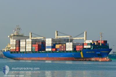
MSC WESER
Container Ship
Current Trip
| Time Travelled | 1 day |
|---|---|
| Remaining Time | 1 day |
| Distance Travelled | 348.79 nm |
| Remaining Distance | 343.09 nm |
| AVG Speed | 9.1 Noeuds |
| MAX Speed | 9.9 Noeuds |
| AVG Wind | 12.3 knots |
| MAX Wind | 16 knots |
| MIN Temp | 26.6°C / 79.88°F |
| MAX Temp | 28.1°C / 82.58°F |
| Tirant d eau | 8.8 m |
| Position reçue | 21 m depuis |
Current Position
| Longitude | -74.58955° |
|---|---|
| Latitude | 11.62922° |
| Etat | Under way using engine |
| Vitesse | 9.3 Noeuds |
| Parcours | 68.2° |
| Zone | Caribbean Sea |
| Station | T-AIS |
| Position reçue | 21 m depuis |
Info
Information
The current position of MSC WESER is in Caribbean Sea with coordinates 11.62922° / -74.58955° as reported on 2024-04-20 04:11 by AIS to our vessel tracker app. The vessel's current speed is 9.3 Noeuds and is heading at the port of COLON. The estimated time of arrival as calculated by MyShipTracking vessel tracking app is 2024-04-21 17:15 LT
The vessel MSC WESER (IMO: 9236690, MMSI: 255805923) is a Container Ship that was built in 2001 ( 23 Age ). It's sailing under the flag of [PT] Portugal.
In this page you can find informations about the vessels current position, last detected port calls, and current voyage information. If the vessels is not in coverage by AIS you will find the latest position.
The current position of MSC WESER is detected by our AIS receivers and we are not responsible for the reliability of the data. The last position was recorded while the vessel was in Coverage by the Ais receivers of our vessel tracking app.
The current draught of MSC WESER as reported by AIS is 8.8 meters
Weather
| Temperature | 26.6°C / 79.88°F |
|---|---|
| Wind Speed | 13 knots |
| Direction | 73° ENE |
| Pressure | 1012.3 hPa |
| Humidity | 85.5 % |
| Cloud Coverage | 100 % |
Featured Company
Last Port Calls
| Port | Arrival | Departure | Time In Port |
|---|---|---|---|
| 2024-04-17 13:58 | 2024-04-18 13:48 | 23 h | |
| 2024-04-15 15:23 | 2024-04-17 00:08 | 1 d | |
| 2024-04-09 07:11 | 2024-04-12 12:28 | 3 d | |
| 2024-04-02 15:47 | 2024-04-03 21:22 | 1 d | |
| 2024-04-01 13:02 | 2024-04-02 14:15 | 1 d | |
| 2024-03-26 11:50 | 2024-03-29 11:39 | 2 d | |
| 2024-03-22 20:13 | 2024-03-23 17:27 | 21 h | |
| 2024-03-18 20:49 | |||
| 2024-03-08 08:57 | 2024-03-11 02:41 | 2 d | |
| 2024-03-01 01:55 | 2024-03-02 06:36 | 1 d |
Most Visited Ports (Last year)
| Port | Arrivals | |
|---|---|---|
| 19 | ||
| 17 | ||
| 12 | ||
| 6 | ||
| 4 | ||
| 4 |
Last Trips
| Origin | Departure | Destination | Arrival | Distance | |
|---|---|---|---|---|---|
| 2024-04-16 19:08 | 2024-04-17 08:58 | 13.56 nm | |||
| 2024-04-12 08:28 | 2024-04-15 10:23 | 1163.25 nm | |||
| 2024-04-03 16:22 | 2024-04-09 03:11 | 1169.72 nm | |||
| 2024-04-02 09:15 | 2024-04-02 10:47 | 12.12 nm | |||
| 2024-03-29 07:39 | 2024-04-01 08:02 | 1161.18 nm | |||
| 2024-03-23 13:27 | 2024-03-26 07:50 | 348.16 nm | |||
| 2024-03-18 15:49 | 2024-03-22 16:13 | 858.30 nm | |||
| 2024-03-02 02:36 | 2024-03-08 04:57 | 342.33 nm | |||
| 2024-02-27 02:45 | 2024-02-29 21:55 | 842.42 nm | |||
| 2024-02-25 20:41 | 2024-02-26 05:00 | 16.70 nm |
Events
| Heure | Evenement | Détails | Position/ Destination | Info |
|---|---|---|---|---|
| 2024-04-20 04:11 | Etat Changé | Under way using engine Default |
11.62922 / -74.58955
PAONX= PLT
|
Vitesse: 8.9 kn Parcours: 68° |
| 2024-04-20 04:11 | Dans la zone couverte |
11.62922 / -74.58955
Caribbean Sea
|
Vitesse: 9.3 kn Parcours: 68.2° |
|
| 2024-04-20 00:57 | Etat Changé | Default Under way using engine |
11.45322 / -75.04974
PAONX= PLT
|
Vitesse: 8.5 kn Parcours: 67.3° |
| 2024-04-20 00:53 | Hors de la zone couverte |
11.44937 / -75.05989
Caribbean Sea
|
Vitesse: 8.5 kn Parcours: 67.3° |
|
| 2024-04-20 00:14 | Etat Changé | Under way using engine Default |
11.41612 / -75.15224
PAONX= PLT
|
Vitesse: 8.9 kn Parcours: 70° |
| 2024-04-20 00:02 | Etat Changé | Default Under way using engine |
11.40634 / -75.17889
PAONX= PLT
|
Vitesse: 9.4 kn Parcours: 65.4° |
| 2024-04-19 23:43 | Detecté en mer | Colombian part of the Caribbean Sea |
11.38617 / -75.22595
Caribbean Sea
|
Vitesse: 9.4 kn Parcours: 65.4° |
| 2024-04-19 23:43 | Etat Changé | Under way using engine Default |
11.38617 / -75.22595
PAONX= PLT
|
Vitesse: 9.8 kn Parcours: 66° |
| 2024-04-19 23:43 | Dans la zone couverte |
11.38617 / -75.22595
Caribbean Sea
|
Vitesse: 9.4 kn Parcours: 65.4° |
|
| 2024-04-18 18:26 | Hors de la zone couverte |
9.81566 / -79.44369
Caribbean Sea
|
Vitesse: 8.8 kn Parcours: 70.1° |