
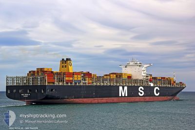
MSC ROSA M
Container Ship
Current Trip
| Time Travelled | 2 days |
|---|---|
| Remaining Time | 13 h, 48 mins |
| Distance Travelled | 970.68 nm |
| Remaining Distance | 211.98 nm |
| AVG Speed | 15.7 Noeuds |
| MAX Speed | 17 Noeuds |
| AVG Wind | 10.6 knots |
| MAX Wind | 17 knots |
| MIN Temp | 14.9°C / 58.82°F |
| MAX Temp | 25.9°C / 78.62°F |
| Tirant d eau | 10.3 m |
| Position reçue | 3 h, 57 m depuis |
Current Position
| Longitude | 118.09846° |
|---|---|
| Latitude | 23.34559° |
| Etat | Under way using engine |
| Vitesse | 16.4 Noeuds |
| Parcours | 226.8° |
| Zone | South China Sea |
| Station | T-AIS |
| Position reçue | 3 h, 57 m depuis |
Info
Information
The current position of MSC ROSA M is in South China Sea with coordinates 23.34559° / 118.09846° as reported on 2024-04-20 07:12 by AIS to our vessel tracker app. The vessel's current speed is 16.4 Noeuds and is heading at the port of NANSHA. The estimated time of arrival as calculated by MyShipTracking vessel tracking app is 2024-04-21 00:57 LT
The vessel MSC ROSA M (IMO: 9461398, MMSI: 354462000) is a Container Ship that was built in 2010 ( 14 Age ). It's sailing under the flag of [PA] Panama.
In this page you can find informations about the vessels current position, last detected port calls, and current voyage information. If the vessels is not in coverage by AIS you will find the latest position.
The current position of MSC ROSA M is detected by our AIS receivers and we are not responsible for the reliability of the data. The last position was recorded while the vessel was in Coverage by the Ais receivers of our vessel tracking app.
The current draught of MSC ROSA M as reported by AIS is 10.3 meters
Weather
| Temperature | 26.2°C / 79.16°F |
|---|---|
| Wind Speed | 11 knots |
| Direction | 206° SSW |
| Pressure | 1008.4 hPa |
| Humidity | 84 % |
| Cloud Coverage | 41 % |
Featured Company
Last Port Calls
| Port | Arrival | Departure | Time In Port |
|---|---|---|---|
| 2024-04-16 17:45 | 2024-04-17 22:43 | 1 d | |
| 2024-03-25 10:21 | 2024-03-31 15:30 | 6 d | |
| 2024-03-09 11:50 | 2024-03-10 11:36 | 23 h | |
| 2024-03-01 17:08 | 2024-03-02 16:56 | 23 h | |
| 2024-02-29 12:38 | 2024-03-01 07:17 | 18 h | |
| 2024-02-02 14:54 |
Most Visited Ports (Last year)
| Port | Arrivals | |
|---|---|---|
| 3 | ||
| 3 | ||
| 3 | ||
| 2 | ||
| 2 | ||
| 2 |
Last Trips
| Origin | Departure | Destination | Arrival | Distance | |
|---|---|---|---|---|---|
| 2024-03-31 08:30 | 2024-04-17 02:45 | 5526.56 nm | |||
| 2024-03-10 19:36 | 2024-03-25 03:21 | 5858.40 nm | |||
| 2024-03-03 00:56 | 2024-03-09 19:50 | 915.07 nm | |||
| 2024-03-01 15:17 | 2024-03-02 01:08 | 123.28 nm | |||
| 2024-02-02 06:54 | 2024-02-29 20:38 | 7079.59 nm |
Events
| Heure | Evenement | Détails | Position/ Destination | Info |
|---|---|---|---|---|
| 2024-04-20 07:17 | Etat Changé | Default Under way using engine |
23.33167 / 118.08167
CNNSA
|
Vitesse: 16.4 kn Parcours: 226.8° |
| 2024-04-20 07:12 | Hors de la zone couverte |
23.34559 / 118.09846
South China Sea
CNNSA
|
Vitesse: 16.4 kn Parcours: 226.8° |
|
| 2024-04-20 05:46 | Detecté en mer | Chinese part of the South China Sea |
23.61341 / 118.41096
South China Sea
CNNSA
|
Vitesse: 16.8 kn Parcours: 227.4° |
| 2024-04-20 05:46 | Etat Changé | Under way using engine Default |
23.61399 / 118.41164
CNNSA
|
Vitesse: 16.9 kn Parcours: 228° |
| 2024-04-20 05:46 | Dans la zone couverte |
23.61341 / 118.41096
South China Sea
CNNSA
|
Vitesse: 16.8 kn Parcours: 227.4° |
|
| 2024-04-18 00:29 | Etat Changé | Default Under way using engine |
34.64473 / 128.84676
CNNSA
|
Vitesse: 15.9 kn Parcours: 217.1° |
| 2024-04-18 00:23 | Hors de la zone couverte |
34.66424 / 128.86939
Japan Sea
CNNSA
|
Vitesse: 15.9 kn Parcours: 217.1° |
|
| 2024-04-17 23:11 | Tirant d'eau modifié | 10.3 11.1 |
34.97080 / 128.80354
CNNSA
|
Vitesse: 11.2 kn Parcours: 161.6° |
| 2024-04-17 23:11 | Changement de destination | CNNSA KRPUS |
34.97080 / 128.80354
CNNSA
|
Vitesse: 11.2 kn Parcours: 161.6° |
| 2024-04-17 23:11 | Changement d'ETA | 2024/04/21 02:00 2024/04/16 16:50 |
34.97080 / 128.80354
CNNSA
|
Vitesse: 11.2 kn Parcours: 161.6° |