
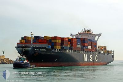
MSC MARTA
Container Ship
Current Trip
| Time Travelled | 5 days |
|---|---|
| Remaining Time | --- |
| Distance Travelled | 2236.80 nm |
| Remaining Distance | --- |
| AVG Speed | 17.7 Noeuds |
| MAX Speed | 19.6 Noeuds |
| AVG Wind | 9.8 knots |
| MAX Wind | 20.8 knots |
| MIN Temp | 9.9°C / 49.82°F |
| MAX Temp | 23.4°C / 74.12°F |
| Tirant d eau | 10.7 m |
| Position reçue | 7 h, 21 m depuis |
Current Position
| Longitude | 5.05306° |
|---|---|
| Latitude | 43.16331° |
| Etat | Under way using engine |
| Vitesse | 13.7 Noeuds |
| Parcours | 5.2° |
| Zone | Mediterranean Sea - Western Basin |
| Station | T-AIS |
| Position reçue | 7 h, 21 m depuis |
Info
Information
The current position of MSC MARTA is in Mediterranean Sea - Western Basin with coordinates 43.16331° / 5.05306° as reported on 2024-04-19 08:00 by AIS to our vessel tracker app. The vessel's current speed is 13.7 Noeuds
The vessel MSC MARTA (IMO: 9295385, MMSI: 371474000) is a Container Ship that was built in 2005 ( 19 Age ). It's sailing under the flag of [PA] Panama.
In this page you can find informations about the vessels current position, last detected port calls, and current voyage information. If the vessels is not in coverage by AIS you will find the latest position.
The current position of MSC MARTA is detected by our AIS receivers and we are not responsible for the reliability of the data. The last position was recorded while the vessel was in Coverage by the Ais receivers of our vessel tracking app.
The current draught of MSC MARTA as reported by AIS is 10.7 meters
Weather
| Temperature | 10.2°C / 50.36°F |
|---|---|
| Wind Speed | 21 knots |
| Direction | 343° NNW |
| Pressure | 1019.9 hPa |
| Humidity | 60.9 % |
| Cloud Coverage | 7 % |
Featured Company
Last Port Calls
| Port | Arrival | Departure | Time In Port |
|---|---|---|---|
| 2024-04-12 13:08 | 2024-04-13 18:36 | 1 d | |
| 2024-04-07 07:27 | 2024-04-08 02:35 | 19 h | |
| 2024-04-04 16:53 | 2024-04-05 19:54 | 1 d | |
| 2024-04-02 06:01 | 2024-04-04 06:41 | 2 d | |
| 2024-03-31 19:16 | 2024-04-01 09:09 | 13 h | |
| 2024-03-29 09:51 | 2024-03-29 21:11 | 11 h | |
| 2024-03-25 20:43 | 2024-03-26 12:22 | 15 h | |
| 2024-03-21 18:06 | 2024-03-22 17:57 | 23 h | |
| 2024-03-17 23:36 | 2024-03-18 23:50 | 1 d | |
| 2024-03-15 10:26 | 2024-03-16 21:40 | 1 d |
Most Visited Ports (Last year)
| Port | Arrivals | |
|---|---|---|
| 13 | ||
| 12 | ||
| 10 | ||
| 10 | ||
| 8 | ||
| 7 |
Last Trips
| Origin | Departure | Destination | Arrival | Distance | |
|---|---|---|---|---|---|
| 2024-04-08 02:35 | 2024-04-12 13:08 | 1200.59 nm | |||
| 2024-04-05 19:54 | 2024-04-07 07:27 | 389.53 nm | |||
| 2024-04-04 07:41 | 2024-04-04 16:53 | 141.61 nm | |||
| 2024-04-01 09:09 | 2024-04-02 07:01 | 152.33 nm | |||
| 2024-03-29 21:11 | 2024-03-31 19:16 | 416.64 nm | |||
| 2024-03-26 12:22 | 2024-03-29 09:51 | 1194.60 nm | |||
| 2024-03-22 17:57 | 2024-03-25 20:43 | 917.64 nm | |||
| 2024-03-19 00:50 | 2024-03-21 18:06 | 1100.44 nm | |||
| 2024-03-16 22:40 | 2024-03-18 00:36 | 343.39 nm | |||
| 2024-03-14 09:24 | 2024-03-15 11:26 | 223.21 nm |
Events
| Heure | Evenement | Détails | Position/ Destination | Info |
|---|---|---|---|---|
| 2024-04-19 08:00 | Hors de la zone couverte |
43.16331 / 5.05306
Mediterranean Sea - Western Basin
SNDKR>FRFOS
|
Vitesse: 13.7 kn Parcours: 5.2° |
|
| 2024-04-19 07:51 | Changement de zone | French part of the Mediterranean Sea - Western Basin Spanish part of the Balearic Sea |
43.12770 / 5.04385
Mediterranean Sea - Western Basin
SNDKR>FRFOS
|
Vitesse: 13.6 kn Parcours: 11.1° |
| 2024-04-19 07:51 | Dans la zone couverte |
43.12770 / 5.04385
Mediterranean Sea - Western Basin
SNDKR>FRFOS
|
Vitesse: 13.6 kn Parcours: 11.1° |
|
| 2024-04-18 16:48 | Hors de la zone couverte |
40.08444 / 1.89025
Balearic Sea
SNDKR>FRFOS
|
Vitesse: 15.4 kn Parcours: 35.7° |
|
| 2024-04-18 16:06 | Detecté en mer | Spanish part of the Balearic Sea |
39.94153 / 1.74758
Balearic Sea
SNDKR>FRFOS
|
Vitesse: 15.5 kn Parcours: 38.7° |
| 2024-04-18 16:06 | Dans la zone couverte |
39.94153 / 1.74758
Balearic Sea
SNDKR>FRFOS
|
Vitesse: 15.5 kn Parcours: 38.7° |
|
| 2024-04-18 08:41 | Hors de la zone couverte |
38.41336 / .22120
Mediterranean Sea - Western Basin
SNDKR>FRFOS
|
Vitesse: 15.5 kn Parcours: 32° |
|
| 2024-04-18 07:48 | Etat Changé | Under way using engine Default |
38.21528 / .07467
SNDKR>FRFOS
|
Vitesse: 15.6 kn Parcours: 28° |
| 2024-04-18 07:40 | Etat Changé | Default Under way using engine |
38.18326 / .05318
SNDKR>FRFOS
|
Vitesse: 15.6 kn Parcours: 27.9° |
| 2024-04-18 07:05 | Etat Changé | Under way using engine Default |
38.05850 / -.04986
SNDKR>FRFOS
|
Vitesse: 15 kn Parcours: 37° |