
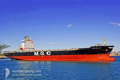
MSC MARIA PIA
Container Ship
Current Trip
| Trip Time | 2 days |
|---|---|
| Trip Distance | 550.44 nm |
| AVG Speed | 8.9 Noeuds |
| MAX Speed | 8.9 Noeuds |
| Tirant d eau | 8.9 m |
| AVG Wind | 16.1 knots |
| MAX Wind | 24.9 knots |
| MIN Temp | 3.3°C / 37.94°F |
| MAX Temp | 8.2°C / 46.76°F |
| Position reçue | 1 m depuis |
Current Position
| Longitude | 4.27061° |
|---|---|
| Latitude | 51.32567° |
| Etat | Under way using engine |
| Vitesse | 4.1 Noeuds |
| Parcours | 184° |
| Zone | North Sea |
| Station | T-AIS |
| Position reçue | 1 m depuis |
Info
Information
The current position of MSC MARIA PIA is in North Sea with coordinates 51.32567° / 4.27061° as reported on 2024-04-25 04:00 by AIS to our vessel tracker app. The vessel's current speed is 4.1 Noeuds and is currently inside the port of ANTWERP.
The vessel MSC MARIA PIA (IMO: 9155107, MMSI: 354711000) is a Container Ship that was built in 1997 ( 27 Age ). It's sailing under the flag of [PA] Panama.
In this page you can find informations about the vessels current position, last detected port calls, and current voyage information. If the vessels is not in coverage by AIS you will find the latest position.
The current position of MSC MARIA PIA is detected by our AIS receivers and we are not responsible for the reliability of the data. The last position was recorded while the vessel was in Coverage by the Ais receivers of our vessel tracking app.
The current draught of MSC MARIA PIA as reported by AIS is 8.9 meters
Weather
| Temperature | 3.6°C / 38.48°F |
|---|---|
| Wind Speed | 5 knots |
| Direction | 260° W |
| Pressure | 1008.4 hPa |
| Humidity | 87.5 % |
| Cloud Coverage | 81 % |
Featured Company
Last Port Calls
| Port | Arrival | Departure | Time In Port |
|---|---|---|---|
| 2024-04-25 03:35 | |||
| 2024-04-22 03:05 | 2024-04-22 12:10 | 9 h | |
| 2024-04-17 11:43 | 2024-04-19 02:21 | 1 d | |
| 2024-04-15 03:40 | 2024-04-15 20:31 | 16 h | |
| 2024-04-11 05:08 | 2024-04-12 00:46 | 19 h | |
| 2024-04-09 03:36 | 2024-04-10 01:33 | 21 h | |
| 2024-04-05 10:22 | 2024-04-06 03:00 | 16 h | |
| 2024-04-03 09:17 | 2024-04-04 14:17 | 1 d | |
| 2024-04-01 03:44 | 2024-04-01 17:27 | 13 h | |
| 2024-03-27 06:47 | 2024-03-28 10:03 | 1 d |
Most Visited Ports (Last year)
| Port | Arrivals | |
|---|---|---|
| 11 | ||
| 10 | ||
| 9 | ||
| 6 | ||
| 6 | ||
| 4 |
Last Trips
| Origin | Departure | Destination | Arrival | Distance | |
|---|---|---|---|---|---|
| 2024-04-22 14:10 | 2024-04-25 05:35 | 550.44 nm | |||
| 2024-04-19 04:21 | 2024-04-22 05:05 | 1159.36 nm | |||
| 2024-04-15 22:31 | 2024-04-17 13:43 | 321.18 nm | |||
| 2024-04-12 02:46 | 2024-04-15 05:40 | 1183.67 nm | |||
| 2024-04-10 03:33 | 2024-04-11 07:08 | 362.50 nm | |||
| 2024-04-06 06:00 | 2024-04-09 05:36 | 1168.32 nm | |||
| 2024-04-04 16:17 | 2024-04-05 13:22 | 289.99 nm | |||
| 2024-04-01 19:27 | 2024-04-03 11:17 | 328.94 nm | |||
| 2024-03-28 11:03 | 2024-04-01 05:44 | 1183.82 nm | |||
| 2024-03-25 14:32 | 2024-03-27 07:47 | 373.61 nm |
Events
| Heure | Evenement | Détails | Position/ Destination | Info |
|---|---|---|---|---|
| 2024-04-25 03:35 | Port d'arrivée |
|
51.36581 / 4.22014
[BE] ANTWERP
|
Vitesse: 10.3 kn Parcours: 160.8° |
| 2024-04-25 00:20 | Changement de zone | Dutch part of the North Sea Belgian part of the North Sea |
51.40445 / 3.33415
North Sea
BE ANR
|
Vitesse: 15.6 kn Parcours: 91.1° |
| 2024-04-24 22:47 | Changement de zone | Belgian part of the North Sea Dutch part of the North Sea |
51.53041 / 3.09723
North Sea
BE ANR
|
Vitesse: 13.3 kn Parcours: 220.6° |
| 2024-04-24 21:08 | Démarrage | 20.94 nm, North West of NEELTJE JANS |
51.82165 / 3.23695
BE ANR
|
Vitesse: 3.2 kn Parcours: 267° |
| 2024-04-24 20:46 | Arret | 21.05 nm, North West of NEELTJE JANS |
51.83202 / 3.24431
BE ANR
|
Vitesse: 0.3 kn Parcours: 2° |
| 2024-04-24 19:54 | Changement d'ETA | 2024/04/24 23:00 2024/04/24 21:30 |
51.82393 / 3.13002
BE ANR
|
Vitesse: 7.6 kn Parcours: 100.8° |
| 2024-04-24 19:04 | Changement d'ETA | 2024/04/24 21:30 2024/04/24 21:00 |
51.94865 / 3.06960
BE ANR
|
Vitesse: 10.5 kn Parcours: 178.6° |
| 2024-04-24 18:58 | Changement d'ETA | 2024/04/24 21:00 2024/04/24 20:00 |
51.96716 / 3.06857
BE ANR
|
Vitesse: 10.4 kn Parcours: 176.7° |
| 2024-04-24 17:19 | Changement de zone | Dutch part of the North Sea United Kingdom part of the North Sea |
52.20391 / 2.83969
North Sea
BE ANR
|
Vitesse: 10.4 kn Parcours: 134.6° |
| 2024-04-24 17:16 | Dans la zone couverte |
52.20993 / 2.83066
North Sea
BE ANR
|
Vitesse: 10.4 kn Parcours: 141.1° |