
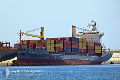
MSC IZMIR F
Container Ship
Current Trip
| Time Travelled | 12 h, 13 mins |
|---|---|
| Remaining Time | 1 h, 14 mins |
| Distance Travelled | 158.60 nm |
| Remaining Distance | 32.91 nm |
| AVG Speed | 11 Noeuds |
| MAX Speed | 15.3 Noeuds |
| AVG Wind | 11.5 knots |
| MAX Wind | 12.9 knots |
| MIN Temp | 22.4°C / 72.32°F |
| MAX Temp | 23.3°C / 73.94°F |
| Tirant d eau | 6.1 m |
| Position reçue | 9 m depuis |
Current Position
| Longitude | -77.46438° |
|---|---|
| Latitude | 25.44862° |
| Etat | Under way using engine |
| Vitesse | 11.7 Noeuds |
| Parcours | 197.5° |
| Zone | North Atlantic Ocean |
| Station | T-AIS |
| Position reçue | 9 m depuis |
Info
Information
The current position of MSC IZMIR F is in North Atlantic Ocean with coordinates 25.44862° / -77.46438° as reported on 2024-04-25 10:16 by AIS to our vessel tracker app. The vessel's current speed is 11.7 Noeuds and is heading at the port of NASSAU. The estimated time of arrival as calculated by MyShipTracking vessel tracking app is 2024-04-25 11:40 LT
The vessel MSC IZMIR F (IMO: 9127021, MMSI: 636017878) is a Container Ship that was built in 1996 ( 28 Age ). It's sailing under the flag of [LR] Liberia.
In this page you can find informations about the vessels current position, last detected port calls, and current voyage information. If the vessels is not in coverage by AIS you will find the latest position.
The current position of MSC IZMIR F is detected by our AIS receivers and we are not responsible for the reliability of the data. The last position was recorded while the vessel was in Coverage by the Ais receivers of our vessel tracking app.
The current draught of MSC IZMIR F as reported by AIS is 6.1 meters
Weather
| Temperature | 22.4°C / 72.32°F |
|---|---|
| Wind Speed | 8 knots |
| Direction | 71° ENE |
| Pressure | 1019.2 hPa |
| Humidity | 64.7 % |
| Cloud Coverage | 91 % |
Featured Company
Last Port Calls
| Port | Arrival | Departure | Time In Port |
|---|---|---|---|
| 2024-04-24 14:33 | 2024-04-24 22:13 | 7 h | |
| 2024-04-24 14:22 | 2024-04-24 14:31 | 8 m | |
| 2024-04-23 13:18 | 2024-04-23 17:44 | 4 h | |
| 2024-04-22 14:28 | 2024-04-22 23:26 | 8 h | |
| 2024-04-22 14:16 | 2024-04-22 14:22 | 6 m | |
| 2024-04-21 12:33 | 2024-04-21 17:17 | 4 h | |
| 2024-04-19 15:04 | 2024-04-19 23:00 | 7 h | |
| 2024-04-19 14:55 | 2024-04-19 15:02 | 6 m | |
| 2024-04-18 12:58 | 2024-04-18 18:00 | 5 h | |
| 2024-04-17 14:19 | 2024-04-17 22:24 | 8 h |
Most Visited Ports (Last year)
| Port | Arrivals | |
|---|---|---|
| 83 | ||
| 81 | ||
| 78 | ||
| 6 | ||
| 6 | ||
| 5 |
Last Trips
| Origin | Departure | Destination | Arrival | Distance | |
|---|---|---|---|---|---|
| 2024-04-24 10:31 | 2024-04-24 10:33 | 0.24 nm | |||
| 2024-04-23 13:44 | 2024-04-24 10:22 | 202.59 nm | |||
| 2024-04-22 19:26 | 2024-04-23 09:18 | 182.50 nm | |||
| 2024-04-22 10:22 | 2024-04-22 10:28 | 0.74 nm | |||
| 2024-04-21 13:17 | 2024-04-22 10:16 | 209.72 nm | |||
| 2024-04-19 19:00 | 2024-04-21 08:33 | 218.37 nm | |||
| 2024-04-19 11:02 | 2024-04-19 11:04 | 0.38 nm | |||
| 2024-04-18 14:00 | 2024-04-19 10:55 | 198.60 nm | |||
| 2024-04-17 18:24 | 2024-04-18 08:58 | 183.07 nm | |||
| 2024-04-17 10:11 | 2024-04-17 10:19 | 0.74 nm |
Events
| Heure | Evenement | Détails | Position/ Destination | Info |
|---|---|---|---|---|
| 2024-04-25 09:09 | Dans la zone couverte |
25.62552 / -77.55285
North Atlantic Ocean
BSNAS
|
Vitesse: 11 kn Parcours: 154.4° |
|
| 2024-04-25 05:36 | Hors de la zone couverte |
25.99998 / -78.32352
North Atlantic Ocean
BSNAS
|
Vitesse: 13.9 kn Parcours: 108.9° |
|
| 2024-04-25 04:26 | Etat Changé | Under way using engine Default |
26.09501 / -78.60065
BSNAS
|
Vitesse: 13.3 kn Parcours: 110° |
| 2024-04-25 04:26 | Dans la zone couverte |
26.09501 / -78.60065
North Atlantic Ocean
BSNAS
|
Vitesse: 13.6 kn Parcours: 109.6° |
|
| 2024-04-25 00:42 | Etat Changé | Default Under way using engine |
26.13844 / -79.55737
BSNAS
|
Vitesse: 13.9 kn Parcours: 85.1° |
| 2024-04-25 00:36 | Hors de la zone couverte |
26.13659 / -79.58446
North Atlantic Ocean
BSNAS
|
Vitesse: 13.9 kn Parcours: 85.1° |
|
| 2024-04-25 00:35 | Detecté en mer | Bahamas part of the North Atlantic Ocean |
26.13627 / -79.58879
North Atlantic Ocean
BSNAS
|
Vitesse: 14 kn Parcours: 84° |
| 2024-04-25 00:24 | Etat Changé | Under way using engine Default |
26.13264 / -79.63710
BSNAS
|
Vitesse: 14 kn Parcours: 85° |
| 2024-04-25 00:11 | Etat Changé | Default Under way using engine |
26.12826 / -79.69281
BSNAS
|
Vitesse: 14 kn Parcours: 84.9° |
| 2024-04-24 22:13 | PORT DE DEPART |
|
26.08700 / -80.11362
BSNAS
|
Vitesse: 4.6 kn Parcours: 348° |