
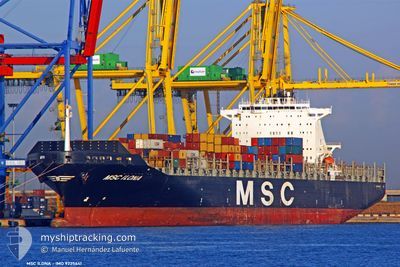
MSC ILONA
Container Ship
Current Trip
| Time Travelled | 2 days |
|---|---|
| Remaining Time | --- |
| Distance Travelled | 1060.23 nm |
| Remaining Distance | --- |
| AVG Speed | 14.7 Noeuds |
| MAX Speed | 16.2 Noeuds |
| AVG Wind | 11 knots |
| MAX Wind | 17 knots |
| MIN Temp | 21.4°C / 70.52°F |
| MAX Temp | 23°C / 73.4°F |
| Tirant d eau | 9 m |
| Position reçue | 2 d depuis |
Current Position
| Longitude | -75.91385° |
|---|---|
| Latitude | 25.90960° |
| Etat | Under way using engine |
| Vitesse | 15.3 Noeuds |
| Parcours | 80.4° |
| Zone | North Atlantic Ocean |
| Station | T-AIS |
| Position reçue | 2 d depuis |
Info
Information
The current position of MSC ILONA is in North Atlantic Ocean with coordinates 25.90960° / -75.91385° as reported on 2024-04-15 15:25 by AIS to our vessel tracker app. The vessel's current speed is 15.3 Noeuds and is heading at the port of TEKIRDAG. The estimated time of arrival as calculated by MyShipTracking vessel tracking app is 2024-04-30 11:00 LT
The vessel MSC ILONA (IMO: 9225641, MMSI: 636092932) is a Container Ship that was built in 2001 ( 23 Age ). It's sailing under the flag of [LR] Liberia.
In this page you can find informations about the vessels current position, last detected port calls, and current voyage information. If the vessels is not in coverage by AIS you will find the latest position.
The current position of MSC ILONA is detected by our AIS receivers and we are not responsible for the reliability of the data. The last position was recorded while the vessel was in Coverage by the Ais receivers of our vessel tracking app.
The current draught of MSC ILONA as reported by AIS is 9 meters
Weather
| Temperature | 21.7°C / 71.06°F |
|---|---|
| Wind Speed | 11 knots |
| Direction | 59° ENE |
| Pressure | 1018 hPa |
| Humidity | 77.4 % |
| Cloud Coverage | 66 % |
Featured Company
Last Port Calls
| Port | Arrival | Departure | Time In Port |
|---|---|---|---|
| 2024-04-14 23:49 | 2024-04-14 23:56 | 7 m | |
| 2024-04-14 07:41 | 2024-04-14 23:38 | 15 h | |
| 2024-04-14 07:12 | 2024-04-14 07:26 | 14 m | |
| 2024-04-10 20:26 | 2024-04-11 12:36 | 16 h | |
| 2024-04-05 14:49 | 2024-04-07 08:49 | 1 d | |
| 2024-03-30 00:11 | 2024-03-31 14:07 | 1 d | |
| 2024-03-21 18:04 | 2024-03-24 08:59 | 2 d | |
| 2024-03-12 10:46 | 2024-03-13 07:22 | 20 h | |
| 2024-03-10 10:28 | 2024-03-11 08:22 | 21 h | |
| 2024-03-06 13:58 | 2024-03-06 14:04 | 6 m |
Most Visited Ports (Last year)
| Port | Arrivals | |
|---|---|---|
| 10 | ||
| 6 | ||
| 5 | ||
| 5 | ||
| 5 | ||
| 5 |
Last Trips
| Origin | Departure | Destination | Arrival | Distance | |
|---|---|---|---|---|---|
| 2024-04-14 19:38 | 2024-04-14 19:49 | 0.44 nm | |||
| 2024-04-14 03:26 | 2024-04-14 03:41 | 0.76 nm | |||
| 2024-04-11 08:36 | 2024-04-14 03:12 | 758.88 nm | |||
| 2024-04-07 04:49 | 2024-04-10 16:26 | 305.82 nm | |||
| 2024-03-31 10:07 | 2024-04-05 10:49 | 1244.45 nm | |||
| 2024-03-24 03:59 | 2024-03-29 20:11 | 1363.35 nm | |||
| 2024-03-13 04:22 | 2024-03-21 13:04 | 3241.48 nm | |||
| 2024-03-11 05:22 | 2024-03-12 07:46 | 391.50 nm | |||
| 2024-03-06 11:04 | 2024-03-10 07:28 | 807.71 nm | |||
| 2024-02-29 00:24 | 2024-03-06 10:58 | 387.63 nm |
Events
| Heure | Evenement | Détails | Position/ Destination | Info |
|---|---|---|---|---|
| 2024-04-15 15:25 | Hors de la zone couverte |
25.90960 / -75.91385
North Atlantic Ocean
USPEF>TRTEK
|
Vitesse: 15.3 kn Parcours: 80.4° |
|
| 2024-04-15 15:25 | Etat Changé | Under way using engine Default |
25.90960 / -75.91385
USPEF>TRTEK
|
Vitesse: 15.3 kn Parcours: 80° |
| 2024-04-15 15:25 | Dans la zone couverte |
25.90960 / -75.91385
North Atlantic Ocean
USPEF>TRTEK
|
Vitesse: 15.3 kn Parcours: 80.4° |
|
| 2024-04-15 14:00 | Etat Changé | Default Under way using engine |
25.84940 / -76.30663
USPEF>TRTEK
|
Vitesse: 15.2 kn Parcours: 81.1° |
| 2024-04-15 13:47 | Hors de la zone couverte |
25.84065 / -76.37189
North Atlantic Ocean
USPEF>TRTEK
|
Vitesse: 15.2 kn Parcours: 81.1° |
|
| 2024-04-15 12:40 | Dans la zone couverte |
25.79204 / -76.68333
North Atlantic Ocean
USPEF>TRTEK
|
Vitesse: 15.3 kn Parcours: 81.3° |
|
| 2024-04-15 09:22 | Etat Changé | Default Under way using engine |
25.85112 / -77.58305
USPEF>TRTEK
|
Vitesse: 15.5 kn Parcours: 105.8° |
| 2024-04-15 09:16 | Hors de la zone couverte |
25.85927 / -77.61471
North Atlantic Ocean
USPEF>TRTEK
|
Vitesse: 15.5 kn Parcours: 105.8° |
|
| 2024-04-15 07:02 | Etat Changé | Under way using engine Default |
26.04348 / -78.21161
USPEF>TRTEK
|
Vitesse: 15.3 kn Parcours: 112° |
| 2024-04-15 06:46 | Dans la zone couverte |
26.04016 / -78.20221
North Atlantic Ocean
USPEF>TRTEK
|
Vitesse: 15 kn Parcours: 111.2° |