
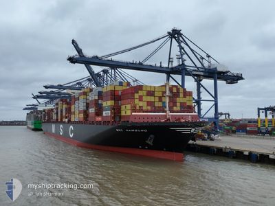
MSC HAMBURG
Cargo
Current Trip
| Time Travelled | 28 days |
|---|---|
| Remaining Time | 1 day |
| Distance Travelled | 10671.30 nm |
| Remaining Distance | 601.41 nm |
| AVG Speed | 14.9 Noeuds |
| MAX Speed | 14.9 Noeuds |
| AVG Wind | 16.4 knots |
| MAX Wind | 37 knots |
| MIN Temp | 8.1°C / 46.58°F |
| MAX Temp | 29.6°C / 85.28°F |
| Tirant d eau | 14.3 m |
| Position reçue | 9 d depuis |
Current Position
| Longitude | 19.26987° |
|---|---|
| Latitude | -34.87640° |
| Etat | Under way using engine |
| Vitesse | 18 Noeuds |
| Parcours | 118.9° |
| Zone | South Atlantic Ocean |
| Station | T-AIS |
| Position reçue | 9 d depuis |
Info
Information
The current position of MSC HAMBURG is in South Atlantic Ocean with coordinates -34.87640° / 19.26987° as reported on 2024-04-14 08:04 by AIS to our vessel tracker app. The vessel's current speed is 18 Noeuds and is heading at the port of COLOMBO. The estimated time of arrival as calculated by MyShipTracking vessel tracking app is 2024-04-24 12:17 LT
The vessel MSC HAMBURG (IMO: 9647461, MMSI: 374886000) is a Cargo It's sailing under the flag of [PA] Panama.
In this page you can find informations about the vessels current position, last detected port calls, and current voyage information. If the vessels is not in coverage by AIS you will find the latest position.
The current position of MSC HAMBURG is detected by our AIS receivers and we are not responsible for the reliability of the data. The last position was recorded while the vessel was in Coverage by the Ais receivers of our vessel tracking app.
The current draught of MSC HAMBURG as reported by AIS is 14.3 meters
Weather
| Temperature | 28.5°C / 83.3°F |
|---|---|
| Wind Speed | 3 knots |
| Direction | 159° SSE |
| Pressure | 1006 hPa |
| Humidity | 75.7 % |
| Cloud Coverage | 100 % |
Featured Company
Last Port Calls
| Port | Arrival | Departure | Time In Port |
|---|---|---|---|
| 2024-03-23 11:58 | 2024-03-26 03:08 | 2 d | |
| 2024-03-19 13:17 | 2024-03-21 22:09 | 2 d | |
| 2024-03-16 23:03 | 2024-03-18 15:28 | 1 d | |
| 2024-02-03 14:34 | 2024-02-04 19:21 | 1 d |
Last Trips
| Origin | Departure | Destination | Arrival | Distance | |
|---|---|---|---|---|---|
| 2024-03-21 23:09 | 2024-03-23 12:58 | 273.85 nm | |||
| 2024-03-18 16:28 | 2024-03-19 14:17 | 189.77 nm | |||
| 2024-02-05 03:21 | 2024-03-17 00:03 | 12002.70 nm | |||
| 2024-01-19 03:25 | 2024-02-03 22:34 | 2685.42 nm |
Events
| Heure | Evenement | Détails | Position/ Destination | Info |
|---|---|---|---|---|
| 2024-04-14 08:11 | Etat Changé | Default Under way using engine |
-34.89434 / 19.30979
LKCMB
|
Vitesse: 18 kn Parcours: 118.9° |
| 2024-04-14 08:04 | Etat Changé | Under way using engine Default |
-34.87640 / 19.26987
LKCMB
|
Vitesse: 18.2 kn Parcours: 118° |
| 2024-04-14 08:04 | Hors de la zone couverte |
-34.87640 / 19.26987
South Atlantic Ocean
LKCMB
|
Vitesse: 18 kn Parcours: 118.9° |
|
| 2024-04-14 07:59 | Etat Changé | Default Under way using engine |
-34.86520 / 19.24515
LKCMB
|
Vitesse: 18.4 kn Parcours: 118.5° |
| 2024-04-14 07:51 | Etat Changé | Under way using engine Default |
-34.84649 / 19.20392
LKCMB
|
Vitesse: 18.2 kn Parcours: 118° |
| 2024-04-14 07:38 | Etat Changé | Default Under way using engine |
-34.81609 / 19.13584
LKCMB
|
Vitesse: 18 kn Parcours: 118.8° |
| 2024-04-14 07:26 | Etat Changé | Under way using engine Default |
-34.78648 / 19.07112
LKCMB
|
Vitesse: 18.1 kn Parcours: 118° |
| 2024-04-14 07:15 | Etat Changé | Default Under way using engine |
-34.75982 / 19.01185
LKCMB
|
Vitesse: 18.3 kn Parcours: 121.1° |
| 2024-04-14 07:01 | Etat Changé | Under way using engine Default |
-34.72482 / 18.93984
LKCMB
|
Vitesse: 18.3 kn Parcours: 121° |
| 2024-04-14 06:52 | Etat Changé | Default Under way using engine |
-34.70279 / 18.89458
LKCMB
|
Vitesse: 18.2 kn Parcours: 119.4° |