
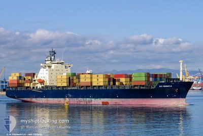
MSC GIANNA III
Container Ship
Current Trip
| Time Travelled | 9 h, 20 mins |
|---|---|
| Remaining Time | 1 day |
| Distance Travelled | 109.30 nm |
| Remaining Distance | 457.95 nm |
| AVG Speed | 12 Noeuds |
| MAX Speed | 12.4 Noeuds |
| AVG Wind | 9.5 knots |
| MAX Wind | 13.8 knots |
| MIN Temp | 10.4°C / 50.72°F |
| MAX Temp | 11.9°C / 53.42°F |
| Tirant d eau | 9.9 m |
| Position reçue | 2 m depuis |
Current Position
| Longitude | 15.47796° |
|---|---|
| Latitude | 42.68029° |
| Etat | Under way using engine |
| Vitesse | 11.8 Noeuds |
| Parcours | 134.6° |
| Zone | Adriatic Sea |
| Station | T-AIS |
| Position reçue | 2 m depuis |
Info
Information
The current position of MSC GIANNA III is in Adriatic Sea with coordinates 42.68029° / 15.47796° as reported on 2024-04-24 15:43 by AIS to our vessel tracker app. The vessel's current speed is 11.8 Noeuds and is heading at the port of GIOIA TAURO. The estimated time of arrival as calculated by MyShipTracking vessel tracking app is 2024-04-26 06:20 LT
The vessel MSC GIANNA III (IMO: 9152856, MMSI: 371711000) is a Container Ship that was built in 1998 ( 26 Age ). It's sailing under the flag of [PA] Panama.
In this page you can find informations about the vessels current position, last detected port calls, and current voyage information. If the vessels is not in coverage by AIS you will find the latest position.
The current position of MSC GIANNA III is detected by our AIS receivers and we are not responsible for the reliability of the data. The last position was recorded while the vessel was in Coverage by the Ais receivers of our vessel tracking app.
The current draught of MSC GIANNA III as reported by AIS is 9.9 meters
Weather
| Temperature | 11.5°C / 52.7°F |
|---|---|
| Wind Speed | 14 knots |
| Direction | 15° NNE |
| Pressure | 1006.4 hPa |
| Humidity | 71.4 % |
| Cloud Coverage | 3 % |
Featured Company
Last Port Calls
| Port | Arrival | Departure | Time In Port |
|---|---|---|---|
| 2024-04-23 06:17 | 2024-04-24 06:26 | 1 d | |
| 2024-04-22 03:07 | 2024-04-22 13:32 | 10 h | |
| 2024-04-21 04:42 | 2024-04-21 16:33 | 11 h | |
| 2024-04-20 04:56 | 2024-04-20 17:29 | 12 h | |
| 2024-04-17 17:11 | 2024-04-19 21:29 | 2 d | |
| 2024-04-14 03:19 | 2024-04-15 10:38 | 1 d | |
| 2024-04-09 21:16 | 2024-04-10 19:46 | 22 h | |
| 2024-04-08 14:00 | 2024-04-09 03:25 | 13 h | |
| 2024-04-06 12:48 | 2024-04-07 22:17 | 1 d | |
| 2024-04-04 06:05 | 2024-04-04 23:54 | 17 h |
Last Trips
| Origin | Departure | Destination | Arrival | Distance | |
|---|---|---|---|---|---|
| 2024-04-22 15:32 | 2024-04-23 08:17 | 169.17 nm | |||
| 2024-04-21 18:33 | 2024-04-22 05:07 | 18.73 nm | |||
| 2024-04-20 19:29 | 2024-04-21 06:42 | 116.47 nm | |||
| 2024-04-19 23:29 | 2024-04-20 06:56 | 90.84 nm | |||
| 2024-04-15 12:38 | 2024-04-17 19:11 | 698.95 nm | |||
| 2024-04-10 22:46 | 2024-04-14 05:19 | 940.68 nm | |||
| 2024-04-09 06:25 | 2024-04-10 00:16 | 138.97 nm | |||
| 2024-04-08 01:17 | 2024-04-08 17:00 | 190.60 nm | |||
| 2024-04-05 01:54 | 2024-04-06 15:48 | 453.23 nm | |||
| 2024-04-02 06:51 | 2024-04-04 08:05 | 227.10 nm |
Events
| Heure | Evenement | Détails | Position/ Destination | Info |
|---|---|---|---|---|
| 2024-04-24 15:06 | Detecté en mer | Croatian part of the Adriatic Sea |
42.76432 / 15.35459
Adriatic Sea
IT GIT
|
Vitesse: 12 kn Parcours: 131.6° |
| 2024-04-24 15:06 | Etat Changé | Under way using engine Default |
42.76432 / 15.35459
IT GIT
|
Vitesse: 12.1 kn Parcours: 132° |
| 2024-04-24 15:06 | Dans la zone couverte |
42.76432 / 15.35459
Adriatic Sea
IT GIT
|
Vitesse: 12 kn Parcours: 131.6° |
|
| 2024-04-24 11:42 | Etat Changé | Default Under way using engine |
43.20826 / 14.67710
IT GIT
|
Vitesse: 11.6 kn Parcours: 121° |
| 2024-04-24 10:43 | Hors de la zone couverte |
43.33631 / 14.47516
Adriatic Sea
IT GIT
|
Vitesse: 11.6 kn Parcours: 121° |
|
| 2024-04-24 07:57 | Etat Changé | Under way using engine Default |
43.64006 / 13.85192
IT GIT
|
Vitesse: 12.2 kn Parcours: 131° |
| 2024-04-24 07:54 | Etat Changé | Default Under way using engine |
43.64617 / 13.84207
IT GIT
|
Vitesse: 12.2 kn Parcours: 124° |
| 2024-04-24 06:34 | Etat Changé | Under way using engine Moored |
43.64747 / 13.50292
IT GIT
|
Vitesse: 10.8 kn Parcours: 57.5° |
| 2024-04-24 06:26 | PORT DE DEPART |
|
43.63275 / 13.48844
IT GIT
|
Vitesse: 6.9 kn Parcours: 346° |
| 2024-04-24 06:23 | Démarrage |
43.62770 / 13.49247
[IT] ANCONA
|
Vitesse: 5.9 kn Parcours: 343° |