
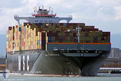
MSC FRANCESCA
Container Ship
Current Trip
| Trip Time | 4 days |
|---|---|
| Trip Distance | 791.68 nm |
| AVG Speed | 8.8 Noeuds |
| MAX Speed | 8.8 Noeuds |
| Tirant d eau | 14.1 m |
| AVG Wind | 9 knots |
| MAX Wind | 26.9 knots |
| MIN Temp | 12.2°C / 53.96°F |
| MAX Temp | 24.9°C / 76.82°F |
| Position reçue | 5 m depuis |
Current Position
| Longitude | 27.47255° |
|---|---|
| Latitude | 40.90104° |
| Etat | Moored |
| Vitesse | |
| Parcours | 202° |
| Zone | Sea of Marmara |
| Station | T-AIS |
| Position reçue | 5 m depuis |
Info
Information
The current position of MSC FRANCESCA is in Sea of Marmara with coordinates 40.90104° / 27.47255° as reported on 2024-04-18 20:58 by AIS to our vessel tracker app. The vessel's current speed is 0 Noeuds and is currently inside the port of BARBAROS.
The vessel MSC FRANCESCA (IMO: 9401116, MMSI: 370993000) is a Container Ship that was built in 2008 ( 16 Age ). It's sailing under the flag of [PA] Panama.
In this page you can find informations about the vessels current position, last detected port calls, and current voyage information. If the vessels is not in coverage by AIS you will find the latest position.
The current position of MSC FRANCESCA is detected by our AIS receivers and we are not responsible for the reliability of the data. The last position was recorded while the vessel was in Coverage by the Ais receivers of our vessel tracking app.
The current draught of MSC FRANCESCA as reported by AIS is 14.1 meters
Weather
| Temperature | 11°C / 51.8°F |
|---|---|
| Wind Speed | 6 knots |
| Direction | 322° NW |
| Pressure | 1010.4 hPa |
| Humidity | 89.6 % |
| Cloud Coverage | 41 % |
Featured Company
Last Port Calls
| Port | Arrival | Departure | Time In Port |
|---|---|---|---|
| 2024-04-18 17:40 | |||
| 2024-04-12 04:44 | 2024-04-13 21:35 | 1 d | |
| 2024-03-10 17:19 | 2024-03-11 23:06 | 1 d | |
| 2024-03-03 21:14 | 2024-03-04 22:45 | 1 d |
Most Visited Ports (Last year)
| Port | Arrivals | |
|---|---|---|
| 6 | ||
| 4 | ||
| 3 | ||
| 3 | ||
| 2 | ||
| 2 |
Last Trips
| Origin | Departure | Destination | Arrival | Distance | |
|---|---|---|---|---|---|
| 2024-04-13 23:35 | 2024-04-18 20:40 | 791.68 nm | |||
| 2024-03-12 04:36 | 2024-04-12 06:44 | 10925.60 nm | |||
| 2024-03-05 06:45 | 2024-03-10 22:49 | 1597.53 nm |
Events
| Heure | Evenement | Détails | Position/ Destination | Info |
|---|---|---|---|---|
| 2024-04-18 17:49 | Etat Changé | Moored Under way using engine |
40.90103 / 27.47261
[TR] BARBAROS
|
Vitesse: Parcours: 204° |
| 2024-04-18 17:42 | Arret |
40.90076 / 27.47309
[TR] BARBAROS
|
Vitesse: 0.3 kn Parcours: 206° |
|
| 2024-04-18 17:40 | Port d'arrivée |
|
40.90076 / 27.47342
[TR] BARBAROS
|
Vitesse: 0.5 kn Parcours: 214° |
| 2024-04-18 16:08 | Démarrage | 2.48 nm, South East of KUMBAG |
40.83964 / 27.50369
TRTEK- ASYAPORT
|
Vitesse: 3.4 kn Parcours: 85° |
| 2024-04-17 18:38 | Arret | 5.88 nm, South East of KUMBAG |
40.79696 / 27.55375
TRTEK- ASYAPORT
|
Vitesse: 0.3 kn Parcours: 37° |
| 2024-04-17 17:33 | Changement de destination | TRTEK- ASYAPORT TRTEK |
40.70405 / 27.54651
TRTEK- ASYAPORT
|
Vitesse: 6.5 kn Parcours: 29.9° |
| 2024-04-17 13:35 | Etat Changé | Under way using engine Default |
40.51154 / 27.01229
TRTEK
|
Vitesse: 7.2 kn Parcours: 67° |
| 2024-04-17 13:30 | Etat Changé | Default Under way using engine |
40.50729 / 27.00023
TRTEK
|
Vitesse: 7.3 kn Parcours: 69.2° |
| 2024-04-17 13:25 | Etat Changé | Under way using engine Default |
40.50385 / 26.98862
TRTEK
|
Vitesse: 7.5 kn Parcours: 68° |
| 2024-04-17 13:25 | Dans la zone couverte |
40.50385 / 26.98862
Sea of Marmara
TRTEK
|
Vitesse: 7.3 kn Parcours: 69.2° |