
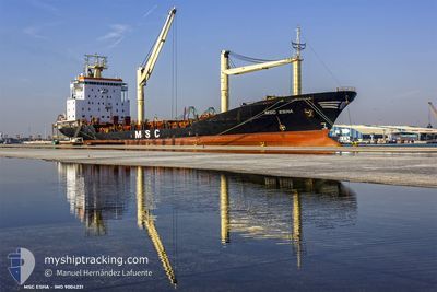
MSC ESHA F
Container Ship
Current Trip
| Time Travelled | 3 days |
|---|---|
| Remaining Time | 22 h, 13 mins |
| Distance Travelled | 704.36 nm |
| Remaining Distance | 233.94 nm |
| AVG Speed | 8.8 Noeuds |
| MAX Speed | 11.8 Noeuds |
| AVG Wind | 13.8 knots |
| MAX Wind | 36.6 knots |
| MIN Temp | 13.4°C / 56.12°F |
| MAX Temp | 24°C / 75.2°F |
| Tirant d eau | 8.8 m |
| Position reçue | 1 m depuis |
Current Position
| Longitude | 28.58765° |
|---|---|
| Latitude | 35.00921° |
| Etat | Under way using engine |
| Vitesse | 10.8 Noeuds |
| Parcours | 98.1° |
| Zone | Mediterranean Sea - Eastern Basin |
| Station | T-AIS |
| Position reçue | 1 m depuis |
Info
Information
The current position of MSC ESHA F is in Mediterranean Sea - Eastern Basin with coordinates 35.00921° / 28.58765° as reported on 2024-04-24 17:09 by AIS to our vessel tracker app. The vessel's current speed is 10.8 Noeuds and is heading at the port of LIMASSOL. The estimated time of arrival as calculated by MyShipTracking vessel tracking app is 2024-04-25 15:23 LT
The vessel MSC ESHA F (IMO: 9004231, MMSI: 356505000) is a Container Ship that was built in 1993 ( 31 Age ). It's sailing under the flag of [PA] Panama.
In this page you can find informations about the vessels current position, last detected port calls, and current voyage information. If the vessels is not in coverage by AIS you will find the latest position.
The current position of MSC ESHA F is detected by our AIS receivers and we are not responsible for the reliability of the data. The last position was recorded while the vessel was in Coverage by the Ais receivers of our vessel tracking app.
The current draught of MSC ESHA F as reported by AIS is 8.8 meters
Weather
| Temperature | 19.2°C / 66.56°F |
|---|---|
| Wind Speed | 3 knots |
| Direction | 205° SSW |
| Pressure | 1005.8 hPa |
| Humidity | 89 % |
| Cloud Coverage | 100 % |
Featured Company
Last Port Calls
| Port | Arrival | Departure | Time In Port |
|---|---|---|---|
| 2024-04-20 07:11 | 2024-04-21 11:44 | 1 d | |
| 2024-04-15 02:21 | 2024-04-16 00:59 | 22 h | |
| 2024-04-11 23:38 | 2024-04-12 20:02 | 20 h | |
| 2024-04-08 23:53 | 2024-04-09 21:10 | 21 h | |
| 2024-04-06 04:25 | 2024-04-07 00:34 | 20 h | |
| 2024-03-30 16:43 | 2024-04-02 09:38 | 2 d | |
| 2024-03-25 14:33 | 2024-03-26 20:10 | 1 d | |
| 2024-03-19 04:14 | 2024-03-20 02:01 | 21 h | |
| 2024-03-14 06:08 | 2024-03-15 10:57 | 1 d | |
| 2024-03-09 14:23 | 2024-03-10 18:21 | 1 d |
Most Visited Ports (Last year)
| Port | Arrivals | |
|---|---|---|
| 13 | ||
| 13 | ||
| 12 | ||
| 11 | ||
| 7 | ||
| 7 |
Last Trips
| Origin | Departure | Destination | Arrival | Distance | |
|---|---|---|---|---|---|
| 2024-04-16 02:59 | 2024-04-20 09:11 | 874.05 nm | |||
| 2024-04-12 22:02 | 2024-04-15 04:21 | 190.01 nm | |||
| 2024-04-10 00:10 | 2024-04-12 01:38 | 372.09 nm | |||
| 2024-04-07 03:34 | 2024-04-09 02:53 | 205.85 nm | |||
| 2024-04-02 11:38 | 2024-04-06 07:25 | 944.44 nm | |||
| 2024-03-26 22:10 | 2024-03-30 17:43 | 870.00 nm | |||
| 2024-03-20 04:01 | 2024-03-25 16:33 | 291.08 nm | |||
| 2024-03-15 11:57 | 2024-03-19 06:14 | 943.22 nm | |||
| 2024-03-10 20:21 | 2024-03-14 07:08 | 851.84 nm | |||
| 2024-03-04 18:04 | 2024-03-09 16:23 | 163.34 nm |
Events
| Heure | Evenement | Détails | Position/ Destination | Info |
|---|---|---|---|---|
| 2024-04-24 16:18 | Etat Changé | Under way using engine Default |
35.02745 / 28.40451
ITGIT > CYLMS
|
Vitesse: 10 kn Parcours: 96° |
| 2024-04-24 16:04 | Etat Changé | Default Under way using engine |
35.03333 / 28.35667
ITGIT > CYLMS
|
Vitesse: 10.7 kn Parcours: 101° |
| 2024-04-24 15:31 | Etat Changé | Under way using engine Default |
35.05354 / 28.23654
ITGIT > CYLMS
|
Vitesse: 10.8 kn Parcours: 101° |
| 2024-04-24 15:06 | Etat Changé | Default Under way using engine |
35.06801 / 28.15061
ITGIT > CYLMS
|
Vitesse: 10.3 kn Parcours: 100.9° |
| 2024-04-24 07:29 | Changement de zone | Greek part of the Mediterranean Sea - Eastern Basin Greek part of the Aegean Sea |
35.32697 / 26.63958
Mediterranean Sea - Eastern Basin
ITGIT > CYLMS
|
Vitesse: 10 kn Parcours: 119.9° |
| 2024-04-23 17:46 | Etat Changé | Under way using engine Default |
35.78159 / 23.79251
ITGIT > CYLMS
|
Vitesse: 9.6 kn Parcours: 96° |
| 2024-04-23 17:40 | Etat Changé | Default Under way using engine |
35.78340 / 23.77198
ITGIT > CYLMS
|
Vitesse: 9.7 kn Parcours: 95.4° |
| 2024-04-23 17:10 | Etat Changé | Under way using engine Default |
35.78949 / 23.67365
ITGIT > CYLMS
|
Vitesse: 9.6 kn Parcours: 89° |
| 2024-04-23 16:42 | Etat Changé | Default Under way using engine |
35.78833 / 23.57833
ITGIT > CYLMS
|
Vitesse: 9.8 kn Parcours: 81.6° |
| 2024-04-23 15:52 | Changement de zone | Greek part of the Aegean Sea Greek part of the Mediterranean Sea - Eastern Basin |
35.78423 / 23.42745
Aegean Sea
ITGIT > CYLMS
|
Vitesse: 9.5 kn Parcours: 96° |