
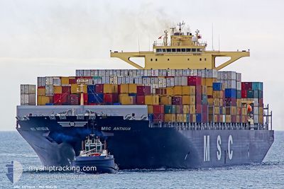
MSC ANTIGUA
Container Ship
Current Trip
| Time Travelled | 25 days |
|---|---|
| Remaining Time | --- |
| Distance Travelled | 9570.05 nm |
| Remaining Distance | --- |
| AVG Speed | 15.7 Noeuds |
| MAX Speed | 19.2 Noeuds |
| AVG Wind | 13.3 knots |
| MAX Wind | 31.9 knots |
| MIN Temp | 15.6°C / 60.08°F |
| MAX Temp | 30°C / 86°F |
| Tirant d eau | 13.5 m |
| Position reçue | 7 d depuis |
Current Position
| Longitude | 19.09538° |
|---|---|
| Latitude | -34.86889° |
| Etat | Under way using engine |
| Vitesse | 11.6 Noeuds |
| Parcours | 108.9° |
| Zone | South Atlantic Ocean |
| Station | T-AIS |
| Position reçue | 7 d depuis |
Info
Information
The current position of MSC ANTIGUA is in South Atlantic Ocean with coordinates -34.86889° / 19.09538° as reported on 2024-04-12 12:25 by AIS to our vessel tracker app. The vessel's current speed is 11.6 Noeuds and is heading at the port of ABU DHABI. The estimated time of arrival as calculated by MyShipTracking vessel tracking app is 2024-04-25 04:00 LT
The vessel MSC ANTIGUA (IMO: 9619476, MMSI: 477305900) is a Container Ship that was built in 2013 ( 11 Age ). It's sailing under the flag of [HK] Hong Kong.
In this page you can find informations about the vessels current position, last detected port calls, and current voyage information. If the vessels is not in coverage by AIS you will find the latest position.
The current position of MSC ANTIGUA is detected by our AIS receivers and we are not responsible for the reliability of the data. The last position was recorded while the vessel was in Coverage by the Ais receivers of our vessel tracking app.
The current draught of MSC ANTIGUA as reported by AIS is 13.5 meters
Weather
| Temperature | 29.8°C / 85.64°F |
|---|---|
| Wind Speed | 7 knots |
| Direction | 298° WNW |
| Pressure | 1008.8 hPa |
| Humidity | 72.8 % |
| Cloud Coverage | 20 % |
Featured Company
Last Port Calls
| Port | Arrival | Departure | Time In Port |
|---|---|---|---|
| 2024-03-22 07:46 | 2024-03-25 13:11 | 3 d | |
| 2024-03-14 18:38 | 2024-03-16 18:08 | 1 d | |
| 2024-03-08 00:05 | 2024-03-10 09:30 | 2 d | |
| 2024-03-03 17:32 | 2024-03-04 14:55 | 21 h | |
| 2024-02-29 16:56 | 2024-03-02 21:55 | 2 d | |
| 2024-02-24 23:06 | 2024-02-27 10:04 | 2 d |
Most Visited Ports (Last year)
| Port | Arrivals | |
|---|---|---|
| 4 | ||
| 4 | ||
| 3 | ||
| 3 | ||
| 3 | ||
| 3 |
Last Trips
| Origin | Departure | Destination | Arrival | Distance | |
|---|---|---|---|---|---|
| 2024-03-16 13:08 | 2024-03-22 03:46 | 1079.10 nm | |||
| 2024-03-10 05:30 | 2024-03-14 13:38 | 1016.58 nm | |||
| 2024-03-04 09:55 | 2024-03-07 19:05 | 433.18 nm | |||
| 2024-03-02 16:55 | 2024-03-03 12:32 | 114.00 nm | |||
| 2024-02-27 05:04 | 2024-02-29 11:56 | 720.77 nm | |||
| 2024-01-26 06:19 | 2024-02-24 18:06 | 11142.98 nm |
Events
| Heure | Evenement | Détails | Position/ Destination | Info |
|---|---|---|---|---|
| 2024-04-12 12:30 | Etat Changé | Default Under way using engine |
-34.87521 / 19.11458
BSFPO>AEAUH
|
Vitesse: 11.6 kn Parcours: 108.9° |
| 2024-04-12 12:25 | Hors de la zone couverte |
-34.86889 / 19.09538
South Atlantic Ocean
BSFPO>AEAUH
|
Vitesse: 11.6 kn Parcours: 108.9° |
|
| 2024-04-12 12:17 | Etat Changé | Under way using engine Default |
-34.85920 / 19.06514
BSFPO>AEAUH
|
Vitesse: 11.4 kn Parcours: 113° |
| 2024-04-12 12:06 | Etat Changé | Default Under way using engine |
-34.84765 / 19.02871
BSFPO>AEAUH
|
Vitesse: 11.4 kn Parcours: 111.4° |
| 2024-04-12 12:04 | Etat Changé | Under way using engine Default |
-34.84445 / 19.01929
BSFPO>AEAUH
|
Vitesse: 11.2 kn Parcours: 112° |
| 2024-04-12 11:59 | Etat Changé | Default Under way using engine |
-34.83936 / 19.00396
BSFPO>AEAUH
|
Vitesse: 11.2 kn Parcours: 114.6° |
| 2024-04-12 11:49 | Etat Changé | Under way using engine Default |
-34.82642 / 18.96655
BSFPO>AEAUH
|
Vitesse: 11.2 kn Parcours: 111° |
| 2024-04-12 11:40 | Dans la zone couverte |
-34.82700 / 18.96835
South Atlantic Ocean
BSFPO>AEAUH
|
Vitesse: 11.2 kn Parcours: 109.8° |
|
| 2024-04-12 10:07 | Etat Changé | Default Under way using engine |
-34.70690 / 18.61903
BSFPO>AEAUH
|
Vitesse: 10.3 kn Parcours: 113.9° |
| 2024-04-12 10:03 | Hors de la zone couverte |
-34.70222 / 18.60574
South Atlantic Ocean
BSFPO>AEAUH
|
Vitesse: 10.3 kn Parcours: 113.9° |