
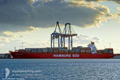
MONTE CERVANTES
Container Ship
Current Trip
MYTPP>>MYTPP
| Time Travelled | 7 days |
|---|---|
| Remaining Time | --- |
| Distance Travelled | 3347.72 nm |
| Remaining Distance | --- |
| AVG Speed | 17.9 Noeuds |
| MAX Speed | 19.3 Noeuds |
| AVG Wind | 13.7 knots |
| MAX Wind | 20.8 knots |
| MIN Temp | 24°C / 75.2°F |
| MAX Temp | 29.9°C / 85.82°F |
| Tirant d eau | 8.8 m |
| Position reçue | 6 d depuis |
Current Position
| Longitude | 95.05284° |
|---|---|
| Latitude | 6.29854° |
| Etat | Under way using engine |
| Vitesse | 17.5 Noeuds |
| Parcours | 256° |
| Zone | Andaman or Burma Sea |
| Station | T-AIS |
| Position reçue | 6 d depuis |
Info
Information
The current position of MONTE CERVANTES is in Andaman or Burma Sea with coordinates 6.29854° / 95.05284° as reported on 2024-04-18 22:35 by AIS to our vessel tracker app. The vessel's current speed is 17.5 Noeuds
The vessel MONTE CERVANTES (IMO: 9283186, MMSI: 563051200) is a Container Ship that was built in 2004 ( 20 Age ). It's sailing under the flag of [SG] Singapore.
In this page you can find informations about the vessels current position, last detected port calls, and current voyage information. If the vessels is not in coverage by AIS you will find the latest position.
The current position of MONTE CERVANTES is detected by our AIS receivers and we are not responsible for the reliability of the data. The last position was recorded while the vessel was in Coverage by the Ais receivers of our vessel tracking app.
The current draught of MONTE CERVANTES as reported by AIS is 8.8 meters
Weather
| Temperature | 26.6°C / 79.88°F |
|---|---|
| Wind Speed | 13 knots |
| Direction | 73° ENE |
| Pressure | 1015.2 hPa |
| Humidity | 81.8 % |
| Cloud Coverage | 38 % |
Featured Company
Last Port Calls
| Port | Arrival | Departure | Time In Port |
|---|---|---|---|
| 2024-04-16 00:51 | 2024-04-17 10:40 | 1 d | |
| 2024-04-08 23:05 | 2024-04-09 16:15 | 17 h | |
| 2024-03-13 23:21 | 2024-03-15 07:03 | 1 d | |
| 2024-03-01 03:39 | 2024-03-02 00:28 | 20 h | |
| 2024-02-26 18:49 | 2024-02-27 12:21 | 17 h | |
| 2024-02-24 10:22 | 2024-02-25 00:35 | 14 h | |
| 2024-02-22 19:07 | 2024-02-23 09:37 | 14 h | |
| 2024-02-19 09:40 | 2024-02-20 06:39 | 20 h | |
| 2024-02-11 09:33 | 2024-02-11 16:12 | 6 h | |
| 2024-02-08 22:02 | 2024-02-09 04:39 | 6 h |
Most Visited Ports (Last year)
| Port | Arrivals | |
|---|---|---|
| 13 | ||
| 7 | ||
| 7 | ||
| 7 | ||
| 7 | ||
| 7 |
Last Trips
| Origin | Departure | Destination | Arrival | Distance | |
|---|---|---|---|---|---|
| 2024-04-10 00:15 | 2024-04-16 08:51 | 25.49 nm | |||
| 2024-03-15 04:03 | 2024-04-09 07:05 | 9078.09 nm | |||
| 2024-03-01 19:28 | 2024-03-13 20:21 | 4716.53 nm | |||
| 2024-02-27 07:21 | 2024-02-29 22:39 | 498.69 nm | |||
| 2024-02-24 19:35 | 2024-02-26 13:49 | 430.65 nm | |||
| 2024-02-23 04:37 | 2024-02-24 05:22 | 255.58 nm | |||
| 2024-02-20 01:39 | 2024-02-22 14:07 | 260.66 nm | |||
| 2024-02-11 13:12 | 2024-02-19 04:40 | 3285.72 nm | |||
| 2024-02-09 01:39 | 2024-02-11 06:33 | 851.30 nm | |||
| 2024-02-05 06:44 | 2024-02-08 19:02 | 783.94 nm |
Events
| Heure | Evenement | Détails | Position/ Destination | Info |
|---|---|---|---|---|
| 2024-04-18 22:35 | Hors de la zone couverte |
6.29854 / 95.05284
Andaman or Burma Sea
|
Vitesse: 17.5 kn Parcours: 256° |
|
| 2024-04-18 22:35 | Dans la zone couverte |
6.29854 / 95.05284
Andaman or Burma Sea
|
Vitesse: 17.5 kn Parcours: 256° |
|
| 2024-04-18 21:09 | Hors de la zone couverte |
6.24881 / 95.46813
Andaman or Burma Sea
|
Vitesse: 18.2 kn Parcours: 293° |
|
| 2024-04-18 21:09 | Detecté en mer | Indonesian part of the Andaman or Burma Sea |
6.24881 / 95.46813
Andaman or Burma Sea
|
Vitesse: 18.2 kn Parcours: 293° |
| 2024-04-18 21:09 | Dans la zone couverte |
6.24881 / 95.46813
Andaman or Burma Sea
|
Vitesse: 18.2 kn Parcours: 293° |
|
| 2024-04-17 11:28 | Etat Changé | Default Under way using engine |
1.23257 / 103.48512
MYTPP>>MYTPP
|
Vitesse: 14.3 kn Parcours: 267° |
| 2024-04-17 11:23 | Hors de la zone couverte |
1.23334 / 103.50922
Singapore Strait
|
Vitesse: 14.3 kn Parcours: 267° |
|
| 2024-04-17 10:40 | PORT DE DEPART |
|
1.32716 / 103.55403
MYTPP>>MYTPP
|
Vitesse: 8.1 kn Parcours: 161° |
| 2024-04-17 10:28 | Démarrage |
1.34653 / 103.54726
[MY] TANJUNG PELEPAS
|
Vitesse: 3.3 kn Parcours: 158° |
|
| 2024-04-17 10:16 | Etat Changé | Under way using engine Default |
1.34762 / 103.54735
[MY] TANJUNG PELEPAS
|
Vitesse: 0.8 kn Parcours: 355° |