
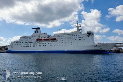
MOBY ZAZA'
Accommodation Ship
Current Trip
| Trip Time | 10 h, 40 mins |
|---|---|
| Trip Distance | 131.39 nm |
| AVG Speed | 12.1 Noeuds |
| MAX Speed | 12.7 Noeuds |
| Tirant d eau | 5.6 m |
| AVG Wind | 8.4 knots |
| MAX Wind | 12.4 knots |
| MIN Temp | 8.4°C / 47.12°F |
| MAX Temp | 14.1°C / 57.38°F |
| Position reçue | 1 d depuis |
Current Position
| Longitude | 13.65298° |
|---|---|
| Latitude | 43.73893° |
| Etat | Under way using engine |
| Vitesse | 11.5 Noeuds |
| Parcours | 271.8° |
| Zone | Adriatic Sea |
| Station | T-AIS |
| Position reçue | 1 d depuis |
Info
Information
The current position of MOBY ZAZA' is in Adriatic Sea with coordinates 43.73893° / 13.65298° as reported on 2024-04-17 03:46 by AIS to our vessel tracker app. The vessel's current speed is 11.5 Noeuds and is currently inside the port of SPLIT.
The vessel MOBY ZAZA' (IMO: 8020642, MMSI: 247369700) is a Accommodation Ship that was built in 1982 ( 42 Age ). It's sailing under the flag of [IT] Italy.
In this page you can find informations about the vessels current position, last detected port calls, and current voyage information. If the vessels is not in coverage by AIS you will find the latest position.
The current position of MOBY ZAZA' is detected by our AIS receivers and we are not responsible for the reliability of the data. The last position was recorded while the vessel was in Coverage by the Ais receivers of our vessel tracking app.
The current draught of MOBY ZAZA' as reported by AIS is 5.6 meters
Weather
| Temperature | 8.6°C / 47.48°F |
|---|---|
| Wind Speed | 3 knots |
| Direction | 66° ENE |
| Pressure | 1005.8 hPa |
| Humidity | 60.5 % |
| Cloud Coverage | 4 % |
Featured Company
Last Port Calls
| Port | Arrival | Departure | Time In Port |
|---|---|---|---|
| 2024-04-18 04:44 | |||
| 2024-04-17 04:55 | 2024-04-17 18:04 | 13 h | |
| 2024-04-16 05:01 | 2024-04-16 18:01 | 13 h | |
| 2024-04-15 04:47 | 2024-04-15 18:07 | 13 h | |
| 2024-04-13 04:48 | 2024-04-14 18:03 | 1 d | |
| 2024-04-12 04:36 | 2024-04-12 18:52 | 14 h | |
| 2024-04-11 05:11 | 2024-04-11 18:10 | 12 h | |
| 2024-04-10 04:41 | 2024-04-10 18:32 | 13 h | |
| 2024-04-09 04:26 | 2024-04-09 18:09 | 13 h | |
| 2024-04-08 04:31 | 2024-04-08 18:12 | 13 h |
Last Trips
| Origin | Departure | Destination | Arrival | Distance | |
|---|---|---|---|---|---|
| 2024-04-17 20:04 | 2024-04-18 06:44 | 131.39 nm | |||
| 2024-04-16 20:01 | 2024-04-17 06:55 | 128.45 nm | |||
| 2024-04-15 20:07 | 2024-04-16 07:01 | 131.18 nm | |||
| 2024-04-14 20:03 | 2024-04-15 06:47 | 132.22 nm | |||
| 2024-04-12 20:52 | 2024-04-13 06:48 | 130.67 nm | |||
| 2024-04-11 20:10 | 2024-04-12 06:36 | 129.25 nm | |||
| 2024-04-10 20:32 | 2024-04-11 07:11 | 131.81 nm | |||
| 2024-04-09 20:09 | 2024-04-10 06:41 | 133.10 nm | |||
| 2024-04-08 20:12 | 2024-04-09 06:26 | 130.84 nm | |||
| 2024-04-07 20:11 | 2024-04-08 06:31 | 132.12 nm |
Events
| Heure | Evenement | Détails | Position/ Destination | Info |
|---|---|---|---|---|
| 2024-04-18 04:44 | Port d'arrivée |
|
43.50274 / 16.43802
[HR] SPLIT
|
Vitesse: 11.7 kn Parcours: 82° |
| 2024-04-17 18:04 | PORT DE DEPART |
|
43.63480 / 13.49107
HRSPU
|
Vitesse: 4.7 kn Parcours: 344° |
| 2024-04-17 17:58 | Démarrage |
43.62534 / 13.49242
[IT] ANCONA
|
Vitesse: 4.7 kn Parcours: 344° |
|
| 2024-04-17 05:19 | Arret |
43.62167 / 13.50667
[IT] ANCONA
|
Vitesse: Parcours: -1° |
|
| 2024-04-17 04:55 | Port d'arrivée |
|
43.62180 / 13.50465
[IT] ANCONA
|
Vitesse: 7.7 kn Parcours: 178° |
| 2024-04-17 03:48 | Etat Changé | Default Under way using engine |
43.73925 / 13.64707
HRSPU
|
Vitesse: 11.5 kn Parcours: 271.8° |
| 2024-04-17 03:46 | Changement de zone | Italian part of the Adriatic Sea Croatian part of the Adriatic Sea |
43.73893 / 13.65298
Adriatic Sea
|
Vitesse: 11.5 kn Parcours: 271.8° |
| 2024-04-17 03:46 | Hors de la zone couverte |
43.73893 / 13.65298
Adriatic Sea
|
Vitesse: 11.5 kn Parcours: 271.8° |
|
| 2024-04-17 03:44 | Etat Changé | Under way using engine Default |
43.73839 / 13.66319
HRSPU
|
Vitesse: 11.4 kn Parcours: 272° |
| 2024-04-17 03:44 | Dans la zone couverte |
43.73893 / 13.65298
Adriatic Sea
|
Vitesse: 11.5 kn Parcours: 271.8° |