
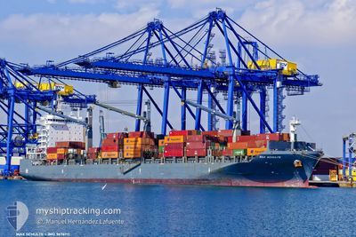
MAX SCHULTE
Cargo
Current Trip
| Trip Time | 2 days |
|---|---|
| Trip Distance | 801.81 nm |
| AVG Speed | 12.3 Noeuds |
| MAX Speed | 12.3 Noeuds |
| Tirant d eau | 8.7 m |
| AVG Wind | 11.9 knots |
| MAX Wind | 30 knots |
| MIN Temp | 13.1°C / 55.58°F |
| MAX Temp | 21.7°C / 71.06°F |
| Position reçue | 4 m depuis |
Current Position
| Longitude | 28.68063° |
|---|---|
| Latitude | 40.96406° |
| Etat | Moored |
| Vitesse | |
| Parcours | 355° |
| Zone | Sea of Marmara |
| Station | T-AIS |
| Position reçue | 4 m depuis |
Info
Information
The current position of MAX SCHULTE is in Sea of Marmara with coordinates 40.96406° / 28.68063° as reported on 2024-04-19 13:36 by AIS to our vessel tracker app. The vessel's current speed is 0 Noeuds and is currently inside the port of AMBARLI.
The vessel MAX SCHULTE (IMO: 9676711, MMSI: 565380000) is a Cargo It's sailing under the flag of [SG] Singapore.
In this page you can find informations about the vessels current position, last detected port calls, and current voyage information. If the vessels is not in coverage by AIS you will find the latest position.
The current position of MAX SCHULTE is detected by our AIS receivers and we are not responsible for the reliability of the data. The last position was recorded while the vessel was in Coverage by the Ais receivers of our vessel tracking app.
The current draught of MAX SCHULTE as reported by AIS is 8.7 meters
Weather
| Temperature | 13.3°C / 55.94°F |
|---|---|
| Wind Speed | 12 knots |
| Direction | 38° NE |
| Pressure | 1011.4 hPa |
| Humidity | 80.6 % |
| Cloud Coverage | 100 % |
Featured Company
Last Port Calls
| Port | Arrival | Departure | Time In Port |
|---|---|---|---|
| 2024-04-18 14:54 | |||
| 2024-04-15 07:14 | 2024-04-15 21:43 | 14 h | |
| 2024-04-06 14:57 | 2024-04-06 22:49 | 7 h | |
| 2024-03-26 13:20 | 2024-03-27 15:41 | 1 d | |
| 2024-03-24 15:18 | 2024-03-25 04:36 | 13 h | |
| 2024-03-22 13:31 | 2024-03-23 10:23 | 20 h | |
| 2024-03-10 15:04 | 2024-03-10 21:34 | 6 h | |
| 2024-03-04 12:23 | 2024-03-05 02:44 | 14 h | |
| 2024-03-03 06:20 | 2024-03-03 14:34 | 8 h | |
| 2024-03-02 13:41 | 2024-03-03 00:54 | 11 h |
Last Trips
| Origin | Departure | Destination | Arrival | Distance | |
|---|---|---|---|---|---|
| 2024-04-16 00:43 | 2024-04-18 17:54 | 801.81 nm | |||
| 2024-04-06 22:49 | 2024-04-15 10:14 | 2019.19 nm | |||
| 2024-03-27 11:41 | 2024-04-06 14:57 | 3866.46 nm | |||
| 2024-03-25 00:36 | 2024-03-26 09:20 | 506.11 nm | |||
| 2024-03-23 06:23 | 2024-03-24 11:18 | 302.29 nm | |||
| 2024-03-10 22:34 | 2024-03-22 09:31 | 3595.89 nm | |||
| 2024-03-05 05:44 | 2024-03-10 16:04 | 1674.59 nm | |||
| 2024-03-03 17:34 | 2024-03-04 15:23 | 285.31 nm | |||
| 2024-03-03 03:54 | 2024-03-03 09:20 | 69.97 nm | |||
| 2024-03-02 12:18 | 2024-03-02 16:41 | 54.99 nm |
Events
| Heure | Evenement | Détails | Position/ Destination | Info |
|---|---|---|---|---|
| 2024-04-18 15:06 | Etat Changé | Moored Under way using engine |
40.96428 / 28.68059
[TR] AMBARLI
|
Vitesse: 0.1 kn Parcours: 355° |
| 2024-04-18 15:02 | Arret |
40.96417 / 28.68070
[TR] AMBARLI
|
Vitesse: 0.2 kn Parcours: 355° |
|
| 2024-04-18 14:54 | Port d'arrivée |
|
40.95958 / 28.68134
[TR] AMBARLI
|
Vitesse: 3.6 kn Parcours: 356° |
| 2024-04-18 11:28 | Changement d'ETA | 2024/04/18 14:30 2024/04/18 15:00 |
40.74000 / 27.75861
TRIST
|
Vitesse: 16.9 kn Parcours: 80.7° |
| 2024-04-18 09:43 | Changement d'ETA | 2024/04/18 15:00 2024/04/18 14:00 |
40.58860 / 27.22641
TRIST
|
Vitesse: 14.3 kn Parcours: 64.7° |
| 2024-04-18 08:56 | Dans la zone couverte |
40.50651 / 26.99214
Sea of Marmara
TRIST
|
Vitesse: 15.4 kn Parcours: 66.1° |
|
| 2024-04-18 07:32 | Etat Changé | Default Under way using engine |
40.33827 / 26.63643
TRIST
|
Vitesse: 15.2 kn Parcours: 47.8° |
| 2024-04-18 07:06 | Hors de la zone couverte |
40.26090 / 26.53279
Sea of Marmara
TRIST
|
Vitesse: 15.2 kn Parcours: 47.8° |
|
| 2024-04-18 05:27 | Changement de zone | Turkish part of the Sea of Marmara Turkish part of the Aegean Sea |
40.01767 / 26.19233
Sea of Marmara
TRIST
|
Vitesse: 7 kn Parcours: 74.9° |
| 2024-04-18 04:43 | Etat Changé | Under way using engine Default |
39.98348 / 26.04681
TRIST
|
Vitesse: 9.2 kn Parcours: 39° |