
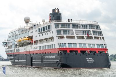
MAUD
Ro-Ro/Passenger Ship
Current Trip
| Time Travelled | 1 day |
|---|---|
| Remaining Time | 2 h, 43 mins |
| Distance Travelled | 208.48 nm |
| Remaining Distance | 34.17 nm |
| AVG Speed | 10.6 Noeuds |
| MAX Speed | 15 Noeuds |
| AVG Wind | 5.9 knots |
| MAX Wind | 13 knots |
| MIN Temp | 7.2°C / 44.96°F |
| MAX Temp | 13.2°C / 55.76°F |
| Tirant d eau | 5 m |
| Position reçue | 42 m depuis |
Current Position
| Longitude | -5.55924° |
|---|---|
| Latitude | 49.90930° |
| Etat | Under way using engine |
| Vitesse | 11.4 Noeuds |
| Parcours | 91.1° |
| Zone | English Channel |
| Station | T-AIS |
| Position reçue | 42 m depuis |
Info
Information
The current position of MAUD is in English Channel with coordinates 49.90930° / -5.55924° as reported on 2024-04-24 21:54 by AIS to our vessel tracker app. The vessel's current speed is 11.4 Noeuds and is heading at the port of ISLES OF SCILLY. The estimated time of arrival as calculated by MyShipTracking vessel tracking app is 2024-04-25 01:20 LT
The vessel MAUD (IMO: 9247728, MMSI: 258595000) is a Ro-Ro/Passenger Ship that was built in 2003 ( 21 Age ). It's sailing under the flag of [NO] Norway.
In this page you can find informations about the vessels current position, last detected port calls, and current voyage information. If the vessels is not in coverage by AIS you will find the latest position.
The current position of MAUD is detected by our AIS receivers and we are not responsible for the reliability of the data. The last position was recorded while the vessel was in Coverage by the Ais receivers of our vessel tracking app.
The current draught of MAUD as reported by AIS is 5 meters
Weather
| Temperature | 7.6°C / 45.68°F |
|---|---|
| Wind Speed | 8 knots |
| Direction | 338° NNW |
| Pressure | 1014.5 hPa |
| Humidity | 84.6 % |
| Cloud Coverage | 12 % |
Featured Company
Last Port Calls
| Port | Arrival | Departure | Time In Port |
|---|---|---|---|
| 2024-04-23 06:47 | 2024-04-23 17:07 | 10 h | |
| 2024-04-22 06:18 | 2024-04-22 15:58 | 9 h | |
| 2024-04-20 06:26 | 2024-04-20 16:18 | 9 h | |
| 2024-04-17 06:04 | 2024-04-17 17:04 | 10 h | |
| 2024-04-14 06:15 | 2024-04-14 17:04 | 10 h | |
| 2024-04-12 04:12 |
Last Trips
| Origin | Departure | Destination | Arrival | Distance | |
|---|---|---|---|---|---|
| 2024-04-22 16:58 | 2024-04-23 07:47 | 186.62 nm | |||
| 2024-04-20 17:18 | 2024-04-22 07:18 | 323.75 nm | |||
| 2024-04-17 18:04 | 2024-04-20 07:26 | 543.45 nm | |||
| 2024-04-14 18:04 | 2024-04-17 07:04 | 611.98 nm | |||
| 2024-04-12 06:12 | 2024-04-14 07:15 | 463.44 nm |
Events
| Heure | Evenement | Détails | Position/ Destination | Info |
|---|---|---|---|---|
| 2024-04-24 21:59 | Etat Changé | Default Under way using engine |
49.90904 / -5.53547
GB ISC
|
Vitesse: 11.4 kn Parcours: 91.1° |
| 2024-04-24 21:53 | Changement de zone | United Kingdom part of the English Channel United Kingdom part of the Celtic Sea |
49.90937 / -5.56496
English Channel
|
Vitesse: 11.4 kn Parcours: 90.1° |
| 2024-04-24 21:52 | Etat Changé | Under way using engine Default |
49.90941 / -5.56988
GB ISC
|
Vitesse: 11.4 kn Parcours: 91° |
| 2024-04-24 21:38 | Dans la zone couverte |
49.90937 / -5.56496
English Channel
|
Vitesse: 11.4 kn Parcours: 90.1° |
|
| 2024-04-24 19:02 | Démarrage | 0.87 nm, West of ISLES OF SCILLY |
49.92296 / -6.33702
GB ISC
|
Vitesse: 8.3 kn Parcours: 218° |
| 2024-04-24 07:21 | Etat Changé | Default At anchor |
49.92931 / -6.32800
GB ISC
|
Vitesse: 0.3 kn Parcours: 34° |
| 2024-04-24 07:15 | Hors de la zone couverte |
49.92927 / -6.32808
Celtic Sea
GB ISC
|
Vitesse: 0.3 kn Parcours: 107.9° |
|
| 2024-04-24 07:14 | Etat Changé | At anchor Under way using engine |
49.92928 / -6.32816
GB ISC
|
Vitesse: 0.3 kn Parcours: 36° |
| 2024-04-24 07:14 | Etat Changé | Under way using engine Default |
49.92929 / -6.32821
GB ISC
|
Vitesse: 0.5 kn Parcours: 47° |
| 2024-04-24 07:14 | Arret | 0.77 nm, North West of ISLES OF SCILLY |
49.92929 / -6.32821
GB ISC
|
Vitesse: 0.2 kn Parcours: 37° |