
MARUS
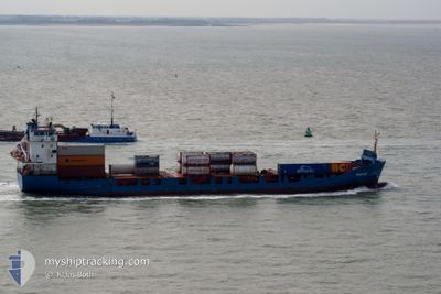
Container Ship
Current Trip
| Trip Time | 20 h, 43 mins |
|---|---|
| Trip Distance | 225.55 nm |
| AVG Speed | 9.9 Noeuds |
| MAX Speed | 16.1 Noeuds |
| Tirant d eau | 4.2 m |
| AVG Wind | 10.1 knots |
| MAX Wind | 14.9 knots |
| MIN Temp | 5°C / 41°F |
| MAX Temp | 7.9°C / 46.22°F |
| Position reçue | 2 m depuis |
Current Position
| Longitude | 3.78114° |
|---|---|
| Latitude | 51.16120° |
| Etat | Moored |
| Vitesse | |
| Parcours | 257° |
| Zone | North Sea |
| Station | T-AIS |
| Position reçue | 2 m depuis |
Info
Information
The current position of MARUS is in North Sea with coordinates 51.16120° / 3.78114° as reported on 2024-04-24 04:24 by AIS to our vessel tracker app. The vessel's current speed is 0 Noeuds and is currently inside the port of GENT.
The vessel MARUS (IMO: 9110559, MMSI: 305707000) is a Container Ship that was built in 1996 ( 28 Age ). It's sailing under the flag of [AG] Antigua Barbuda.
In this page you can find informations about the vessels current position, last detected port calls, and current voyage information. If the vessels is not in coverage by AIS you will find the latest position.
The current position of MARUS is detected by our AIS receivers and we are not responsible for the reliability of the data. The last position was recorded while the vessel was in Coverage by the Ais receivers of our vessel tracking app.
The current draught of MARUS as reported by AIS is 4.7 meters
Weather
| Temperature | 5.6°C / 42.08°F |
|---|---|
| Wind Speed | 11 knots |
| Direction | 330° NNW |
| Pressure | 1013.7 hPa |
| Humidity | 79 % |
| Cloud Coverage | 100 % |
Featured Company
Last Port Calls
| Port | Arrival | Departure | Time In Port |
|---|---|---|---|
| 2024-04-23 19:20 | |||
| 2024-04-22 09:00 | 2024-04-22 22:37 | 13 h | |
| 2024-04-20 18:41 | 2024-04-21 11:46 | 17 h | |
| 2024-04-20 17:36 | 2024-04-20 17:46 | 9 m | |
| 2024-04-19 07:32 | 2024-04-19 23:22 | 15 h | |
| 2024-04-17 23:54 | 2024-04-18 08:13 | 8 h | |
| 2024-04-14 17:13 | 2024-04-16 23:38 | 2 d | |
| 2024-04-13 06:16 | 2024-04-13 18:04 | 11 h | |
| 2024-04-11 05:00 | 2024-04-12 09:31 | 1 d | |
| 2024-04-09 19:53 | 2024-04-10 04:47 | 8 h |
Last Trips
| Origin | Departure | Destination | Arrival | Distance | |
|---|---|---|---|---|---|
| 2024-04-22 23:37 | 2024-04-23 21:20 | 225.55 nm | |||
| 2024-04-21 13:46 | 2024-04-22 10:00 | 226.36 nm | |||
| 2024-04-20 19:46 | 2024-04-20 20:41 | 8.19 nm | |||
| 2024-04-20 00:22 | 2024-04-20 19:36 | 217.89 nm | |||
| 2024-04-18 10:13 | 2024-04-19 08:32 | 226.63 nm | |||
| 2024-04-17 00:38 | 2024-04-18 01:54 | 225.25 nm | |||
| 2024-04-13 20:04 | 2024-04-14 18:13 | 227.09 nm | |||
| 2024-04-12 10:31 | 2024-04-13 08:16 | 225.53 nm | |||
| 2024-04-10 06:47 | 2024-04-11 06:00 | 227.34 nm | |||
| 2024-04-08 17:33 | 2024-04-09 21:53 | 240.30 nm |
Events
| Heure | Evenement | Détails | Position/ Destination | Info |
|---|---|---|---|---|
| 2024-04-24 01:38 | Tirant d'eau modifié | 4.7 4.2 |
51.16137 / 3.78102
[BE] GENT
|
Vitesse: Parcours: 257° |
| 2024-04-23 19:33 | Etat Changé | Moored Under way using engine |
51.16130 / 3.78095
[BE] GENT
|
Vitesse: Parcours: 258° |
| 2024-04-23 19:29 | Arret |
51.16128 / 3.78097
[BE] GENT
|
Vitesse: 0.2 kn Parcours: 257° |
|
| 2024-04-23 19:20 | Port d'arrivée |
|
51.16670 / 3.79180
[BE] GENT
|
Vitesse: 6 kn Parcours: 209.5° |
| 2024-04-23 18:05 | Démarrage | 0.53 nm, North West of TERNEUZEN |
51.32739 / 3.81799
BEGNE
|
Vitesse: 6.7 kn Parcours: 151.8° |
| 2024-04-23 17:28 | Arret | 0.65 nm, North West of TERNEUZEN |
51.32921 / 3.81665
BEGNE
|
Vitesse: 0.3 kn Parcours: 154° |
| 2024-04-23 17:02 | Changement d'ETA | 2024/04/23 21:30 2024/04/23 19:30 |
51.34296 / 3.81049
BEGNE
|
Vitesse: 3.2 kn Parcours: 173° |
| 2024-04-23 11:41 | Changement d'ETA | 2024/04/23 19:30 2024/04/23 21:30 |
51.94870 / 2.84579
BEGNE
|
Vitesse: 10.6 kn Parcours: 119.5° |
| 2024-04-23 10:58 | Changement de zone | Dutch part of the North Sea United Kingdom part of the North Sea |
52.01384 / 2.67139
North Sea
BEGNE
|
Vitesse: 10.5 kn Parcours: 123.8° |
| 2024-04-23 10:43 | Etat Changé | Under way using engine Default |
52.03804 / 2.61429
BEGNE
|
Vitesse: 10.5 kn Parcours: 125° |