
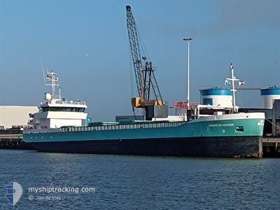
MARIETJE HESTER
General Cargo
Current Trip
| Time Travelled | 1 day |
|---|---|
| Remaining Time | 3 days |
| Distance Travelled | 365.74 nm |
| Remaining Distance | 896.42 nm |
| AVG Speed | 10.6 Noeuds |
| MAX Speed | 13.3 Noeuds |
| AVG Wind | 11.3 knots |
| MAX Wind | 15 knots |
| MIN Temp | -1.3°C / 29.66°F |
| MAX Temp | 3.6°C / 38.48°F |
| Tirant d eau | 3.6 m |
| Position reçue | 1 m depuis |
Current Position
| Longitude | 15.53040° |
|---|---|
| Latitude | 55.74956° |
| Etat | Under way using engine |
| Vitesse | 10.5 Noeuds |
| Parcours | 239.9° |
| Zone | Baltic Sea |
| Station | T-AIS |
| Position reçue | 1 m depuis |
Info
Information
The current position of MARIETJE HESTER is in Baltic Sea with coordinates 55.74956° / 15.53040° as reported on 2024-04-25 06:54 by AIS to our vessel tracker app. The vessel's current speed is 10.5 Noeuds and is heading at the port of ROTTERDAM. The estimated time of arrival as calculated by MyShipTracking vessel tracking app is 2024-04-28 23:52 LT
The vessel MARIETJE HESTER (IMO: 9279032, MMSI: 244482000) is a General Cargo that was built in 2005 ( 19 Age ). It's sailing under the flag of [NL] Netherlands.
In this page you can find informations about the vessels current position, last detected port calls, and current voyage information. If the vessels is not in coverage by AIS you will find the latest position.
The current position of MARIETJE HESTER is detected by our AIS receivers and we are not responsible for the reliability of the data. The last position was recorded while the vessel was in Coverage by the Ais receivers of our vessel tracking app.
The current draught of MARIETJE HESTER as reported by AIS is 3.6 meters
Weather
| Temperature | 3.6°C / 38.48°F |
|---|---|
| Wind Speed | 6 knots |
| Direction | 63° ENE |
| Pressure | 1006.1 hPa |
| Humidity | 71.3 % |
| Cloud Coverage | 14 % |
Featured Company
Last Port Calls
| Port | Arrival | Departure | Time In Port |
|---|---|---|---|
| 2024-04-23 13:40 | 2024-04-23 19:41 | 6 h | |
| 2024-04-08 06:18 | 2024-04-09 15:01 | 1 d | |
| 2024-04-08 04:58 | 2024-04-08 05:18 | 20 m | |
| 2024-04-03 16:42 | 2024-04-04 15:42 | 23 h | |
| 2024-04-01 05:01 | 2024-04-02 17:30 | 1 d | |
| 2024-03-28 07:39 | 2024-03-28 21:55 | 14 h | |
| 2024-03-26 16:03 | 2024-03-27 22:59 | 1 d | |
| 2024-03-15 16:10 | 2024-03-19 22:06 | 4 d | |
| 2024-03-10 10:27 | 2024-03-14 11:58 | 4 d | |
| 2024-03-04 01:24 | 2024-03-05 12:54 | 1 d |
Last Trips
| Origin | Departure | Destination | Arrival | Distance | |
|---|---|---|---|---|---|
| 2024-04-09 16:01 | 2024-04-23 16:40 | 2112.17 nm | |||
| 2024-04-08 06:18 | 2024-04-08 07:18 | 4.77 nm | |||
| 2024-04-04 17:42 | 2024-04-08 05:58 | 660.96 nm | |||
| 2024-04-02 18:30 | 2024-04-03 18:42 | 250.73 nm | |||
| 2024-03-28 21:55 | 2024-04-01 06:01 | 704.12 nm | |||
| 2024-03-27 22:59 | 2024-03-28 07:39 | 79.59 nm | |||
| 2024-03-19 23:06 | 2024-03-26 16:03 | 947.63 nm | |||
| 2024-03-14 12:58 | 2024-03-15 17:10 | 321.88 nm | |||
| 2024-03-05 13:54 | 2024-03-10 11:27 | 527.74 nm | |||
| 2024-03-04 02:16 | 2024-03-04 02:24 | 0.60 nm |
Events
| Heure | Evenement | Détails | Position/ Destination | Info |
|---|---|---|---|---|
| 2024-04-24 23:38 | Etat Changé | Under way using engine Default |
56.54925 / 17.03025
NLRTM
|
Vitesse: 10.2 kn Parcours: 200° |
| 2024-04-24 23:38 | Dans la zone couverte |
56.54925 / 17.03025
Baltic Sea
NLRTM
|
Vitesse: 10.8 kn Parcours: 200.9° |
|
| 2024-04-24 20:56 | Etat Changé | Default Under way using engine |
56.97674 / 17.32560
NLRTM
|
Vitesse: 10.4 kn Parcours: 200.5° |
| 2024-04-24 20:52 | Hors de la zone couverte |
56.98978 / 17.33456
Baltic Sea
NLRTM
|
Vitesse: 10.4 kn Parcours: 200.5° |
|
| 2024-04-24 20:39 | Etat Changé | Under way using engine Default |
57.02507 / 17.35837
NLRTM
|
Vitesse: 10.5 kn Parcours: 200° |
| 2024-04-24 20:20 | Etat Changé | Default Under way using engine |
57.07525 / 17.39279
NLRTM
|
Vitesse: 10.6 kn Parcours: 201° |
| 2024-04-24 17:54 | Etat Changé | Under way using engine Default |
57.46966 / 17.69069
NLRTM
|
Vitesse: 10.5 kn Parcours: 213° |
| 2024-04-24 17:52 | Etat Changé | Default Under way using engine |
57.47370 / 17.69558
NLRTM
|
Vitesse: 10.5 kn Parcours: 213.6° |
| 2024-04-24 17:29 | Etat Changé | Under way using engine Default |
57.53026 / 17.76560
NLRTM
|
Vitesse: 10.7 kn Parcours: 214° |
| 2024-04-24 17:20 | Dans la zone couverte |
57.52331 / 17.75703
Baltic Sea
NLRTM
|
Vitesse: 10.4 kn Parcours: 213.7° |