
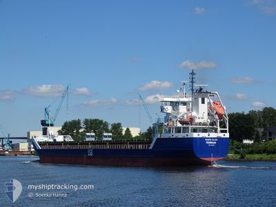
MARIA ELISE
General Cargo
Current Trip
| Time Travelled | 9 h, 50 mins |
|---|---|
| Remaining Time | 1 day |
| Distance Travelled | 101.32 nm |
| Remaining Distance | 276.44 nm |
| AVG Speed | 10.5 Noeuds |
| MAX Speed | 11.9 Noeuds |
| AVG Wind | 15.3 knots |
| MAX Wind | 17 knots |
| MIN Temp | 0.3°C / 32.54°F |
| MAX Temp | 2.7°C / 36.86°F |
| Tirant d eau | 4.3 m |
| Position reçue | 1 m depuis |
Current Position
| Longitude | 24.37369° |
|---|---|
| Latitude | 59.78788° |
| Etat | Under way using engine |
| Vitesse | 10.2 Noeuds |
| Parcours | 257.6° |
| Zone | Gulf of Finland |
| Station | T-AIS |
| Position reçue | 1 m depuis |
Info
Information
The current position of MARIA ELISE is in Gulf of Finland with coordinates 59.78788° / 24.37369° as reported on 2024-04-24 10:37 by AIS to our vessel tracker app. The vessel's current speed is 10.2 Noeuds and is heading at the port of RIGA. The estimated time of arrival as calculated by MyShipTracking vessel tracking app is 2024-04-25 13:03 LT
The vessel MARIA ELISE (IMO: 9534250, MMSI: 636091859) is a General Cargo that was built in 2009 ( 15 Age ). It's sailing under the flag of [LR] Liberia.
In this page you can find informations about the vessels current position, last detected port calls, and current voyage information. If the vessels is not in coverage by AIS you will find the latest position.
The current position of MARIA ELISE is detected by our AIS receivers and we are not responsible for the reliability of the data. The last position was recorded while the vessel was in Coverage by the Ais receivers of our vessel tracking app.
The current draught of MARIA ELISE as reported by AIS is 4.3 meters
Weather
| Temperature | 2.7°C / 36.86°F |
|---|---|
| Wind Speed | 9 knots |
| Direction | 208° SSW |
| Pressure | 1015.2 hPa |
| Humidity | 78.9 % |
| Cloud Coverage | 68 % |
Featured Company
Last Port Calls
| Port | Arrival | Departure | Time In Port |
|---|---|---|---|
| 2024-04-22 21:48 | 2024-04-24 00:48 | 1 d | |
| 2024-04-17 08:20 | 2024-04-18 12:21 | 1 d | |
| 2024-04-13 16:19 | 2024-04-15 14:06 | 1 d | |
| 2024-04-10 21:40 | 2024-04-12 01:27 | 1 d | |
| 2024-04-08 09:57 | 2024-04-09 13:08 | 1 d | |
| 2024-04-05 19:23 | 2024-04-06 23:30 | 1 d | |
| 2024-04-03 07:01 | 2024-04-04 04:49 | 21 h | |
| 2024-03-31 13:00 | 2024-04-01 19:33 | 1 d | |
| 2024-03-28 12:35 | 2024-03-29 22:46 | 1 d | |
| 2024-03-22 17:14 | 2024-03-26 17:00 | 3 d |
Last Trips
| Origin | Departure | Destination | Arrival | Distance | |
|---|---|---|---|---|---|
| 2024-04-18 15:21 | 2024-04-23 00:48 | 742.58 nm | |||
| 2024-04-15 17:06 | 2024-04-17 11:20 | 409.85 nm | |||
| 2024-04-12 04:27 | 2024-04-13 19:19 | 397.58 nm | |||
| 2024-04-09 16:08 | 2024-04-11 00:40 | 368.93 nm | |||
| 2024-04-07 02:30 | 2024-04-08 12:57 | 370.01 nm | |||
| 2024-04-04 07:49 | 2024-04-05 22:23 | 361.69 nm | |||
| 2024-04-01 22:33 | 2024-04-03 10:01 | 366.29 nm | |||
| 2024-03-30 00:46 | 2024-03-31 16:00 | 399.56 nm | |||
| 2024-03-26 18:00 | 2024-03-28 14:35 | 427.72 nm | |||
| 2024-03-16 23:01 | 2024-03-22 18:14 | 1052.90 nm |
Events
| Heure | Evenement | Détails | Position/ Destination | Info |
|---|---|---|---|---|
| 2024-04-24 09:22 | Changement de zone | Finnish part of the Gulf of Finland Estonian part of the Gulf of Finland |
59.83174 / 24.77782
Gulf of Finland
LV RIX
|
Vitesse: 9.9 kn Parcours: 257.4° |
| 2024-04-24 08:59 | Changement d'ETA | 2024/04/25 18:00 2024/04/25 19:00 |
59.84700 / 24.91182
LV RIX
|
Vitesse: 10.7 kn Parcours: 256.2° |
| 2024-04-24 08:55 | Detecté en mer | Estonian part of the Gulf of Finland |
59.84872 / 24.92643
Gulf of Finland
LV RIX
|
Vitesse: 10.8 kn Parcours: 256.6° |
| 2024-04-24 08:54 | Etat Changé | Under way using engine Default |
59.84993 / 24.93688
LV RIX
|
Vitesse: 10.8 kn Parcours: 257° |
| 2024-04-24 08:52 | Dans la zone couverte |
59.84872 / 24.92643
Gulf of Finland
LV RIX
|
Vitesse: 10.8 kn Parcours: 256.6° |
|
| 2024-04-24 04:52 | Etat Changé | Default Under way using engine |
60.10016 / 26.17886
LV RIX
|
Vitesse: 10.1 kn Parcours: 228.3° |
| 2024-04-24 04:47 | Hors de la zone couverte |
60.10970 / 26.20047
Gulf of Finland
LV RIX
|
Vitesse: 10.1 kn Parcours: 228.3° |
|
| 2024-04-24 01:06 | Tirant d'eau modifié | 4.3 6.3 |
60.45572 / 27.14406
LV RIX
|
Vitesse: 11.7 kn Parcours: 184.2° |
| 2024-04-24 01:06 | Changement de destination | LV RIX FI HMN |
60.45572 / 27.14406
LV RIX
|
Vitesse: 11.7 kn Parcours: 184.2° |
| 2024-04-24 01:06 | Changement d'ETA | 2024/04/25 19:00 2024/04/22 20:00 |
60.45572 / 27.14406
LV RIX
|
Vitesse: 11.7 kn Parcours: 184.2° |