
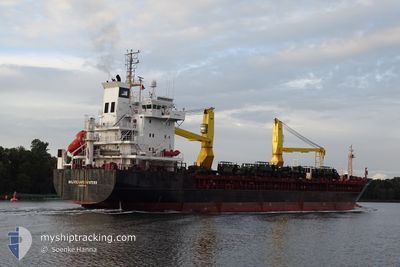
MAJ RICHARD WINTERS
General Cargo
Current Trip
| Time Travelled | 9 days |
|---|---|
| Remaining Time | 5 days |
| Distance Travelled | 2427.61 nm |
| Remaining Distance | 1641.73 nm |
| AVG Speed | 10.6 Noeuds |
| MAX Speed | 14.5 Noeuds |
| AVG Wind | 16 knots |
| MAX Wind | 29.3 knots |
| MIN Temp | 5.6°C / 42.08°F |
| MAX Temp | 13.6°C / 56.48°F |
| Tirant d eau | 5.6 m |
| Position reçue | 4 d depuis |
Current Position
| Longitude | -5.23128° |
|---|---|
| Latitude | 49.54431° |
| Etat | Under way using engine |
| Vitesse | 10.6 Noeuds |
| Parcours | 252.3° |
| Zone | English Channel |
| Station | T-AIS |
| Position reçue | 4 d depuis |
Info
Information
The current position of MAJ RICHARD WINTERS is in English Channel with coordinates 49.54431° / -5.23128° as reported on 2024-04-14 23:30 by AIS to our vessel tracker app. The vessel's current speed is 10.6 Noeuds and is heading at the port of GRANDE ANSE. The estimated time of arrival as calculated by MyShipTracking vessel tracking app is 2024-04-25 02:42 LT
The vessel MAJ RICHARD WINTERS (IMO: 9210309, MMSI: 366750000) is a General Cargo that was built in 2000 ( 24 Age ). It's sailing under the flag of [US] USA.
In this page you can find informations about the vessels current position, last detected port calls, and current voyage information. If the vessels is not in coverage by AIS you will find the latest position.
The current position of MAJ RICHARD WINTERS is detected by our AIS receivers and we are not responsible for the reliability of the data. The last position was recorded while the vessel was in Coverage by the Ais receivers of our vessel tracking app.
The current draught of MAJ RICHARD WINTERS as reported by AIS is 5.6 meters
Weather
| Temperature | 13.6°C / 56.48°F |
|---|---|
| Wind Speed | 23 knots |
| Direction | 155° SSE |
| Pressure | 1009.2 hPa |
| Humidity | 94.6 % |
| Cloud Coverage | 100 % |
Featured Company
Most Visited Ports (Last year)
| Port | Arrivals | |
|---|---|---|
| 7 | ||
| 3 | ||
| 3 | ||
| 3 | ||
| 2 | ||
| 1 |
Events
| Heure | Evenement | Détails | Position/ Destination | Info |
|---|---|---|---|---|
| 2024-04-14 23:36 | Etat Changé | Default Under way using engine |
49.53928 / -5.25610
CAGAE
|
Vitesse: 10.6 kn Parcours: 252.3° |
| 2024-04-14 23:30 | Hors de la zone couverte |
49.54431 / -5.23128
English Channel
CAGAE
|
Vitesse: 10.6 kn Parcours: 252.3° |
|
| 2024-04-14 23:30 | Etat Changé | Under way using engine Default |
49.54444 / -5.23064
CAGAE
|
Vitesse: 10.7 kn Parcours: 252° |
| 2024-04-14 23:24 | Etat Changé | Default Under way using engine |
49.54968 / -5.20516
CAGAE
|
Vitesse: 10.6 kn Parcours: 253.7° |
| 2024-04-14 23:18 | Etat Changé | Under way using engine Default |
49.55552 / -5.17646
CAGAE
|
Vitesse: 10.5 kn Parcours: 254° |
| 2024-04-14 23:04 | Etat Changé | Default Under way using engine |
49.56624 / -5.11958
CAGAE
|
Vitesse: 10.4 kn Parcours: 253.7° |
| 2024-04-14 22:59 | Etat Changé | Under way using engine Default |
49.57034 / -5.09784
CAGAE
|
Vitesse: 9.9 kn Parcours: 255° |
| 2024-04-14 22:48 | Etat Changé | Default Under way using engine |
49.57914 / -5.05104
CAGAE
|
Vitesse: 10.5 kn Parcours: 253.7° |
| 2024-04-14 22:42 | Etat Changé | Under way using engine Default |
49.58411 / -5.02425
CAGAE
|
Vitesse: 10.3 kn Parcours: 255° |
| 2024-04-14 22:20 | Etat Changé | Default Under way using engine |
49.60090 / -4.93072
CAGAE
|
Vitesse: 10.2 kn Parcours: 255.3° |