
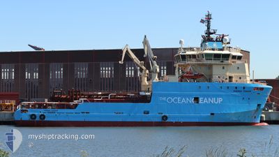
MAERSK TENDER
Anchor Handling Vessel
Current Trip
GPGP
| Time Travelled | 6 days |
|---|---|
| Remaining Time | --- |
| Distance Travelled | 1233.40 nm |
| Remaining Distance | --- |
| AVG Speed | 10.4 Noeuds |
| MAX Speed | 13.2 Noeuds |
| AVG Wind | 11.6 knots |
| MAX Wind | 21.9 knots |
| MIN Temp | 7.8°C / 46.04°F |
| MAX Temp | 15°C / 59°F |
| Tirant d eau | 7.4 m |
| Position reçue | 5 d depuis |
Current Position
| Longitude | -126.81260° |
|---|---|
| Latitude | 45.20482° |
| Etat | Under way using engine |
| Vitesse | 10.4 Noeuds |
| Parcours | 203.8° |
| Zone | North Pacific Ocean |
| Station | T-AIS |
| Position reçue | 5 d depuis |
Info
Information
The current position of MAERSK TENDER is in North Pacific Ocean with coordinates 45.20482° / -126.81260° as reported on 2024-04-20 01:53 by AIS to our vessel tracker app. The vessel's current speed is 10.4 Noeuds
The vessel MAERSK TENDER (IMO: 9388651, MMSI: 220590000) is a Anchor Handling Vessel that was built in 2009 ( 15 Age ). It's sailing under the flag of [DK] Denmark.
In this page you can find informations about the vessels current position, last detected port calls, and current voyage information. If the vessels is not in coverage by AIS you will find the latest position.
The current position of MAERSK TENDER is detected by our AIS receivers and we are not responsible for the reliability of the data. The last position was recorded while the vessel was in Coverage by the Ais receivers of our vessel tracking app.
The current draught of MAERSK TENDER as reported by AIS is 7.4 meters
Weather
| Temperature | 14.9°C / 58.82°F |
|---|---|
| Wind Speed | 11 knots |
| Direction | 13° NNE |
| Pressure | 1027.5 hPa |
| Humidity | 67.7 % |
| Cloud Coverage | 8 % |
Featured Company
Most Visited Ports (Last year)
| Port | Arrivals | |
|---|---|---|
| 6 |
Events
| Heure | Evenement | Détails | Position/ Destination | Info |
|---|---|---|---|---|
| 2024-04-24 19:50 | Arret |
31.74500 / -136.10667
GPGP
|
Vitesse: Parcours: -1° |
|
| 2024-04-24 19:25 | Démarrage |
31.75755 / -136.10558
GPGP
|
Vitesse: 3.1 kn Parcours: 187° |
|
| 2024-04-23 14:26 | Arret |
32.21333 / -136.04666
GPGP
|
Vitesse: Parcours: -1° |
|
| 2024-04-20 01:59 | Etat Changé | Default Under way using engine |
45.19047 / -126.82179
GPGP
|
Vitesse: 10.4 kn Parcours: 203.8° |
| 2024-04-20 01:53 | Hors de la zone couverte |
45.20482 / -126.81260
North Pacific Ocean
GPGP
|
Vitesse: 10.4 kn Parcours: 203.8° |
|
| 2024-04-20 01:50 | Etat Changé | Under way using engine Default |
45.21186 / -126.80807
GPGP
|
Vitesse: 10.2 kn Parcours: 204° |
| 2024-04-20 01:46 | Dans la zone couverte |
45.20747 / -126.81091
North Pacific Ocean
GPGP
|
Vitesse: 10.5 kn Parcours: 205.3° |
|
| 2024-04-19 18:54 | Etat Changé | Default Under way using engine |
46.35166 / -126.17870
GPGP
|
Vitesse: 10.9 kn Parcours: 206.2° |
| 2024-04-19 18:47 | Hors de la zone couverte |
46.37201 / -126.16404
North Pacific Ocean
GPGP
|
Vitesse: 10.9 kn Parcours: 206.2° |
|
| 2024-04-19 18:43 | Etat Changé | Under way using engine Default |
46.38238 / -126.15661
GPGP
|
Vitesse: 10.7 kn Parcours: 205° |