
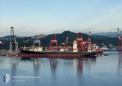
MAERSK KARUN
Container Ship
Current Trip
GI TEMA
| Time Travelled | 25 days |
|---|---|
| Remaining Time | --- |
| Distance Travelled | 7093.05 nm |
| Remaining Distance | --- |
| AVG Speed | 13.8 Noeuds |
| MAX Speed | 19.2 Noeuds |
| AVG Wind | 13.4 knots |
| MAX Wind | 39.3 knots |
| MIN Temp | 16.5°C / 61.7°F |
| MAX Temp | 29.8°C / 85.64°F |
| Tirant d eau | 13.1 m |
| Position reçue | 12 d depuis |
Current Position
| Longitude | 18.06719° |
|---|---|
| Latitude | -34.41621° |
| Etat | Under way using engine |
| Vitesse | 15.5 Noeuds |
| Parcours | 291.7° |
| Zone | South Atlantic Ocean |
| Station | T-AIS |
| Position reçue | 12 d depuis |
Info
Information
The current position of MAERSK KARUN is in South Atlantic Ocean with coordinates -34.41621° / 18.06719° as reported on 2024-04-11 12:53 by AIS to our vessel tracker app. The vessel's current speed is 15.5 Noeuds
The vessel MAERSK KARUN (IMO: 9624299, MMSI: 354060000) is a Container Ship that was built in 2014 ( 10 Age ). It's sailing under the flag of [PA] Panama.
In this page you can find informations about the vessels current position, last detected port calls, and current voyage information. If the vessels is not in coverage by AIS you will find the latest position.
The current position of MAERSK KARUN is detected by our AIS receivers and we are not responsible for the reliability of the data. The last position was recorded while the vessel was in Coverage by the Ais receivers of our vessel tracking app.
The current draught of MAERSK KARUN as reported by AIS is 13.1 meters
Weather
| Temperature | 28.6°C / 83.48°F |
|---|---|
| Wind Speed | 7 knots |
| Direction | 195° SSW |
| Pressure | 1008.4 hPa |
| Humidity | 76.3 % |
| Cloud Coverage | 100 % |
Featured Company
Last Port Calls
| Port | Arrival | Departure | Time In Port |
|---|---|---|---|
| 2024-03-29 05:09 | 2024-03-29 14:09 | 8 h | |
| 2024-03-25 23:06 | |||
| 2024-03-21 07:37 | |||
| 2024-03-08 17:16 | 2024-03-09 04:03 | 10 h | |
| 2024-02-20 13:35 | 2024-02-21 15:44 | 1 d | |
| 2024-02-14 14:07 | 2024-02-15 15:11 | 1 d |
Most Visited Ports (Last year)
| Port | Arrivals | |
|---|---|---|
| 9 | ||
| 3 | ||
| 3 | ||
| 3 | ||
| 2 | ||
| 2 |
Last Trips
| Origin | Departure | Destination | Arrival | Distance | |
|---|---|---|---|---|---|
| 2024-03-26 04:36 | 2024-03-29 10:39 | 1246.66 nm | |||
| 2024-03-09 12:03 | 2024-03-21 13:07 | 2560.86 nm | |||
| 2024-02-21 23:44 | 2024-03-09 01:16 | 4787.32 nm | |||
| 2024-02-15 23:11 | 2024-02-20 21:35 | 2175.93 nm | |||
| 2024-01-31 18:19 | 2024-02-14 22:07 | 2886.44 nm |
Events
| Heure | Evenement | Détails | Position/ Destination | Info |
|---|---|---|---|---|
| 2024-04-23 17:29 | Arret | 4.66 nm, South East of LOME |
6.06677 / 1.32001
GI TEMA
|
Vitesse: 0.2 kn Parcours: 192° |
| 2024-04-23 16:52 | Démarrage | 2.84 nm, South East of LOME |
6.11584 / 1.32939
GI TEMA
|
Vitesse: 7.8 kn Parcours: 160° |
| 2024-04-23 15:44 | Arret | 2.58 nm, South East of LOME |
6.11526 / 1.32396
GI TEMA
|
Vitesse: 0.3 kn Parcours: 231° |
| 2024-04-23 07:27 | Démarrage | 1.21 nm, South West of TEMA |
5.61440 / .00084
GI TEMA
|
Vitesse: 3.9 kn Parcours: 82° |
| 2024-04-21 00:46 | Arret | 1.51 nm, South West of TEMA |
5.61550 / -.00680
GI TEMA
|
Vitesse: 0.3 kn Parcours: 246° |
| 2024-04-20 23:04 | Démarrage | 6.35 nm, South East of TEMA |
5.55011 / .08469
GI TEMA
|
Vitesse: 3.3 kn Parcours: 152° |