
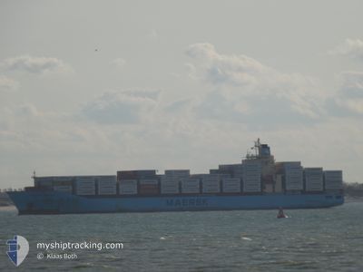
MAERSK BRATAN
Container Ship
Current Trip
| Time Travelled | 12 days |
|---|---|
| Remaining Time | 14 h, 7 mins |
| Distance Travelled | 4714.79 nm |
| Remaining Distance | 107.04 nm |
| AVG Speed | 15.6 Noeuds |
| MAX Speed | 19 Noeuds |
| AVG Wind | 15 knots |
| MAX Wind | 27.4 knots |
| MIN Temp | 6.6°C / 43.88°F |
| MAX Temp | 28.8°C / 83.84°F |
| Tirant d eau | 11.5 m |
| Position reçue | 1 m depuis |
Current Position
| Longitude | 1.80892° |
|---|---|
| Latitude | 51.13192° |
| Etat | Under way using engine |
| Vitesse | 8.2 Noeuds |
| Parcours | 62.2° |
| Zone | North Sea |
| Station | T-AIS |
| Position reçue | 1 m depuis |
Info
Information
The current position of MAERSK BRATAN is in North Sea with coordinates 51.13192° / 1.80892° as reported on 2024-04-20 07:20 by AIS to our vessel tracker app. The vessel's current speed is 8.2 Noeuds and is heading at the port of ANTWERP. The estimated time of arrival as calculated by MyShipTracking vessel tracking app is 2024-04-20 21:28 LT
The vessel MAERSK BRATAN (IMO: 9394894, MMSI: 563508000) is a Container Ship that was built in 2009 ( 15 Age ). It's sailing under the flag of [SG] Singapore.
In this page you can find informations about the vessels current position, last detected port calls, and current voyage information. If the vessels is not in coverage by AIS you will find the latest position.
The current position of MAERSK BRATAN is detected by our AIS receivers and we are not responsible for the reliability of the data. The last position was recorded while the vessel was in Coverage by the Ais receivers of our vessel tracking app.
The current draught of MAERSK BRATAN as reported by AIS is 11.5 meters
Weather
| Temperature | 7.1°C / 44.78°F |
|---|---|
| Wind Speed | 22 knots |
| Direction | 348° NNW |
| Pressure | 1025.4 hPa |
| Humidity | 66.3 % |
| Cloud Coverage | 72 % |
Featured Company
Last Port Calls
| Port | Arrival | Departure | Time In Port |
|---|---|---|---|
| 2024-04-07 02:02 | 2024-04-08 00:29 | 22 h | |
| 2024-04-05 10:45 | 2024-04-06 11:39 | 1 d | |
| 2024-03-29 00:26 | 2024-03-30 06:16 | 1 d | |
| 2024-03-21 13:42 | 2024-03-22 15:10 | 1 d | |
| 2024-03-03 09:37 | 2024-03-05 02:23 | 1 d | |
| 2024-02-29 14:30 | 2024-03-01 12:36 | 22 h | |
| 2024-02-12 22:24 | 2024-02-13 07:22 | 8 h | |
| 2024-02-10 21:26 | 2024-02-11 23:30 | 1 d | |
| 2024-02-08 14:37 | 2024-02-09 17:55 | 1 d | |
| 2024-02-01 16:03 |
Most Visited Ports (Last year)
| Port | Arrivals | |
|---|---|---|
| 13 | ||
| 12 | ||
| 7 | ||
| 6 | ||
| 6 | ||
| 6 |
Last Trips
| Origin | Departure | Destination | Arrival | Distance | |
|---|---|---|---|---|---|
| 2024-04-06 06:39 | 2024-04-06 21:02 | 42.92 nm | |||
| 2024-03-30 03:16 | 2024-04-05 05:45 | 2674.11 nm | |||
| 2024-03-22 10:10 | 2024-03-28 21:26 | 2713.55 nm | |||
| 2024-03-05 03:23 | 2024-03-21 08:42 | 5342.44 nm | |||
| 2024-03-01 13:36 | 2024-03-03 10:37 | 123.52 nm | |||
| 2024-02-13 02:22 | 2024-02-29 15:30 | 4724.50 nm | |||
| 2024-02-11 18:30 | 2024-02-12 17:24 | 362.24 nm | |||
| 2024-02-09 12:55 | 2024-02-10 16:26 | 67.17 nm | |||
| 2024-02-01 13:03 | 2024-02-08 09:37 | 2669.79 nm |
Events
| Heure | Evenement | Détails | Position/ Destination | Info |
|---|---|---|---|---|
| 2024-04-20 05:55 | Changement de zone | French part of the North Sea French part of the English Channel |
51.01427 / 1.59952
North Sea
PAMAN>>BEANT
|
Vitesse: 7.2 kn Parcours: 46.8° |
| 2024-04-20 01:37 | Etat Changé | Under way using engine Default |
50.58318 / 1.15186
PAMAN>>BEANT
|
Vitesse: 9 kn Parcours: 53° |
| 2024-04-20 01:35 | Etat Changé | Default Under way using engine |
50.58047 / 1.14609
PAMAN>>BEANT
|
Vitesse: 8.8 kn Parcours: 54.2° |
| 2024-04-20 01:29 | Changement de zone | French part of the English Channel United Kingdom part of the English Channel |
50.57111 / 1.12560
English Channel
PAMAN>>BEANT
|
Vitesse: 8.8 kn Parcours: 54.2° |
| 2024-04-20 01:29 | Etat Changé | Under way using engine Default |
50.57111 / 1.12560
PAMAN>>BEANT
|
Vitesse: 8.8 kn Parcours: 54° |
| 2024-04-20 01:24 | Dans la zone couverte |
50.57111 / 1.12560
English Channel
PAMAN>>BEANT
|
Vitesse: 8.8 kn Parcours: 54.2° |
|
| 2024-04-19 22:50 | Etat Changé | Default Under way using engine |
50.41298 / .55557
PAMAN>>BEANT
|
Vitesse: 9.1 kn Parcours: 71.3° |
| 2024-04-19 22:44 | Hors de la zone couverte |
50.40836 / .53581
English Channel
PAMAN>>BEANT
|
Vitesse: 9.1 kn Parcours: 71.3° |
|
| 2024-04-19 22:35 | Etat Changé | Under way using engine Default |
50.40120 / .50282
PAMAN>>BEANT
|
Vitesse: 9.2 kn Parcours: 76° |
| 2024-04-19 22:28 | Etat Changé | Default Under way using engine |
50.39649 / .47518
PAMAN>>BEANT
|
Vitesse: 9.2 kn Parcours: 74.5° |