
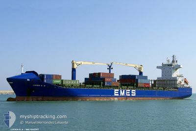
LUCIEN GA
Container Ship
Current Trip
TNRDS
| Time Travelled | 1 day |
|---|---|
| Remaining Time | --- |
| Distance Travelled | 261.25 nm |
| Remaining Distance | --- |
| AVG Speed | 8.6 Noeuds |
| MAX Speed | 9.5 Noeuds |
| AVG Wind | 25.8 knots |
| MAX Wind | 27.9 knots |
| MIN Temp | 15.8°C / 60.44°F |
| MAX Temp | 16°C / 60.8°F |
| Tirant d eau | 7.7 m |
| Position reçue | 9 d depuis |
Current Position
| Longitude | 13.16678° |
|---|---|
| Latitude | 35.82317° |
| Etat | Under way using engine |
| Vitesse | 9.3 Noeuds |
| Parcours | 346.6° |
| Zone | Mediterranean Sea - Eastern Basin |
| Station | T-AIS |
| Position reçue | 9 d depuis |
Info
Information
The current position of LUCIEN GA is in Mediterranean Sea - Eastern Basin with coordinates 35.82317° / 13.16678° as reported on 2024-04-10 03:55 by AIS to our vessel tracker app. The vessel's current speed is 9.3 Noeuds
The vessel LUCIEN GA (IMO: 9242297, MMSI: 271000677) is a Container Ship that was built in 2002 ( 22 Age ). It's sailing under the flag of [TR] Turkey.
In this page you can find informations about the vessels current position, last detected port calls, and current voyage information. If the vessels is not in coverage by AIS you will find the latest position.
The current position of LUCIEN GA is detected by our AIS receivers and we are not responsible for the reliability of the data. The last position was recorded while the vessel was in Coverage by the Ais receivers of our vessel tracking app.
The current draught of LUCIEN GA as reported by AIS is 7.7 meters
Weather
| Temperature | 15.9°C / 60.62°F |
|---|---|
| Wind Speed | 25 knots |
| Direction | 329° NNW |
| Pressure | 1016.4 hPa |
| Humidity | 64.9 % |
| Cloud Coverage | 31 % |
Featured Company
Last Port Calls
| Port | Arrival | Departure | Time In Port |
|---|---|---|---|
| 2024-04-12 08:47 | 2024-04-18 09:08 | 6 d | |
| 2024-04-07 09:07 | 2024-04-09 11:30 | 2 d | |
| 2024-04-02 22:47 | 2024-04-03 17:54 | 19 h | |
| 2024-04-01 21:08 | 2024-04-02 17:52 | 20 h | |
| 2024-03-29 07:27 | 2024-03-30 09:47 | 1 d | |
| 2024-03-20 21:59 | 2024-03-25 01:15 | 4 d | |
| 2024-03-09 16:50 | 2024-03-14 16:49 | 4 d | |
| 2024-02-28 22:15 | 2024-03-02 18:58 | 2 d | |
| 2024-02-19 15:28 | 2024-02-21 11:40 | 1 d | |
| 2024-02-16 15:36 | 2024-02-17 12:20 | 20 h |
Last Trips
| Origin | Departure | Destination | Arrival | Distance | |
|---|---|---|---|---|---|
| 2024-04-09 12:30 | 2024-04-12 09:47 | 364.94 nm | |||
| 2024-04-03 20:54 | 2024-04-07 10:07 | 1090.88 nm | |||
| 2024-04-02 20:52 | 2024-04-03 01:47 | 55.18 nm | |||
| 2024-03-30 12:47 | 2024-04-02 00:08 | 274.88 nm | |||
| 2024-03-25 02:15 | 2024-03-29 10:27 | 1071.63 nm | |||
| 2024-03-14 17:49 | 2024-03-20 22:59 | 210.77 nm | |||
| 2024-03-02 19:58 | 2024-03-09 17:50 | 322.56 nm | |||
| 2024-02-21 14:40 | 2024-02-28 23:15 | 1175.69 nm | |||
| 2024-02-17 15:20 | 2024-02-19 18:28 | 62.86 nm | |||
| 2024-02-14 06:00 | 2024-02-16 18:36 | 329.19 nm |
Events
| Heure | Evenement | Détails | Position/ Destination | Info |
|---|---|---|---|---|
| 2024-04-18 09:08 | PORT DE DEPART |
|
37.12530 / 10.68587
TNRDS
|
Vitesse: Parcours: 256° |
| 2024-04-12 08:47 | Port d'arrivée |
|
36.80357 / 10.27074
[TN] RADES
|
Vitesse: Parcours: -1° |
| 2024-04-12 05:19 | Arret | 4.9 nm, East of RADES |
36.79167 / 10.40333
TNRDS
|
Vitesse: Parcours: -1° |
| 2024-04-12 04:19 | Démarrage | 4.61 nm, South East of SIDI BOU SAID |
36.82667 / 10.43333
TNRDS
|
Vitesse: 5 kn Parcours: 195° |
| 2024-04-10 23:41 | Arret | 4.3 nm, South East of SIDI BOU SAID |
36.83500 / 10.43167
TNRDS
|
Vitesse: Parcours: -1° |
| 2024-04-10 04:00 | Etat Changé | Default Under way using engine |
35.83500 / 13.16167
TNRDS
|
Vitesse: 9.3 kn Parcours: 346.6° |
| 2024-04-10 03:55 | Etat Changé | Under way using engine Default |
35.82317 / 13.16678
TNRDS
|
Vitesse: 9 kn Parcours: 348° |
| 2024-04-10 03:55 | Hors de la zone couverte |
35.82317 / 13.16678
Mediterranean Sea - Eastern Basin
TNRDS
|
Vitesse: 9.3 kn Parcours: 346.6° |
|
| 2024-04-10 03:36 | Etat Changé | Default Under way using engine |
35.77167 / 13.17167
TNRDS
|
Vitesse: 9.3 kn Parcours: 1.5° |
| 2024-04-10 03:33 | Etat Changé | Under way using engine Default |
35.76614 / 13.17303
TNRDS
|
Vitesse: 9 kn Parcours: 0° |