
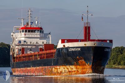
LONGVIK
General Cargo
Current Trip
| Time Travelled | 3 days |
|---|---|
| Remaining Time | 23 h, 40 mins |
| Distance Travelled | 682.20 nm |
| Remaining Distance | 246.15 nm |
| AVG Speed | 9.7 Noeuds |
| MAX Speed | 11 Noeuds |
| AVG Wind | 12.6 knots |
| MAX Wind | 23 knots |
| MIN Temp | 0.5°C / 32.9°F |
| MAX Temp | 7.7°C / 45.86°F |
| Tirant d eau | 4.4 m |
| Position reçue | 3 d depuis |
Current Position
| Longitude | 16.55403° |
|---|---|
| Latitude | 55.98242° |
| Etat | Under way using engine |
| Vitesse | 8.8 Noeuds |
| Parcours | 62° |
| Zone | Baltic Sea |
| Station | T-AIS |
| Position reçue | 3 d depuis |
Info
Information
The current position of LONGVIK is in Baltic Sea with coordinates 55.98242° / 16.55403° as reported on 2024-04-22 09:52 by AIS to our vessel tracker app. The vessel's current speed is 8.8 Noeuds and is heading at the port of RIGA. The estimated time of arrival as calculated by MyShipTracking vessel tracking app is 2024-04-26 10:57 LT
The vessel LONGVIK (IMO: 9548299, MMSI: 246669000) is a General Cargo that was built in 2011 ( 13 Age ). It's sailing under the flag of [NL] Netherlands.
In this page you can find informations about the vessels current position, last detected port calls, and current voyage information. If the vessels is not in coverage by AIS you will find the latest position.
The current position of LONGVIK is detected by our AIS receivers and we are not responsible for the reliability of the data. The last position was recorded while the vessel was in Coverage by the Ais receivers of our vessel tracking app.
The current draught of LONGVIK as reported by AIS is 4.4 meters
Weather
| Temperature | 2.9°C / 37.22°F |
|---|---|
| Wind Speed | 10 knots |
| Direction | 350° N |
| Pressure | 1006.1 hPa |
| Humidity | 85.8 % |
| Cloud Coverage | 69 % |
Featured Company
Last Port Calls
| Port | Arrival | Departure | Time In Port |
|---|---|---|---|
| 2024-04-20 21:58 | 2024-04-21 16:52 | 18 h | |
| 2024-04-18 09:52 | 2024-04-18 23:44 | 13 h | |
| 2024-04-14 20:31 | 2024-04-16 12:09 | 1 d | |
| 2024-04-10 20:39 | 2024-04-12 12:09 | 1 d | |
| 2024-04-09 02:29 | 2024-04-10 10:13 | 1 d | |
| 2024-04-05 20:17 | 2024-04-06 23:13 | 1 d | |
| 2024-04-02 06:50 | 2024-04-03 13:48 | 1 d | |
| 2024-03-29 13:07 | 2024-03-30 17:37 | 1 d | |
| 2024-03-24 17:13 | 2024-03-26 15:34 | 1 d | |
| 2024-03-20 22:07 | 2024-03-21 16:05 | 17 h |
Last Trips
| Origin | Departure | Destination | Arrival | Distance | |
|---|---|---|---|---|---|
| 2024-04-19 02:44 | 2024-04-20 23:58 | 465.50 nm | |||
| 2024-04-16 14:09 | 2024-04-18 12:52 | 469.05 nm | |||
| 2024-04-12 14:09 | 2024-04-14 22:31 | 101.98 nm | |||
| 2024-04-10 12:13 | 2024-04-10 22:39 | 99.24 nm | |||
| 2024-04-07 02:13 | 2024-04-09 04:29 | 467.89 nm | |||
| 2024-04-03 15:48 | 2024-04-05 23:17 | 558.94 nm | |||
| 2024-03-30 19:37 | 2024-04-02 08:50 | 600.15 nm | |||
| 2024-03-26 16:34 | 2024-03-29 15:07 | 654.48 nm | |||
| 2024-03-21 18:05 | 2024-03-24 18:13 | 649.21 nm | |||
| 2024-03-18 18:03 | 2024-03-21 00:07 | 511.84 nm |
Events
| Heure | Evenement | Détails | Position/ Destination | Info |
|---|---|---|---|---|
| 2024-04-24 11:52 | Démarrage | 6.76 nm, North of RIGA |
57.05460 / 24.02950
RIGA
|
Vitesse: 4.2 kn Parcours: 7° |
| 2024-04-23 16:48 | Arret | 6.54 nm, North of RIGA |
57.05007 / 24.02618
RIGA
|
Vitesse: 0.1 kn Parcours: 255° |
| 2024-04-22 10:00 | Etat Changé | Default Under way using engine |
55.99166 / 16.58463
RIGA
|
Vitesse: 8.8 kn Parcours: 62° |
| 2024-04-22 09:52 | Hors de la zone couverte |
55.98242 / 16.55403
Baltic Sea
RIGA
|
Vitesse: 8.8 kn Parcours: 62° |
|
| 2024-04-22 05:11 | Detecté en mer | Swedish part of the Baltic Sea |
55.61515 / 15.40138
Baltic Sea
RIGA
|
Vitesse: 9.8 kn Parcours: 60° |
| 2024-04-22 00:29 | Detecté en mer | Danish part of the Kattegat |
55.17975 / 14.29107
Kattegat
RIGA
|
Vitesse: 9.8 kn Parcours: 82° |
| 2024-04-21 18:46 | Changement de zone | Swedish part of the Baltic Sea Danish part of the Baltic Sea |
55.29908 / 12.64918
Baltic Sea
RIGA
|
Vitesse: 10.5 kn Parcours: 128° |
| 2024-04-21 18:37 | Changement de zone | Danish part of the Baltic Sea Danish part of the Kattegat |
55.31698 / 12.61512
Baltic Sea
RIGA
|
Vitesse: 10.5 kn Parcours: 132° |
| 2024-04-21 17:07 | Changement de destination | RIGA AVEDOERE PEC-577 |
55.55590 / 12.49490
RIGA
|
Vitesse: 10.4 kn Parcours: 167° |
| 2024-04-21 16:52 | PORT DE DEPART |
|
55.59617 / 12.48587
AVEDOERE PEC-577
|
Vitesse: 6.9 kn Parcours: 175° |