
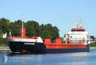
LONGVANN
General Cargo
Current Trip
| Time Travelled | 2 days |
|---|---|
| Remaining Time | --- |
| Distance Travelled | 461.87 nm |
| Remaining Distance | --- |
| AVG Speed | 9.3 Noeuds |
| MAX Speed | 17.7 Noeuds |
| AVG Wind | 12.4 knots |
| MAX Wind | 19.8 knots |
| MIN Temp | 4.7°C / 40.46°F |
| MAX Temp | 10.4°C / 50.72°F |
| Tirant d eau | 4 m |
| Position reçue | 1 m depuis |
Current Position
| Longitude | -2.05012° |
|---|---|
| Latitude | 57.13577° |
| Etat | Under way using engine |
| Vitesse | |
| Parcours | --- |
| Zone | North Sea |
| Station | T-AIS |
| Position reçue | 1 m depuis |
Info
Information
The current position of LONGVANN is in North Sea with coordinates 57.13577° / -2.05012° as reported on 2024-04-24 03:26 by AIS to our vessel tracker app. The vessel's current speed is 0 Noeuds
The vessel LONGVANN (IMO: 9548304, MMSI: 246670000) is a General Cargo that was built in 2011 ( 13 Age ). It's sailing under the flag of [NL] Netherlands.
In this page you can find informations about the vessels current position, last detected port calls, and current voyage information. If the vessels is not in coverage by AIS you will find the latest position.
The current position of LONGVANN is detected by our AIS receivers and we are not responsible for the reliability of the data. The last position was recorded while the vessel was in Coverage by the Ais receivers of our vessel tracking app.
The current draught of LONGVANN as reported by AIS is 4 meters
Weather
| Temperature | 5.6°C / 42.08°F |
|---|---|
| Wind Speed | 15 knots |
| Direction | 341° NNW |
| Pressure | 1021.2 hPa |
| Humidity | 64.9 % |
| Cloud Coverage | 75 % |
Featured Company
Last Port Calls
| Port | Arrival | Departure | Time In Port |
|---|---|---|---|
| 2024-04-19 16:37 | 2024-04-21 12:02 | 1 d | |
| 2024-04-13 11:59 | 2024-04-14 00:21 | 12 h | |
| 2024-04-02 16:51 | 2024-04-03 18:08 | 1 d | |
| 2024-03-27 09:08 | 2024-03-30 04:18 | 2 d | |
| 2024-03-22 06:56 | 2024-03-23 09:17 | 1 d | |
| 2024-03-19 23:43 | 2024-03-20 18:21 | 18 h | |
| 2024-03-12 21:18 | 2024-03-13 16:50 | 19 h | |
| 2024-03-10 06:12 | 2024-03-11 04:34 | 22 h | |
| 2024-03-06 15:30 | 2024-03-08 08:02 | 1 d | |
| 2024-03-03 12:45 | 2024-03-04 04:25 | 15 h |
Most Visited Ports (Last year)
| Port | Arrivals | |
|---|---|---|
| 14 | ||
| 8 | ||
| 6 | ||
| 5 | ||
| 4 | ||
| 3 |
Last Trips
| Origin | Departure | Destination | Arrival | Distance | |
|---|---|---|---|---|---|
| 2024-04-14 03:21 | 2024-04-19 17:37 | 1416.47 nm | |||
| 2024-04-03 20:08 | 2024-04-13 14:59 | 1880.53 nm | |||
| 2024-03-30 05:18 | 2024-04-02 18:51 | 794.28 nm | |||
| 2024-03-23 10:17 | 2024-03-27 10:08 | 749.68 nm | |||
| 2024-03-20 19:21 | 2024-03-22 07:56 | 398.94 nm | |||
| 2024-03-13 17:50 | 2024-03-20 00:43 | 1162.96 nm | |||
| 2024-03-11 06:34 | 2024-03-12 22:18 | 427.66 nm | |||
| 2024-03-08 09:02 | 2024-03-10 08:12 | 452.66 nm | |||
| 2024-03-04 06:25 | 2024-03-06 16:30 | 555.10 nm | |||
| 2024-03-01 15:05 | 2024-03-03 14:45 | 543.16 nm |
Events
| Heure | Evenement | Détails | Position/ Destination | Info |
|---|---|---|---|---|
| 2024-04-23 07:07 | Arret | 0.88 nm, South East of ABERDEEN |
57.13547 / -2.05197
ABERDEEN
|
Vitesse: 0.3 kn Parcours: 511° |
| 2024-04-22 23:17 | Etat Changé | Under way using engine Default |
57.94368 / -2.05337
ABERDEEN
|
Vitesse: 7.8 kn Parcours: 151° |
| 2024-04-22 22:58 | Dans la zone couverte |
57.94368 / -2.05337
North Sea
ABERDEEN
|
Vitesse: 7.7 kn Parcours: 147° |
|
| 2024-04-22 19:07 | Etat Changé | Default Under way using engine |
58.53555 / -2.82252
ABERDEEN
|
Vitesse: 12.9 kn Parcours: 141° |
| 2024-04-22 19:01 | Hors de la zone couverte |
58.55165 / -2.84663
North Sea
ABERDEEN
|
Vitesse: 12.9 kn Parcours: 141° |
|
| 2024-04-22 17:29 | Changement de zone | United Kingdom part of the North Sea United Kingdom part of the North Atlantic Ocean |
58.70227 / -3.40745
North Sea
ABERDEEN
|
Vitesse: 11.6 kn Parcours: 84° |
| 2024-04-22 14:38 | Detecté en mer | United Kingdom part of the North Atlantic Ocean |
58.66598 / -4.41685
North Atlantic Ocean
ABERDEEN
|
Vitesse: 10.6 kn Parcours: 85° |
| 2024-04-22 14:35 | Etat Changé | Under way using engine Default |
58.66533 / -4.43277
ABERDEEN
|
Vitesse: 10.6 kn Parcours: 84° |
| 2024-04-22 14:34 | Dans la zone couverte |
58.66598 / -4.41685
North Atlantic Ocean
ABERDEEN
|
Vitesse: 10.6 kn Parcours: 85° |
|
| 2024-04-22 09:05 | Hors de la zone couverte |
58.09873 / -5.72503
Inner Seas off the West Coast of Scotland
ABERDEEN
|
Vitesse: 11.6 kn Parcours: 35° |