
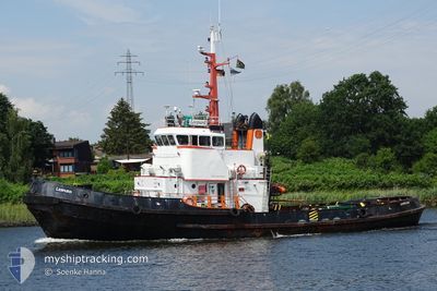
LEOPARD
Tug
Current Trip
| Time Travelled | 2 days |
|---|---|
| Remaining Time | 11 h, 50 mins |
| Distance Travelled | 288.73 nm |
| Remaining Distance | 76.01 nm |
| AVG Speed | 5.8 Noeuds |
| MAX Speed | 9.6 Noeuds |
| AVG Wind | 10.8 knots |
| MAX Wind | 16.9 knots |
| MIN Temp | 0.4°C / 32.72°F |
| MAX Temp | 7.6°C / 45.68°F |
| Tirant d eau | 4.5 m |
| Position reçue | 1 m depuis |
Current Position
| Longitude | 12.08014° |
|---|---|
| Latitude | 54.44364° |
| Etat | Restricted manoeuverability |
| Vitesse | 6 Noeuds |
| Parcours | 271.9° |
| Zone | Baltic Sea |
| Station | T-AIS |
| Position reçue | 1 m depuis |
Info
Information
The current position of LEOPARD is in Baltic Sea with coordinates 54.44364° / 12.08014° as reported on 2024-04-25 14:04 by AIS to our vessel tracker app. The vessel's current speed is 6 Noeuds and is heading at the port of KIEL. The estimated time of arrival as calculated by MyShipTracking vessel tracking app is 2024-04-26 01:55 LT
The vessel LEOPARD (IMO: 6819697, MMSI: 576909000) is a Tug that was built in 1969 ( 55 Age ). It's sailing under the flag of [VU] Vanuatu.
In this page you can find informations about the vessels current position, last detected port calls, and current voyage information. If the vessels is not in coverage by AIS you will find the latest position.
The current position of LEOPARD is detected by our AIS receivers and we are not responsible for the reliability of the data. The last position was recorded while the vessel was in Coverage by the Ais receivers of our vessel tracking app.
The current draught of LEOPARD as reported by AIS is 4.5 meters
Weather
| Temperature | 7.5°C / 45.5°F |
|---|---|
| Wind Speed | 15 knots |
| Direction | 104° ESE |
| Pressure | 1002.9 hPa |
| Humidity | 74.5 % |
| Cloud Coverage | 93 % |
Featured Company
Last Port Calls
| Port | Arrival | Departure | Time In Port |
|---|---|---|---|
| 2024-04-18 04:56 | 2024-04-23 12:29 | 5 d | |
| 2024-04-17 05:34 | 2024-04-17 10:44 | 5 h | |
| 2024-03-25 09:17 | 2024-04-11 07:52 | 16 d | |
| 2024-03-21 09:43 | 2024-03-23 10:41 | 2 d | |
| 2024-03-09 11:12 | 2024-03-18 05:02 | 8 d | |
| 2024-03-08 19:34 | 2024-03-08 20:48 | 1 h | |
| 2024-03-07 05:58 | 2024-03-07 15:07 | 9 h | |
| 2024-03-03 19:11 | 2024-03-05 07:27 | 1 d | |
| 2024-03-01 11:15 | 2024-03-02 14:31 | 1 d | |
| 2024-02-29 14:51 | 2024-02-29 17:07 | 2 h |
Most Visited Ports (Last year)
| Port | Arrivals | |
|---|---|---|
| 14 | ||
| 7 | ||
| 4 | ||
| 4 | ||
| 3 | ||
| 3 |
Last Trips
| Origin | Departure | Destination | Arrival | Distance | |
|---|---|---|---|---|---|
| 2024-04-17 13:44 | 2024-04-18 06:56 | 117.58 nm | |||
| 2024-04-11 09:52 | 2024-04-17 08:34 | 138.53 nm | |||
| 2024-03-23 11:41 | 2024-03-25 10:17 | 288.47 nm | |||
| 2024-03-18 06:02 | 2024-03-21 10:43 | 261.96 nm | |||
| 2024-03-08 21:48 | 2024-03-09 12:12 | 120.29 nm | |||
| 2024-03-07 16:07 | 2024-03-08 20:34 | 228.36 nm | |||
| 2024-03-05 08:27 | 2024-03-07 06:58 | 227.93 nm | |||
| 2024-03-02 15:31 | 2024-03-03 20:11 | 141.83 nm | |||
| 2024-02-29 18:07 | 2024-03-01 12:15 | 133.27 nm | |||
| 2024-02-26 10:24 | 2024-02-29 15:51 | 401.88 nm |
Events
| Heure | Evenement | Détails | Position/ Destination | Info |
|---|---|---|---|---|
| 2024-04-25 06:56 | Changement de zone | Danish part of the Baltic Sea German part of the Baltic Sea |
54.84931 / 12.94773
Baltic Sea
DE KEL
|
Vitesse: 5.8 kn Parcours: 250.5° |
| 2024-04-25 05:19 | Etat Changé | Restricted manoeuverability Default |
54.89326 / 13.19317
DE KEL
|
Vitesse: 5.3 kn Parcours: 252° |
| 2024-04-25 05:17 | Etat Changé | Default Restricted manoeuverability |
54.89408 / 13.19775
DE KEL
|
Vitesse: 5.4 kn Parcours: 253.7° |
| 2024-04-25 05:11 | Etat Changé | Restricted manoeuverability Default |
54.89643 / 13.21243
DE KEL
|
Vitesse: 5.4 kn Parcours: 254° |
| 2024-04-25 05:08 | Etat Changé | Default Restricted manoeuverability |
54.89750 / 13.21916
DE KEL
|
Vitesse: 5.4 kn Parcours: 256.7° |
| 2024-04-25 04:47 | Etat Changé | Restricted manoeuverability Default |
54.90546 / 13.27491
DE KEL
|
Vitesse: 5.5 kn Parcours: 257° |
| 2024-04-25 04:40 | Dans la zone couverte |
54.90546 / 13.27491
Baltic Sea
DE KEL
|
Vitesse: 5.5 kn Parcours: 260.7° |
|
| 2024-04-25 03:24 | Etat Changé | Default Restricted manoeuverability |
54.90649 / 13.50167
DE KEL
|
Vitesse: 5.9 kn Parcours: 265.4° |
| 2024-04-25 03:19 | Hors de la zone couverte |
54.90699 / 13.51591
Baltic Sea
DE KEL
|
Vitesse: 5.9 kn Parcours: 265.4° |
|
| 2024-04-25 00:17 | Changement de zone | German part of the Baltic Sea Danish part of the Kattegat |
54.91782 / 14.04226
Baltic Sea
DE KEL
|
Vitesse: 5.6 kn Parcours: 263.9° |