
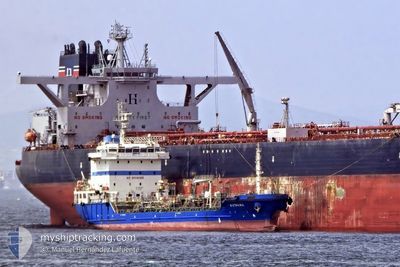
KYTHIRA
Tanker
Current Trip
EG PSD
| Time Travelled | --- |
|---|---|
| Remaining Time | --- |
| Distance Travelled | 1240.05 nm |
| Remaining Distance | --- |
| AVG Speed | 9.5 Noeuds |
| MAX Speed | 9.5 Noeuds |
| AVG Wind | 10.5 knots |
| MAX Wind | 23 knots |
| MIN Temp | 14.7°C / 58.46°F |
| MAX Temp | 27.4°C / 81.32°F |
| Tirant d eau | 6.6 m |
| Position reçue | 2 h, 12 m depuis |
Current Position
| Longitude | 32.35530° |
|---|---|
| Latitude | 31.21391° |
| Etat | Under way using engine |
| Vitesse | 1.2 Noeuds |
| Parcours | 222° |
| Zone | Mediterranean Sea - Eastern Basin |
| Station | T-AIS |
| Position reçue | 2 h, 12 m depuis |
Info
Information
The current position of KYTHIRA is in Mediterranean Sea - Eastern Basin with coordinates 31.21391° / 32.35530° as reported on 2024-04-24 16:12 by AIS to our vessel tracker app. The vessel's current speed is 1.2 Noeuds
The vessel KYTHIRA (IMO: 9417543, MMSI: 248338000) is a Tanker It's sailing under the flag of [MT] Malta.
In this page you can find informations about the vessels current position, last detected port calls, and current voyage information. If the vessels is not in coverage by AIS you will find the latest position.
The current position of KYTHIRA is detected by our AIS receivers and we are not responsible for the reliability of the data. The last position was recorded while the vessel was in Coverage by the Ais receivers of our vessel tracking app.
The current draught of KYTHIRA as reported by AIS is 6.6 meters
Weather
| Temperature | 24.6°C / 76.28°F |
|---|---|
| Wind Speed | 15 knots |
| Direction | 87° E |
| Pressure | 1005.8 hPa |
| Humidity | 59 % |
| Cloud Coverage | 99 % |
Featured Company
Last Port Calls
| Port | Arrival | Departure | Time In Port |
|---|---|---|---|
| 2024-04-24 06:44 | 2024-04-24 16:27 | 9 h | |
| 2024-04-22 06:08 | |||
| 2024-04-16 09:33 | 2024-04-16 21:11 | 11 h | |
| 2024-03-02 19:10 | 2024-03-03 20:05 | 1 d | |
| 2024-02-13 11:18 | 2024-02-14 10:11 | 22 h |
Most Visited Ports (Last year)
| Port | Arrivals | |
|---|---|---|
| 8 | ||
| 4 | ||
| 3 | ||
| 2 | ||
| 2 | ||
| 2 |
Last Trips
| Origin | Departure | Destination | Arrival | Distance | |
|---|---|---|---|---|---|
| 2024-02-14 13:11 | 2024-04-24 08:44 | 1225.92 nm | |||
| 2024-02-14 13:11 | 2024-04-22 08:08 | 1175.57 nm | |||
| 2024-02-14 13:11 | 2024-04-16 11:33 | 1007.35 nm | |||
| 2024-02-14 13:11 | 2024-03-02 21:10 | 469.15 nm | |||
| 2024-01-25 13:26 | 2024-02-13 14:18 | 1417.28 nm |
Events
| Heure | Evenement | Détails | Position/ Destination | Info |
|---|---|---|---|---|
| 2024-04-24 16:27 | PORT DE DEPART |
|
31.23200 / 32.35860
EG PSD
|
Vitesse: 7 kn Parcours: 14° |
| 2024-04-24 16:20 | Démarrage |
31.21726 / 32.35416
[EG] SUEZ CANAL
|
Vitesse: 5.7 kn Parcours: 15° |
|
| 2024-04-24 16:16 | Etat Changé | Default Under way using engine |
31.21346 / 32.35434
[EG] SUEZ CANAL
|
Vitesse: 1.2 kn Parcours: 222° |
| 2024-04-24 16:12 | Etat Changé | Under way using engine Default |
31.21391 / 32.35530
[EG] SUEZ CANAL
|
Vitesse: Parcours: 194° |
| 2024-04-24 16:12 | Dans la zone couverte |
31.21391 / 32.35530
Mediterranean Sea - Eastern Basin
[EG] SUEZ CANAL
|
Vitesse: 1.2 kn Parcours: 204.5° |
|
| 2024-04-24 16:12 | Hors de la zone couverte |
31.21391 / 32.35530
Mediterranean Sea - Eastern Basin
|
Vitesse: 1.2 kn Parcours: 204.5° |
|
| 2024-04-24 07:04 | Arret |
31.21537 / 32.35616
[EG] SUEZ CANAL
|
Vitesse: Parcours: 192° |
|
| 2024-04-24 06:44 | Port d'arrivée |
|
31.22216 / 32.35634
[EG] SUEZ CANAL
|
Vitesse: 7 kn Parcours: 192° |
| 2024-04-24 05:12 | Démarrage | 10.96 nm, North East of PORT SAID |
31.39858 / 32.43446
EG PSD
|
Vitesse: 6.7 kn Parcours: 245° |
| 2024-04-23 22:11 | Hors de la zone couverte |
31.39402 / 32.42945
Mediterranean Sea - Eastern Basin
|
Vitesse: 5.8 kn Parcours: 66.5° |