
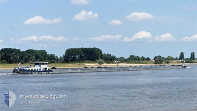
KVB GRACE II
Cargo
Current Trip
| Time Travelled | 2 days |
|---|---|
| Remaining Time | 7 h, 57 mins |
| Distance Travelled | 94.42 nm |
| Remaining Distance | 66.38 nm |
| AVG Speed | 6.6 Noeuds |
| MAX Speed | 13 Noeuds |
| AVG Wind | 5.8 knots |
| MAX Wind | 15 knots |
| MIN Temp | 0.3°C / 32.54°F |
| MAX Temp | 10°C / 50°F |
| Tirant d eau | 2.8 m |
| Position reçue | 7 m depuis |
Current Position
| Longitude | 4.31521° |
|---|---|
| Latitude | 51.31755° |
| Etat | Under way using engine |
| Vitesse | 8.8 Noeuds |
| Parcours | 335.4° |
| Zone | North Sea |
| Station | T-AIS |
| Position reçue | 7 m depuis |
Info
Information
The current position of KVB GRACE II is in North Sea with coordinates 51.31755° / 4.31521° as reported on 2024-04-23 08:54 by AIS to our vessel tracker app. The vessel's current speed is 8.8 Noeuds and is heading at the port of MAASVLAKTE - ROTTERDAM. The estimated time of arrival as calculated by MyShipTracking vessel tracking app is 2024-04-23 16:58 LT
The vessel KVB GRACE II (MMSI: 244002001) is a Cargo It's sailing under the flag of [NL] Netherlands.
In this page you can find informations about the vessels current position, last detected port calls, and current voyage information. If the vessels is not in coverage by AIS you will find the latest position.
The current position of KVB GRACE II is detected by our AIS receivers and we are not responsible for the reliability of the data. The last position was recorded while the vessel was in Coverage by the Ais receivers of our vessel tracking app.
The current draught of KVB GRACE II as reported by AIS is 2.8 meters
Weather
| Temperature | 6.4°C / 43.52°F |
|---|---|
| Wind Speed | 4 knots |
| Direction | 17° NNE |
| Pressure | 1022.4 hPa |
| Humidity | 55 % |
| Cloud Coverage | 72 % |
Featured Company
Last Port Calls
| Port | Arrival | Departure | Time In Port |
|---|---|---|---|
| 2024-04-20 12:16 | 2024-04-20 12:41 | 24 m | |
| 2024-04-16 09:32 | 2024-04-19 08:42 | 2 d | |
| 2024-04-12 08:44 | 2024-04-12 09:21 | 36 m | |
| 2024-04-10 14:36 | 2024-04-11 04:59 | 14 h | |
| 2024-04-05 10:09 | 2024-04-05 12:24 | 2 h | |
| 2024-03-28 20:10 | 2024-03-29 06:38 | 10 h | |
| 2024-03-28 12:20 | 2024-03-28 14:13 | 1 h | |
| 2024-03-27 17:48 | 2024-03-28 08:08 | 14 h | |
| 2024-03-26 16:37 | 2024-03-26 17:20 | 43 m | |
| 2024-03-23 11:17 | 2024-03-23 13:22 | 2 h |
Most Visited Ports (Last year)
| Port | Arrivals | |
|---|---|---|
| 30 | ||
| 27 | ||
| 14 | ||
| 11 | ||
| 11 | ||
| 8 |
Last Trips
| Origin | Departure | Destination | Arrival | Distance | |
|---|---|---|---|---|---|
| 2024-04-19 10:42 | 2024-04-20 14:16 | 124.11 nm | |||
| 2024-04-12 11:21 | 2024-04-16 11:32 | 42.14 nm | |||
| 2024-04-11 06:59 | 2024-04-12 10:44 | 60.99 nm | |||
| 2024-04-05 14:24 | 2024-04-10 16:36 | 152.21 nm | |||
| 2024-03-29 07:38 | 2024-04-05 12:09 | 108.30 nm | |||
| 2024-03-28 15:13 | 2024-03-28 21:10 | 33.54 nm | |||
| 2024-03-28 09:08 | 2024-03-28 13:20 | 26.50 nm | |||
| 2024-03-26 18:20 | 2024-03-27 18:48 | 121.66 nm | |||
| 2024-03-23 14:22 | 2024-03-26 17:37 | 32.17 nm | |||
| 2024-03-22 08:26 | 2024-03-23 12:17 | 64.62 nm |
Events
| Heure | Evenement | Détails | Position/ Destination | Info |
|---|---|---|---|---|
| 2024-04-23 07:01 | Démarrage | 0.95 nm, South East of WIJNEGEM |
51.22744 / 4.53437
HARTELHAVEN
|
Vitesse: 4.2 kn Parcours: 300° |
| 2024-04-23 06:41 | Arret | 1.07 nm, South East of WIJNEGEM |
51.22659 / 4.53726
HARTELHAVEN
|
Vitesse: Parcours: 297° |
| 2024-04-23 06:30 | Changement de destination | HARTELHAVEN ALBERTKANAAL |
51.22269 / 4.55156
HARTELHAVEN
|
Vitesse: 5.3 kn Parcours: 289.3° |
| 2024-04-23 06:30 | Changement d'ETA | 2024/04/23 18:45 2024/04/22 05:05 |
51.22269 / 4.55156
HARTELHAVEN
|
Vitesse: 5.3 kn Parcours: 289.3° |
| 2024-04-23 05:48 | Etat Changé | Under way using engine Default |
51.19084 / 4.66733
ALBERTKANAAL
|
Vitesse: 8.1 kn Parcours: 288° |
| 2024-04-23 05:11 | Etat Changé | Default Under way using engine |
51.17667 / 4.78167
ALBERTKANAAL
|
Vitesse: 7.7 kn Parcours: 286.6° |
| 2024-04-23 05:05 | Etat Changé | Under way using engine Default |
51.17399 / 4.80339
ALBERTKANAAL
|
Vitesse: 6 kn Parcours: 297° |
| 2024-04-23 05:05 | Dans la zone couverte |
51.17409 / 4.80291
North Sea
|
Vitesse: 7.7 kn Parcours: 286.6° |
|
| 2024-04-23 04:44 | Démarrage | 0.76 nm, West of OLEN |
51.16000 / 4.85333
ALBERTKANAAL
|
Vitesse: 6 kn Parcours: 297° |
| 2024-04-23 04:26 | Arret | 0.43 nm, North West of OLEN |
51.15833 / 4.86167
ALBERTKANAAL
|
Vitesse: Parcours: -1° |