
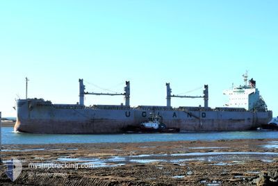
KRISTINITA
Bulk Carrier
Current Trip
NL AMS
| Time Travelled | 1 day |
|---|---|
| Remaining Time | --- |
| Distance Travelled | 69.38 nm |
| Remaining Distance | --- |
| AVG Speed | 7.8 Noeuds |
| MAX Speed | 13.6 Noeuds |
| AVG Wind | 23.2 knots |
| MAX Wind | 29 knots |
| MIN Temp | 2.9°C / 37.22°F |
| MAX Temp | 10.1°C / 50.18°F |
| Tirant d eau | 6.4 m |
| Position reçue | 1 m depuis |
Current Position
| Longitude | 2.70333° |
|---|---|
| Latitude | 51.54092° |
| Etat | Under way using engine |
| Vitesse | 5.3 Noeuds |
| Parcours | 8.6° |
| Zone | North Sea |
| Station | T-AIS |
| Position reçue | 1 m depuis |
Info
Information
The current position of KRISTINITA is in North Sea with coordinates 51.54092° / 2.70333° as reported on 2024-04-19 21:17 by AIS to our vessel tracker app. The vessel's current speed is 5.3 Noeuds
The vessel KRISTINITA (IMO: 9520936, MMSI: 259951000) is a Bulk Carrier that was built in 2011 ( 13 Age ). It's sailing under the flag of [NO] Norway.
In this page you can find informations about the vessels current position, last detected port calls, and current voyage information. If the vessels is not in coverage by AIS you will find the latest position.
The current position of KRISTINITA is detected by our AIS receivers and we are not responsible for the reliability of the data. The last position was recorded while the vessel was in Coverage by the Ais receivers of our vessel tracking app.
The current draught of KRISTINITA as reported by AIS is 6.4 meters
Weather
| Temperature | 7.7°C / 45.86°F |
|---|---|
| Wind Speed | 26 knots |
| Direction | 349° N |
| Pressure | 1019.7 hPa |
| Humidity | 66.7 % |
| Cloud Coverage | 93 % |
Featured Company
Most Visited Ports (Last year)
| Port | Arrivals | |
|---|---|---|
| 1 | ||
| 1 | ||
| 1 | ||
| 1 | ||
| 1 | ||
| 1 |
Events
| Heure | Evenement | Détails | Position/ Destination | Info |
|---|---|---|---|---|
| 2024-04-19 21:11 | Changement de destination | NL AMS WESTHINDER ANCH |
51.53295 / 2.70144
NL AMS
|
Vitesse: 5.1 kn Parcours: 7.3° |
| 2024-04-19 21:03 | Démarrage | 20.22 nm, North West of OOSTENDE |
51.52539 / 2.69832
WESTHINDER ANCH
|
Vitesse: 3.1 kn Parcours: 7° |
| 2024-04-19 18:53 | Arret | 18.48 nm, North West of OOSTENDE |
51.49382 / 2.70216
WESTHINDER ANCH
|
Vitesse: 0.3 kn Parcours: 348° |
| 2024-04-19 17:49 | Démarrage | 18.74 nm, North West of OOSTENDE |
51.49372 / 2.68807
WESTHINDER ANCH
|
Vitesse: 3.4 kn Parcours: 273° |
| 2024-04-19 16:56 | Arret | 18.97 nm, North West of OOSTENDE |
51.49385 / 2.67640
WESTHINDER ANCH
|
Vitesse: 0.3 kn Parcours: 5° |
| 2024-04-19 15:14 | Etat Changé | Under way using engine At anchor |
51.45992 / 2.67339
WESTHINDER ANCH
|
Vitesse: 5.2 kn Parcours: 10.4° |
| 2024-04-19 15:02 | Démarrage | 16.45 nm, North West of OOSTENDE |
51.44439 / 2.67952
WESTHINDER ANCH
|
Vitesse: 3.2 kn Parcours: 345° |
| 2024-04-18 08:04 | Etat Changé | At anchor Under way using engine |
51.44418 / 2.67559
WESTHINDER ANCH
|
Vitesse: 0.4 kn Parcours: 311° |
| 2024-04-18 08:00 | Arret | 16.53 nm, North West of OOSTENDE |
51.44397 / 2.67506
WESTHINDER ANCH
|
Vitesse: 0.3 kn Parcours: 317° |
| 2024-04-18 05:23 | Changement de zone | Belgian part of the North Sea Dutch part of the North Sea |
51.40718 / 3.32849
North Sea
WESTHINDER ANCH
|
Vitesse: 13.2 kn Parcours: 270.3° |