
EMERALD
Cargo
Current Trip
| Trip Time | 11 days |
|---|---|
| Trip Distance | 1349.99 nm |
| AVG Speed | 9.8 Noeuds |
| MAX Speed | 9.8 Noeuds |
| Tirant d eau | 6.5 m |
| AVG Wind | 10.7 knots |
| MAX Wind | 21 knots |
| MIN Temp | 10.9°C / 51.62°F |
| MAX Temp | 20.2°C / 68.36°F |
| Position reçue | 6 d depuis |
Current Position
| Longitude | 38.96532° |
|---|---|
| Latitude | 43.97512° |
| Etat | Under way using engine |
| Vitesse | 11.3 Noeuds |
| Parcours | 67.5° |
| Zone | Black Sea |
| Station | T-AIS |
| Position reçue | 6 d depuis |
Info
Information
The current position of EMERALD is in Black Sea with coordinates 43.97512° / 38.96532° as reported on 2024-04-11 12:33 by AIS to our vessel tracker app. The vessel's current speed is 11.3 Noeuds and is currently inside the port of TUAPSE.
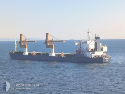
The vessel EMERALD (IMO: 911413900, MMSI: 372676000) is a Cargo It's sailing under the flag of [PA] Panama.
In this page you can find informations about the vessels current position, last detected port calls, and current voyage information. If the vessels is not in coverage by AIS you will find the latest position.
The current position of EMERALD is detected by our AIS receivers and we are not responsible for the reliability of the data. The last position was recorded while the vessel was in Coverage by the Ais receivers of our vessel tracking app.
The current draught of EMERALD as reported by AIS is 6.5 meters
Weather
| Temperature | 17.4°C / 63.32°F |
|---|---|
| Wind Speed | 5 knots |
| Direction | 95° E |
| Pressure | 1002.4 hPa |
| Humidity | 52.6 % |
| Cloud Coverage | 100 % |
Featured Company
Last Port Calls
| Port | Arrival | Departure | Time In Port |
|---|---|---|---|
| 2024-04-15 11:26 | |||
| 2024-03-30 23:13 | 2024-04-04 05:38 | 4 d | |
| 2024-03-21 01:22 | 2024-03-21 13:57 | 12 h |
Most Visited Ports (Last year)
| Port | Arrivals | |
|---|---|---|
| 4 | ||
| 3 | ||
| 2 | ||
| 1 | ||
| 1 | ||
| 1 |
Last Trips
| Origin | Departure | Destination | Arrival | Distance | |
|---|---|---|---|---|---|
| 2024-04-04 07:38 | 2024-04-15 14:26 | 1349.99 nm | |||
| 2024-03-21 15:57 | 2024-03-31 01:13 | 18.54 nm | |||
| 2024-01-26 03:16 | 2024-03-21 03:22 | 2766.83 nm |
Events
| Heure | Evenement | Détails | Position/ Destination | Info |
|---|---|---|---|---|
| 2024-04-15 11:26 | Port d'arrivée |
|
44.09282 / 39.06736
[RU] TUAPSE
|
Vitesse: 0.4 kn Parcours: -1° |
| 2024-04-11 13:35 | Arret | 3.14 nm, South of TUAPSE |
44.03816 / 39.08554
RUKZP
|
Vitesse: 0.3 kn Parcours: -1° |
| 2024-04-11 12:38 | Etat Changé | Default Under way using engine |
43.98050 / 38.98361
RUKZP
|
Vitesse: 11.3 kn Parcours: 67.5° |
| 2024-04-11 12:33 | Hors de la zone couverte |
43.97512 / 38.96532
Black Sea
|
Vitesse: 11.3 kn Parcours: 67.5° |
|
| 2024-04-11 12:33 | Etat Changé | Under way using engine Default |
43.97449 / 38.96322
RUKZP
|
Vitesse: 11.2 kn Parcours: 67° |
| 2024-04-11 12:30 | Dans la zone couverte |
43.97512 / 38.96532
Black Sea
|
Vitesse: 11.3 kn Parcours: 67.5° |
|
| 2024-04-11 09:25 | Etat Changé | Default Under way using engine |
43.82995 / 38.41414
RUKZP
|
Vitesse: 10.8 kn Parcours: 71.1° |
| 2024-04-11 09:22 | Detecté en mer | Russian part of the Black Sea |
43.82755 / 38.40434
Black Sea
|
Vitesse: 10.8 kn Parcours: 71.1° |
| 2024-04-11 09:22 | Etat Changé | Under way using engine Default |
43.82755 / 38.40434
RUKZP
|
Vitesse: 10.9 kn Parcours: 70° |
| 2024-04-11 09:22 | Hors de la zone couverte |
43.82755 / 38.40434
Black Sea
|
Vitesse: 10.8 kn Parcours: 71.1° |