
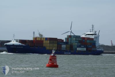
KRISTIN SCHEPERS
Container Ship
Current Trip
| Time Travelled | 2 days |
|---|---|
| Remaining Time | 1 day |
| Distance Travelled | 971.16 nm |
| Remaining Distance | 419.02 nm |
| AVG Speed | 15 Noeuds |
| MAX Speed | 19.7 Noeuds |
| AVG Wind | 9.8 knots |
| MAX Wind | 19.3 knots |
| MIN Temp | 6.3°C / 43.34°F |
| MAX Temp | 13.8°C / 56.84°F |
| Tirant d eau | 6.6 m |
| Position reçue | 20 h, 58 m depuis |
Current Position
| Longitude | -7.91724° |
|---|---|
| Latitude | 46.22439° |
| Etat | Under way using engine |
| Vitesse | 16.3 Noeuds |
| Parcours | 208.4° |
| Zone | North Atlantic Ocean |
| Station | T-AIS |
| Position reçue | 20 h, 58 m depuis |
Info
Information
The current position of KRISTIN SCHEPERS is in North Atlantic Ocean with coordinates 46.22439° / -7.91724° as reported on 2024-04-24 23:20 by AIS to our vessel tracker app. The vessel's current speed is 16.3 Noeuds and is heading at the port of CADIZ. The estimated time of arrival as calculated by MyShipTracking vessel tracking app is 2024-04-26 22:04 LT
The vessel KRISTIN SCHEPERS (IMO: 9404089, MMSI: 255806436) is a Container Ship that was built in 2007 ( 17 Age ). It's sailing under the flag of [PT] Portugal.
In this page you can find informations about the vessels current position, last detected port calls, and current voyage information. If the vessels is not in coverage by AIS you will find the latest position.
The current position of KRISTIN SCHEPERS is detected by our AIS receivers and we are not responsible for the reliability of the data. The last position was recorded while the vessel was in Coverage by the Ais receivers of our vessel tracking app.
The current draught of KRISTIN SCHEPERS as reported by AIS is 6.6 meters
Weather
| Temperature | 13.8°C / 56.84°F |
|---|---|
| Wind Speed | 16 knots |
| Direction | 314° NW |
| Pressure | 1013 hPa |
| Humidity | 71.5 % |
| Cloud Coverage | 83 % |
Featured Company
Last Port Calls
| Port | Arrival | Departure | Time In Port |
|---|---|---|---|
| 2024-04-22 22:25 | 2024-04-23 07:49 | 9 h | |
| 2024-04-21 19:47 | 2024-04-22 02:10 | 6 h | |
| 2024-04-20 08:37 | 2024-04-20 20:15 | 11 h | |
| 2024-04-16 09:26 | 2024-04-16 20:00 | 10 h | |
| 2024-04-14 09:01 | 2024-04-15 17:51 | 1 d | |
| 2024-04-13 04:38 | 2024-04-13 13:25 | 8 h | |
| 2024-04-06 19:43 | 2024-04-07 07:27 | 11 h | |
| 2024-04-04 09:19 | 2024-04-04 19:56 | 10 h | |
| 2024-04-02 19:50 | 2024-04-03 14:43 | 18 h | |
| 2024-03-30 19:09 | 2024-03-31 01:35 | 6 h |
Last Trips
| Origin | Departure | Destination | Arrival | Distance | |
|---|---|---|---|---|---|
| 2024-04-22 03:10 | 2024-04-23 00:25 | 272.27 nm | |||
| 2024-04-20 21:15 | 2024-04-21 20:47 | 307.35 nm | |||
| 2024-04-16 21:00 | 2024-04-20 09:37 | 988.24 nm | |||
| 2024-04-15 18:51 | 2024-04-16 10:26 | 199.02 nm | |||
| 2024-04-13 15:25 | 2024-04-14 10:01 | 261.32 nm | |||
| 2024-04-07 09:27 | 2024-04-13 06:38 | 1460.38 nm | |||
| 2024-04-04 20:56 | 2024-04-06 21:43 | 280.70 nm | |||
| 2024-04-03 15:43 | 2024-04-04 10:19 | 299.18 nm | |||
| 2024-03-31 03:35 | 2024-04-02 20:50 | 764.88 nm | |||
| 2024-03-29 10:48 | 2024-03-30 20:09 | 474.65 nm |
Events
| Heure | Evenement | Détails | Position/ Destination | Info |
|---|---|---|---|---|
| 2024-04-24 23:25 | Etat Changé | Default Under way using engine |
46.20334 / -7.93333
ESCAD
|
Vitesse: 16.3 kn Parcours: 208.4° |
| 2024-04-24 23:20 | Hors de la zone couverte |
46.22439 / -7.91724
North Atlantic Ocean
ESCAD
|
Vitesse: 16.3 kn Parcours: 208.4° |
|
| 2024-04-24 22:13 | Changement d'ETA | 2024/04/27 10:00 2024/04/27 12:00 |
46.48475 / -7.70006
ESCAD
|
Vitesse: 15.9 kn Parcours: 210.2° |
| 2024-04-24 22:10 | Changement de zone | French part of the North Atlantic Ocean French part of the Celtic Sea |
46.49587 / -7.69071
North Atlantic Ocean
ESCAD
|
Vitesse: 15.9 kn Parcours: 209.8° |
| 2024-04-24 22:09 | Etat Changé | Under way using engine Default |
46.50013 / -7.68717
ESCAD
|
Vitesse: 16 kn Parcours: 209° |
| 2024-04-24 21:55 | Dans la zone couverte |
46.49587 / -7.69071
North Atlantic Ocean
ESCAD
|
Vitesse: 15.9 kn Parcours: 209.8° |
|
| 2024-04-24 14:37 | Etat Changé | Default Under way using engine |
48.27667 / -6.30167
ESCAD
|
Vitesse: 14.8 kn Parcours: 205.7° |
| 2024-04-24 14:31 | Hors de la zone couverte |
48.30275 / -6.28442
Celtic Sea
ESCAD
|
Vitesse: 14.8 kn Parcours: 205.7° |
|
| 2024-04-24 14:15 | Etat Changé | Under way using engine Default |
48.35981 / -6.24425
ESCAD
|
Vitesse: 14 kn Parcours: 205° |
| 2024-04-24 14:02 | Etat Changé | Default Under way using engine |
48.41179 / -6.20676
ESCAD
|
Vitesse: 15.1 kn Parcours: 205.8° |