
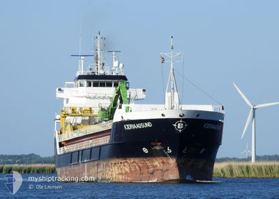
KJERVAAGSUND
General Cargo
Current Trip
| Time Travelled | 1 day |
|---|---|
| Remaining Time | 52 mins |
| Distance Travelled | 411.30 nm |
| Remaining Distance | 11.27 nm |
| AVG Speed | 10.9 Noeuds |
| MAX Speed | 11.9 Noeuds |
| AVG Wind | 10.5 knots |
| MAX Wind | 20 knots |
| MIN Temp | 2.3°C / 36.14°F |
| MAX Temp | 6.4°C / 43.52°F |
| Tirant d eau | 5.6 m |
| Position reçue | Maintenant |
Current Position
| Longitude | 11.17352° |
|---|---|
| Latitude | 58.23760° |
| Etat | Under way using engine |
| Vitesse | 10.8 Noeuds |
| Parcours | 70.5° |
| Zone | Skaggerak |
| Station | T-AIS |
| Position reçue | Maintenant |
Info
Information
The current position of KJERVAAGSUND is in Skaggerak with coordinates 58.23760° / 11.17352° as reported on 2024-04-23 16:32 by AIS to our vessel tracker app. The vessel's current speed is 10.8 Noeuds and is heading at the port of LYSEKIL. The estimated time of arrival as calculated by MyShipTracking vessel tracking app is 2024-04-23 17:25 LT
The vessel KJERVAAGSUND (IMO: 9312690, MMSI: 257036300) is a General Cargo that was built in 2005 ( 19 Age ). It's sailing under the flag of [NO] Norway.
In this page you can find informations about the vessels current position, last detected port calls, and current voyage information. If the vessels is not in coverage by AIS you will find the latest position.
The current position of KJERVAAGSUND is detected by our AIS receivers and we are not responsible for the reliability of the data. The last position was recorded while the vessel was in Coverage by the Ais receivers of our vessel tracking app.
The current draught of KJERVAAGSUND as reported by AIS is 5.6 meters
Weather
| Temperature | 4.6°C / 40.28°F |
|---|---|
| Wind Speed | 6 knots |
| Direction | 69° ENE |
| Pressure | 1011 hPa |
| Humidity | 89.3 % |
| Cloud Coverage | 100 % |
Featured Company
Last Port Calls
| Port | Arrival | Departure | Time In Port |
|---|---|---|---|
| 2024-04-22 01:38 | 2024-04-22 03:05 | 1 h | |
| 2024-04-20 23:13 | 2024-04-21 17:07 | 17 h | |
| 2024-04-17 03:25 | 2024-04-17 13:39 | 10 h | |
| 2024-04-09 14:02 | 2024-04-10 17:14 | 1 d | |
| 2024-03-28 21:02 | 2024-04-05 14:42 | 7 d | |
| 2024-03-25 05:33 | 2024-03-25 07:08 | 1 h | |
| 2024-03-24 01:06 | 2024-03-24 20:47 | 19 h | |
| 2024-03-22 05:50 | 2024-03-23 07:49 | 1 d | |
| 2024-03-09 06:38 | 2024-03-09 18:29 | 11 h | |
| 2024-02-29 11:11 | 2024-03-02 11:40 | 2 d |
Most Visited Ports (Last year)
| Port | Arrivals | |
|---|---|---|
| 17 | ||
| 7 | ||
| 6 | ||
| 6 | ||
| 4 | ||
| 3 |
Last Trips
| Origin | Departure | Destination | Arrival | Distance | |
|---|---|---|---|---|---|
| 2024-04-21 19:07 | 2024-04-22 03:38 | 91.83 nm | |||
| 2024-04-17 15:39 | 2024-04-21 01:13 | 730.17 nm | |||
| 2024-04-10 19:14 | 2024-04-17 05:25 | 1294.45 nm | |||
| 2024-04-05 16:42 | 2024-04-09 16:02 | 375.93 nm | |||
| 2024-03-25 08:08 | 2024-03-28 22:02 | 923.70 nm | |||
| 2024-03-24 21:47 | 2024-03-25 06:33 | 91.79 nm | |||
| 2024-03-23 08:49 | 2024-03-24 02:06 | 196.39 nm | |||
| 2024-03-09 20:29 | 2024-03-22 06:50 | 2154.41 nm | |||
| 2024-03-02 12:40 | 2024-03-09 08:38 | 1112.90 nm | |||
| 2024-02-27 09:58 | 2024-02-29 12:11 | 572.84 nm |
Events
| Heure | Evenement | Détails | Position/ Destination | Info |
|---|---|---|---|---|
| 2024-04-23 14:22 | Detecté en mer | Swedish part of the Skaggerak |
58.15811 / 10.44358
Skaggerak
SELYS
|
Vitesse: 11.3 kn Parcours: 78.4° |
| 2024-04-23 11:49 | Detecté en mer | Danish part of the Skaggerak |
58.06779 / 9.57871
Skaggerak
SELYS
|
Vitesse: 10.8 kn Parcours: 80.5° |
| 2024-04-23 11:28 | Changement d'ETA | 2024/04/23 18:30 2024/04/23 20:30 |
58.05656 / 9.46518
SELYS
|
Vitesse: 10.4 kn Parcours: 79.1° |
| 2024-04-23 04:20 | Changement de zone | Norwegian part of the Skaggerak Norwegian part of the North Sea |
57.93508 / 7.10881
Skaggerak
SELYS
|
Vitesse: 10.5 kn Parcours: 100.1° |
| 2024-04-22 18:04 | Tirant d'eau modifié | 5.6 5.8 |
59.35413 / 4.97443
SELYS
|
Vitesse: 11.1 kn Parcours: 167.4° |
| 2024-04-22 18:04 | Changement d'ETA | 2024/04/23 20:30 2024/04/22 03:30 |
59.35413 / 4.97443
SELYS
|
Vitesse: 11.1 kn Parcours: 167.4° |
| 2024-04-22 17:58 | Changement de destination | SELYS NOMAY |
59.37384 / 4.96658
SELYS
|
Vitesse: 11.1 kn Parcours: 170° |
| 2024-04-22 09:18 | Changement de zone | Norwegian part of the North Sea Norwegian part of the Norwegian Sea |
60.99573 / 4.47271
North Sea
|
Vitesse: 11.2 kn Parcours: 172.4° |
| 2024-04-22 03:05 | PORT DE DEPART |
|
61.92524 / 5.11900
NOMAY
|
Vitesse: 8.8 kn Parcours: 191° |
| 2024-04-22 02:59 | Démarrage |
61.93845 / 5.12544
[NO] MALOY
|
Vitesse: 4.9 kn Parcours: 188° |